2020s Maps of West Alexandria, Ohio
Explore 2 historic maps of West Alexandria from the 2020s. These maps offer a rare glimpse into what life looked like during the 2020s — showing old roads, neighborhoods, homes, and landmarks that have changed or disappeared over time.
Whether you're researching your family's past, planning a metal detecting trip, or studying how West Alexandria's landscape evolved across the 2020s, these high-resolution maps are a powerful tool for exploring the history of this region.
- Focus on a specific era: All maps on this page are from the 2020s, giving you a focused view of this time period.
- See what’s changed: Compare century-old streets, trails, and buildings to today's modern landscape using overlays and satellite layers.
- Research with precision: Use these maps for genealogy, historical research, land use analysis, or educational projects.
- View, download, or print: Maps are fully viewable online in high resolution, and can be downloaded or printed for your own records.
Start exploring West Alexandria's history through authentic maps from the 2020s. This is your window into the past.
West Alexandria, OH maps
(2)- 2023 Map of West Alexandria, 2023 Print
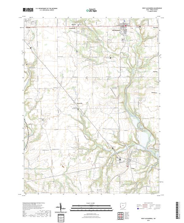 2023 West Alexandria2023 Print · USGSPreble County agriculture and small-town life are preserved in this recent survey of the West Alexandria and Gratis vicinities. Genealogists can trace family landmarks through numerous rural sites like Sugar Hill Cem, Brower Cem, and Sampleville.
 - 2023 Map of Lewisburg, 2023 Print
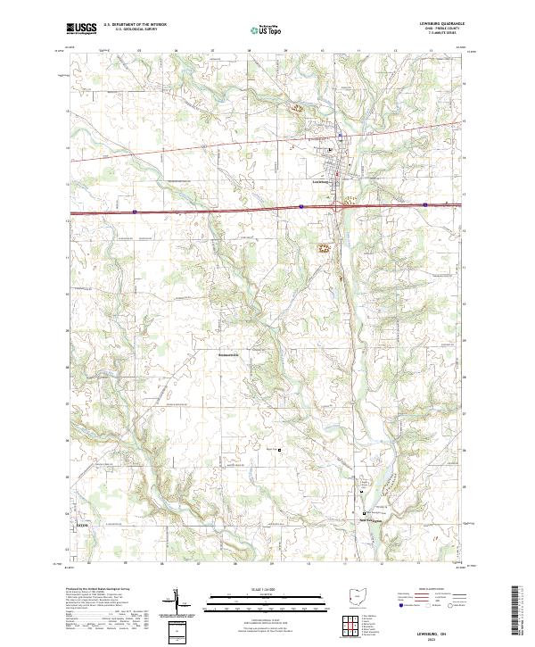 2023 Lewisburg2023 Print · USGSPreble County's eastern townships are shown in detail during the early twenty-first century as the landscape transitions from the village of Lewisburg to rural farmland. Genealogists can locate family sites and historic burials at Myers Cem, Sugar Grove Cem, and New Lexington.
End of results
Showing maps 1-2 of 2
Top cities near West Alexandria
- Dayton historical maps
- Middletown historical maps
- Trotwood historical maps
- Oxford historical maps
- Miamisburg historical maps
- Clayton historical maps
See more
Frequently asked questions
- What are the different types of historical maps available for West Alexandria?
- What is the oldest map of West Alexandria?
- Where can I purchase historical maps of West Alexandria for my home or office?
- Where can I download high-res historical maps of West Alexandria?
- Are there historical topographic maps available for West Alexandria?
- Is there historical aerial imagery available for West Alexandria?
- Where are historical maps of West Alexandria sourced from?