Old Maps of Howland Township, Ohio
Explore 39 old maps of Howland Township, spanning from 1905 to today. These high-resolution historic maps reveal how streets, neighborhoods, landmarks, and natural features evolved over time — perfect for genealogy, metal detecting, research, and local history exploration.
What you can do with these maps:
- See how Howland Township changed over time: Compare historical maps to modern-day views to trace roads, homesites, rail lines & more.
- View detailed metadata: Each map includes creators, publishers, year, scale, and archive source.
- Overlay maps with satellite & LiDAR: Visualize the past alongside modern tools to explore terrain & human change.
- Trusted historical sources: Maps sourced from the USGS, Library of Congress, and other archives.
- Access maps your way: View online, download high-res files, or order prints for personal or research use.
Start exploring old maps of Howland Township to uncover forgotten places, hidden landmarks, and the deep history beneath your feet.
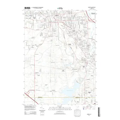
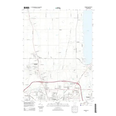
Howland Township, OH maps
(39)- 1905 Map of Bristolville, 1956 Print
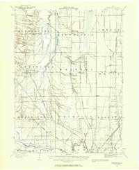 1905 Bristolville1956 Print · USGSTrumbull County at the start of the century was a landscape of thriving rail-connected hamlets and winding river valleys. Genealogists can trace family footprints through historic townships to settlements like Delightful, West Farmington, and the old county Infirmary.
 - 1906 Map of Youngstown, 1958 Print
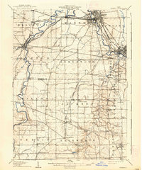
 1906 Youngstown1958 Print · USGSThe Mahoning Valley's industrial heartland is caught at its early twentieth-century peak, showing the massive rail and steel infrastructure at the state border. Researchers can trace the lineage of local neighborhoods and schools like Hell Street School, Idora Park, and Tibbetts Corners.
 - 1907 Map of Kinsman, 1940 Print
 1907 Kinsman1940 Print · USGSEastern Trumbull County thrived at the start of the century as a vital crossroads of Ohio and Pennsylvania rail lines. Local historians can trace the foundations of Kinsman, Orangeville, and the remote State Line Church during the height of the steam rail era.2 unique versions available
 - 1907 Map of Bristolville, 1943 Print
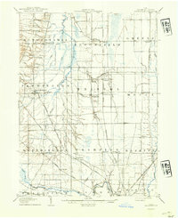 1907 Bristolville1943 Print · USGSTrumbull County at the turn of the century shows a landscape defined by the Grand River and an expanding rail network. Genealogists can trace family roots through historic townships and small stops like West Farmington, Mesopotamia, and the Infirmary south of Oakfield.
 - 1908 Map of Youngstown, 1937 Print
 1908 Youngstown1937 Print · USGSThe Mahoning Valley at the height of its industrial boom is defined by a massive concentration of rail lines and riverfront steel towns. Genealogists and historians can trace the footprint of early neighborhood schools like Bell School, find the original layout of Idora Park, and locate vanished rail stops along the ERIE RAILROAD.2 unique versions available
 - 1908 Map of Warren, 1937 Print
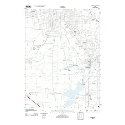
 1908 Warren1937 Print · USGSTrumbull and Mahoning counties at the turn of the century show a landscape defined by the heavy rail corridors of the Mahoning River valley. Genealogists can trace family footprints near Russell School, the Infirmary, and early settlements like Mineral Ridge.2 unique versions available
 - 1950 Map of Cleveland
 1950 Cleveland1950 Print · USGSCovers Howland Township, including Cleveland, Akron, and other nearby areas
 - 1954 Map of Girard, 1956 Print
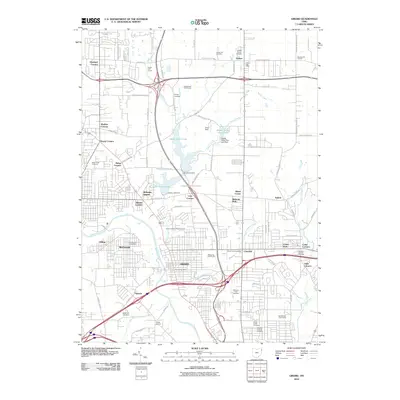
 1954 Girard1956 Print · USGSThe Mahoning River valley in the mid-1950s shows an industrial powerhouse at its peak, dominated by a dense rail network. Genealogists and local historians can trace family locations near Girard and McDonald, or locate sites like St Rose Sch and Tod Homestead Cemetery.
 - 1956 Map of Cleveland, 1967 Print
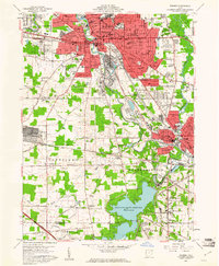
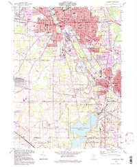
 1956 Cleveland1967 Print · USGSNortheast Ohio and Western Pennsylvania are shown at their industrial height during the mid-fifties, from the steel mills to the lakeshore. Researchers can trace the massive Ravenna Arsenal, the Ohio Turnpike, and vanished rail sidings of the B & O RR.3 unique versions available
 - 1959 Map of Warren, 1961 Print
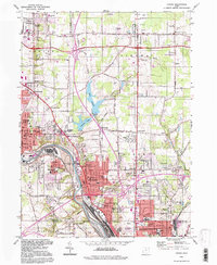
 1959 Warren1961 Print · USGSWarren and Niles are at the heart of the Mahoning Valley's industrial peak in the late fifties. Genealogists and historians can trace neighborhood growth through dozens of named sites like Oakwood Cemetery, Harding High Sch, and the DeForest Junction rail yards.4 unique versions available
 - 1960 Map of Champion Heights, 1962 Print
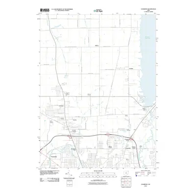
 1960 Champion Heights1962 Print · USGSThe industrial Mahoning Valley meets the rural expanses of Trumbull County in the early sixties. Researchers can trace the Baltimore and Ohio rail lines and locate family landmarks like McMurry Cem or the County Infirmary Farm.5 unique versions available
 - 1961 Map of Cortland, 1963 Print
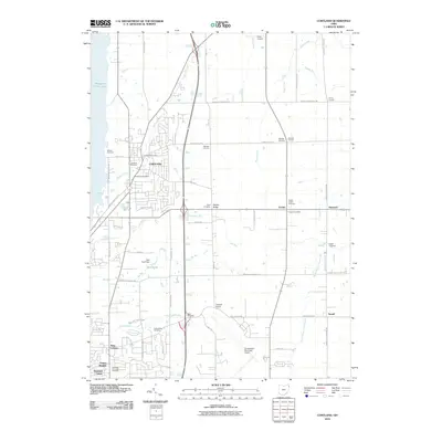
 1961 Cortland1963 Print · USGSTrumbull County is captured here in the early sixties as the suburbs and transportation networks of the post-war era began to expand. Genealogists can trace family names at Hillside Cem and Chadwick Corners or locate the old Nutwood (Fowler Sta) along the rails.3 unique versions available
 - 1962 Map of Cleveland
 1962 Cleveland1962 Print · USGSNortheast Ohio and the Pennsylvania borderlands appear here during the industrial peak of the early sixties. Genealogists and historians can trace the expansive rail lines of the Nickel Plate Road and the growth of suburbs from Parma to Lyndhurst.
 - 1962 Map of Girard, 1964 Print
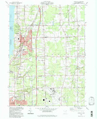
 1962 Girard1964 Print · USGSThe Mahoning Valley steel corridor is captured here at its mid-century industrial peak. Genealogists and historians can trace family-named crossroads like Madden Corners and Hakes Corners or locate local landmarks like the Ursuline Convent and H C Mines Sch.4 unique versions available
 - 1986 Map of Youngstown, 1988 Print
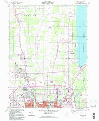
 1986 Youngstown1988 Print · USGSThe industrial corridor of the Mahoning Valley and the collegiate towns of Western Pennsylvania are captured here in the mid-eighties. Researchers can trace the rail lines of the Conrail network or locate historical sites like Churchill and Crown Hill Cem.2 unique versions available
 - 1994 Map of Warren, 1997 Print
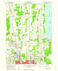
 1994 Warren1997 Print · USGSThe Mahoning Valley's industrial and residential landscape is captured here in the mid-1990s, centered on the urban cores of WARREN and NILES. Trace family roots and local history through numerous sites like Harding High School, Oakwood Cemetery, and the Niles and New Lisbon Railroad.
 - 1994 Map of Girard, 1997 Print
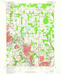
 1994 Girard1997 Print · USGSThe industrial heart of the Mahoning Valley is captured here during the 1990s as the region transitioned from its steel-mill peak. Genealogists can locate family sites near Tod Homestead Cemetery, while historians trace the rail-and-river economy along the Mahoning River and Lake Girard.
 - 1994 Map of Champion, 1997 Print
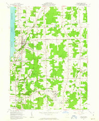
 1994 Champion1997 Print · USGSTrumbull County in the late twentieth century shows the intersection of the industrial Warren outskirts with the rural townships of the Western Reserve. Researchers can locate family sites and local landmarks like Hoagland Corner, the McMurray Cem, and Wildare.
 - 1994 Map of Cortland, 1997 Print
 1994 Cortland1997 Print · USGSTrumbull County in the mid-nineties shows a mix of growing residential hubs and traditional Ohio crossroads. Genealogists can trace family landmarks across Sheldon Corners and several historic burial sites, including Casterline Cem and Sheldon Cem.
 - 2010 Map of Champion, 2010 Print
 2010 Champion2010 Print · USGSCovers Howland Township, including Warren, Champion, and other nearby areas
 - 2010 Map of Warren, 2010 Print
 2010 Warren2010 Print · USGSCovers Howland Township, including Warren, Weathersfield Township, and other nearby areas
 - 2010 Map of Cortland, 2010 Print
 2010 Cortland2010 Print · USGSCovers Howland Township, including Cortland, Cortland, and other nearby areas
 - 2010 Map of Girard, 2010 Print
 2010 Girard2010 Print · USGSCovers Howland Township, including Youngstown, Warren, and other nearby areas
 - 2013 Map of Warren, 2013 Print
 2013 Warren2013 Print · USGSCovers Howland Township, including Warren, Weathersfield Township, and other nearby areas
 - 2013 Map of Champion, 2013 Print
 2013 Champion2013 Print · USGSCovers Howland Township, including Warren, Champion, and other nearby areas
Showing maps 1-25 of 39
Top cities near Howland Township
- Youngstown historical maps
- Boardman historical maps
- Warren historical maps
- Austintown historical maps
- Weathersfield Township historical maps
- Niles historical maps
See more
Top neighborhoods of Howland Township
- Howland Center historical maps
- Morgandale historical maps
- Bolindale historical maps
- Hidden Valley historical maps
- Brittainy Oaks historical maps
- Kensington Manor historical maps
See more
Frequently asked questions
- What are the different types of historical maps available for Howland Township?
- What is the oldest map of Howland Township?
- Where can I purchase historical maps of Howland Township for my home or office?
- Where can I download high-res historical maps of Howland Township?
- Are there historical topographic maps available for Howland Township?
- Is there historical aerial imagery available for Howland Township?
- Where are historical maps of Howland Township sourced from?