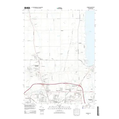
2013 Map of Champion
USGS Topo · Published 2013About this map
Champion Heights and the northern reaches of Warren anchor this Trumbull County landscape, characterized by a dense network of residential streets and educational hubs like the Kent State Univ Trumbull Campus. The eastern edge is defined by the expansive shoreline of Mosquito Cr Lake, where numerous bays and inlets like Jewel Bay meet rural crossroads. Significant genealogy resources are scattered throughout the region, including the Champion Center Cem, McMurray Cem, and Bazetta Cem. Cultural landmarks of the era are also present, such as the Elm Road Triple Drive In Theatre and Skyway Drive-In, which reflect the mid-century development patterns of the Mahoning Valley. The transition from the urban grid of Warren to rural settlements like Wildare and Klondike is visible as the terrain moves north from the Mahoning River toward the reservoir.
Find a feature on this map
164 named features on this map. Tap any name to fly to it.
Don’t see what you’re looking for? This feature index may not catch every label — zoom into the map to look around manually.
Map Details
Editions of this 2013 Champion Map
This is the sole edition of this map. No revisions or reprints were ever made.
Other maps of this area

1905 · Bristolville
USGS Topo · 1:62,500

1906 · Youngstown
USGS Topo · 1:62,500

1907 · Kinsman
USGS Topo · 1:62,500

1907 · Bristolville
USGS Topo · 1:62,500

1908 · Youngstown
USGS Topo · 1:62,500

1908 · Warren
USGS Topo · 1:62,500

1950 · Cleveland
USGS Topo · 1:250,000

1952 · West Farmington
USGS Topo · 1:24,000

1952 · Southington
USGS Topo · 1:24,000

1954 · Girard
USGS Topo · 1:24,000