
1952 Map of West Farmington
USGS Topo · Published 1954About this map
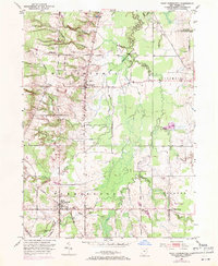
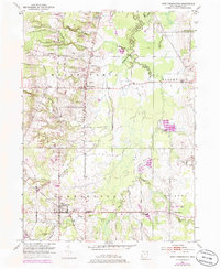
Mesopotamia and West Farmington anchor this Trumbull County landscape in the early 1950s, a region defined by its orderly rural settlement and the winding course of the Grand River. The map highlights the agricultural and transport infrastructure of the mid-century, where the Baltimore and Ohio railroad cuts through the southern terrain near Farmington. Numerous small rural intersections like Coffee Corners and Center Creek Corners indicate a well-established network of farm-to-market roads, including the historically named Girdle Road and Plank Road. Local family history is preserved through features such as Hillside Cem and Fairview Cem. The presence of several distinct branches of Swine Creek and Coffee Creek reveals a complex drainage system across the townships of Bloomfield and Bristol, characteristic of this part of the Connecticut Western Reserve.
Find a feature on this map
33 named features on this map. Tap any name to fly to it.
Don’t see what you’re looking for? This feature index may not catch every label — zoom into the map to look around manually.
Map Details
Editions of this 1952 West Farmington Map
3 editions found
Other maps of this area

1904 · Chardon
USGS Topo · 1:62,500

1905 · Bristolville
USGS Topo · 1:62,500

1905 · Garrettsville
USGS Topo · 1:62,500

1905 · Jefferson
USGS Topo · 1:62,500

1906 · Chardon
USGS Topo · 1:62,500

1907 · Bristolville
USGS Topo · 1:62,500

1907 · Jefferson
USGS Topo · 1:62,500

1907 · Garrettsville
USGS Topo · 1:62,500

1950 · Cleveland
USGS Topo · 1:250,000

1952 · Southington
USGS Topo · 1:24,000
Featured Places
- Mesopotamia Township, OH
- Mesopotamia, Mesopotamia Township
- Farmington, Farmington Township
- Farmington Township, OH
- Bloomfield Township, OH