
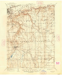
1906 Map of Chardon
USGS Topo · Published 1940About this map
The Grand River carves a deep valley across the northern landscape of Geauga and Lake Counties, while the county seat of Chardon sits atop the high ground to the south. This 1904 survey, reprinted in 1940, captures a region defined by its complex drainage systems and early 20th-century transportation. The Chardon and Cleveland Electric RR and several other lines, including the Baltimore and Ohio RR, connect the small townships of Huntsburg, Montville, and Thompson.
Find a feature on this map
67 named features on this map. Tap any name to fly to it.
Don’t see what you’re looking for? This feature index may not catch every label — zoom into the map to look around manually.
Map Details
Editions of this 1906 Chardon Map
2 editions found
Other maps of this area

1904 · Chardon
USGS Topo · 1:62,500

1905 · Ashtabula
USGS Topo · 1:62,500

1905 · Perry
USGS Topo · 1:62,500

1905 · Bristolville
USGS Topo · 1:62,500

1905 · Garrettsville
USGS Topo · 1:62,500

1905 · Jefferson
USGS Topo · 1:62,500

1905 · Mentor
USGS Topo · 1:62,500

1906 · Chagrin Falls
USGS Topo · 1:62,500

1907 · Bristolville
USGS Topo · 1:62,500

1907 · Jefferson
USGS Topo · 1:62,500