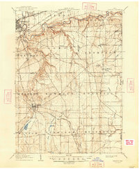
1906 Map of Chardon
USGS Topo · Published 1948About this map
Chardon and the surrounding townships of Northeast Ohio are captured here during a period of transition, where established rural farming communities were increasingly linked by a growing network of rails and electric lines. The Grand River carves a deep valley across the northern portion of the sheet, creating the dramatic geography at Indian Point and separating the industrial-leaning Painesville from the upland townships like Leroy. A notable feature of the early 20th-century social landscape is the Infirmary located just south of the Grand River, reflecting the era's approach to county-provided care. Transportation dominates the western edge, where the Baltimore and Ohio RR and the Chardon and Cleveland Electric line provided vital connections for residents in Concord and Munson. To the east, the landscape remains more dispersed, with local commerce centered on places like Montville and Huntsburg.
Find a feature on this map
56 named features on this map. Tap any name to fly to it.
Don’t see what you’re looking for? This feature index may not catch every label — zoom into the map to look around manually.
Map Details
Editions of this 1906 Chardon Map
2 editions found
Other maps of this area

1904 · Chardon
USGS Topo · 1:62,500

1905 · Ashtabula
USGS Topo · 1:62,500

1905 · Perry
USGS Topo · 1:62,500

1905 · Bristolville
USGS Topo · 1:62,500

1905 · Garrettsville
USGS Topo · 1:62,500

1905 · Jefferson
USGS Topo · 1:62,500

1905 · Mentor
USGS Topo · 1:62,500

1906 · Chardon
USGS Topo · 1:62,500

1906 · Chagrin Falls
USGS Topo · 1:62,500

1907 · Bristolville
USGS Topo · 1:62,500