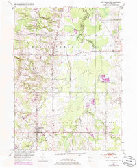
1952 Map of West Farmington
USGS Topo · Published 1979About this map
The Baltimore and Ohio railroad corridor anchors the southern portion of this landscape, passing directly through the village of West Farmington. This 1952 topographic survey, with later revisions, documents a segment of the Connecticut Western Reserve characterized by a transition from the agricultural plateaus of Mesopotamia and Bloomfield to the meandering drainage basins of the Grand River. Local history is preserved in the location of several rural cemeteries, including Hillside Cem and Fairview Cem, which served the scattered farming communities and small crossroads settlements like Coffee Corners and Center Creek Corners. The intricate network of small waterways, such as Swine Creek, Coffee Creek, and Andrews Creek, illustrates the natural drainage patterns that shaped early road placements, including the long, straight stretches of Girdle Road and Ashtabula Road.
Find a feature on this map
33 named features on this map. Tap any name to fly to it.
Don’t see what you’re looking for? This feature index may not catch every label — zoom into the map to look around manually.
Map Details
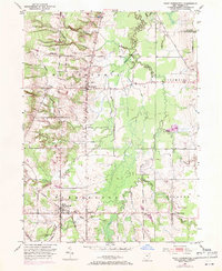
Editions of this 1952 West Farmington Map
3 editions found
Other maps of this area

1904 · Chardon
USGS Topo · 1:62,500

1905 · Bristolville
USGS Topo · 1:62,500

1905 · Garrettsville
USGS Topo · 1:62,500

1905 · Jefferson
USGS Topo · 1:62,500

1906 · Chardon
USGS Topo · 1:62,500

1907 · Bristolville
USGS Topo · 1:62,500

1907 · Jefferson
USGS Topo · 1:62,500

1907 · Garrettsville
USGS Topo · 1:62,500

1950 · Cleveland
USGS Topo · 1:250,000

1952 · West Farmington
USGS Topo · 1:24,000
Featured Places
- Mesopotamia Township, OH
- Mesopotamia, Mesopotamia Township
- Farmington, Farmington Township
- Farmington Township, OH
- Bloomfield Township, OH