
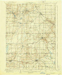
1907 Map of Garrettsville
USGS Topo · Published 1943About this map
The Cuyahoga River and its upper tributaries carve through the glaciated plateaus of northeast Ohio in this early twentieth-century survey. The landscape is defined by a dense network of early rail and electric lines, including the Eastern Ohio Traction company and the Erie RR, which connected agricultural hubs like Middlefield and Burton to larger regional markets. Small crossroads and rail stops like Welshfield and Burton Sta appear alongside more established villages.
Find a feature on this map
63 named features on this map. Tap any name to fly to it.
Don’t see what you’re looking for? This feature index may not catch every label — zoom into the map to look around manually.
Map Details
Editions of this 1907 Garrettsville Map
2 editions found
Other maps of this area

1904 · Chardon
USGS Topo · 1:62,500

1905 · Bristolville
USGS Topo · 1:62,500

1905 · Garrettsville
USGS Topo · 1:62,500

1905 · Jefferson
USGS Topo · 1:62,500

1905 · Mentor
USGS Topo · 1:62,500

1906 · Chardon
USGS Topo · 1:62,500

1906 · Kent
USGS Topo · 1:62,500

1906 · Chagrin Falls
USGS Topo · 1:62,500

1906 · Ravenna
USGS Topo · 1:62,500

1907 · Bristolville
USGS Topo · 1:62,500
Featured Places
- Southington Township, OH
- Mesopotamia Township, OH
- Nelson, OH
- Farmington Township, OH
- Braceville Township, OH