
1906 Map of Kent
USGS Topo · Published 1941About this map
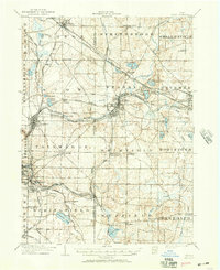
The Cuyahoga River anchors this detailed early 20th-century landscape, winding through the industrial and residential hearts of Kent and Cuyahoga Falls. This era was defined by a dense web of transportation, as seen in the converging lines of the Erie and Baltimore and Ohio RR and the Pennsylvania System. Smaller communities like Stow Corners, Darrowville, and Brimfield Sta. Thorndyke P O reveal the rural character of Summit and Portage Counties before modern suburban expansion. Notable for its glacial hydrology, the map identifies numerous bodies of water such as Twin Lakes, Silver Lake, and Sandy Lake. To the south, the industrial influence of Akron is visible near East Akron and Brittain, where the Little Cuyahoga River and the Cleveland Terminal and Valley RR supported the region's burgeoning manufacturing core.
Find a feature on this map
75 named features on this map. Tap any name to fly to it.
Don’t see what you’re looking for? This feature index may not catch every label — zoom into the map to look around manually.
Map Details
Editions of this 1906 Kent Map
2 editions found
Other maps of this area

1901 · Massillon
USGS Topo · 1:62,500

1901 · Canton
USGS Topo · 1:62,500

1903 · Massillon
USGS Topo · 1:62,500

1903 · Cleveland
USGS Topo · 1:62,500

1903 · Canton
USGS Topo · 1:62,500

1903 · Akron
USGS Topo · 1:62,500

1905 · Akron
USGS Topo · 1:62,500

1905 · Garrettsville
USGS Topo · 1:62,500

1906 · Chagrin Falls
USGS Topo · 1:62,500

1906 · Ravenna
USGS Topo · 1:62,500