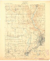
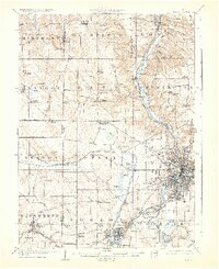
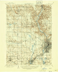
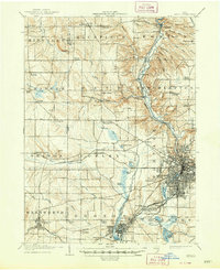
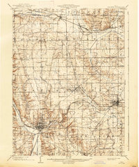
1905 Map of Akron
USGS Topo · Published 1905About this map
The Cuyahoga River valley and the Ohio Canal corridor anchor this early 20th-century landscape, illustrating the complex transit systems that fueled the region's industrial growth. From the high elevation of Boston Ledges in the north down to the concentrated urban grid of Akron, the map captures the transition from rural townships like Hinckley and Granger to the burgeoning manufacturing centers of Barberton and Kenmore. The intricate canal infrastructure is still clearly visible, featuring labeled landmarks such as Deep Lock and Pancake Lock along the waterway.
Find a feature on this map
97 named features on this map. Tap any name to fly to it.
Don’t see what you’re looking for? This feature index may not catch every label — zoom into the map to look around manually.
Map Details
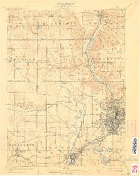
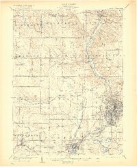
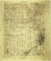
Editions of this 1905 Akron Map
7 editions found
Other maps of this area

1901 · Massillon
USGS Topo · 1:62,500

1901 · Canton
USGS Topo · 1:62,500

1901 · Wooster
USGS Topo · 1:62,500

1902 · Berea
USGS Topo · 1:62,500

1903 · Massillon
USGS Topo · 1:62,500
1903 · Wooster
USGS Topo · 1:62,500

1903 · Cleveland
USGS Topo · 1:62,500

1903 · Canton
USGS Topo · 1:62,500

1903 · Akron
USGS Topo · 1:62,500

1904 · Berea
USGS Topo · 1:62,500