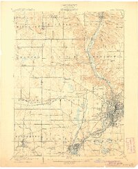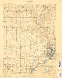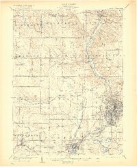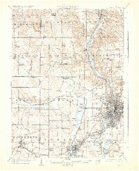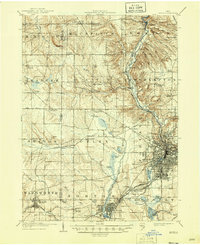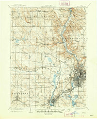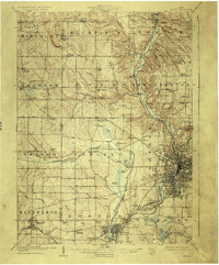
1905 Map of Akron
USGS Topo · Published 1926About this map
Akron and its industrial satellites emerge at a pivotal moment in Northeast Ohio's development, where the legacy of the Ohio and Erie Canal meets a complex network of turn-of-the-century rail lines. The city's grid is well-established near Summit Lake and the Glendale Cemetery, while to the south, Barberton and New Portage show the expansion of manufacturing around Chemical Pond. This survey details the transition from rural township life to an integrated industrial corridor, documenting numerous small crossroads like Ellis Corners Montrose PO and Ghent.
Find a feature on this map
90 named features on this map. Tap any name to fly to it.
Don’t see what you’re looking for? This feature index may not catch every label — zoom into the map to look around manually.
Map Details
Editions of this 1905 Akron Map
7 editions found