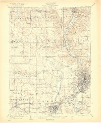
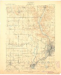
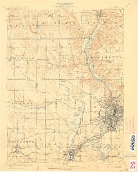
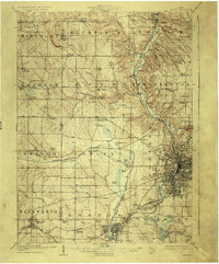
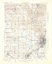
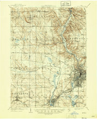
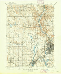
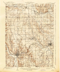
1905 Map of Akron
USGS Topo · Published 1919About this map
Akron serves as the industrial anchor of this 1903 survey, which illustrates the city’s complex relationship with the winding Cuyahoga River and the legacy of the Ohio and Erie Canal. The canal infrastructure is documented in detail, including notable waypoints such as Pancake Lock and Deep Lock. The landscape is characterized by a dense network of water bodies, including Summit Lake, Nesmith Lake, and several smaller ponds like Black Pond and White Pond, which influenced early development patterns.
Find a feature on this map
96 named features on this map. Tap any name to fly to it.
Don’t see what you’re looking for? This feature index may not catch every label — zoom into the map to look around manually.
Map Details
Editions of this 1905 Akron Map
7 editions found
Other maps of this area

1901 · Massillon
USGS Topo · 1:62,500

1901 · Canton
USGS Topo · 1:62,500

1901 · Wooster
USGS Topo · 1:62,500

1902 · Berea
USGS Topo · 1:62,500

1903 · Massillon
USGS Topo · 1:62,500
1903 · Wooster
USGS Topo · 1:62,500

1903 · Cleveland
USGS Topo · 1:62,500

1903 · Canton
USGS Topo · 1:62,500

1903 · Akron
USGS Topo · 1:62,500

1904 · Berea
USGS Topo · 1:62,500