2020s Maps of South Lebanon, Ohio
Explore 2 historic maps of South Lebanon from the 2020s. These maps offer a rare glimpse into what life looked like during the 2020s — showing old roads, neighborhoods, homes, and landmarks that have changed or disappeared over time.
Whether you're researching your family's past, planning a metal detecting trip, or studying how South Lebanon's landscape evolved across the 2020s, these high-resolution maps are a powerful tool for exploring the history of this region.
- Focus on a specific era: All maps on this page are from the 2020s, giving you a focused view of this time period.
- See what’s changed: Compare century-old streets, trails, and buildings to today's modern landscape using overlays and satellite layers.
- Research with precision: Use these maps for genealogy, historical research, land use analysis, or educational projects.
- View, download, or print: Maps are fully viewable online in high resolution, and can be downloaded or printed for your own records.
Start exploring South Lebanon's history through authentic maps from the 2020s. This is your window into the past.
South Lebanon, OH maps
(2)- 2023 Map of South Lebanon, 2023 Print
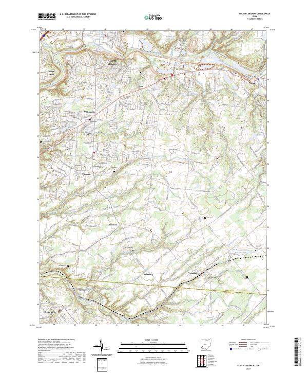 2023 South Lebanon2023 Print · USGSThe Little Miami River corridor in Warren County is captured in this modern survey, showing a landscape of well-connected villages and historic burial grounds. Genealogists and researchers can trace local family lineages at Deerfield Cem, Hill Graveyard, and the Barrett Cem.
 - 2023 Map of Lebanon, 2023 Print
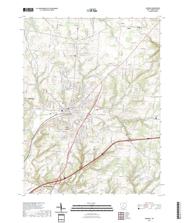 2023 Lebanon2023 Print · USGSWarren County shows its modern growth and deep roots in this recent survey of the area around the county seat. Researchers can find numerous family and community burial sites like Pioneer Cem, Dodds Cem, and Hatfield Cem alongside the historic Warren County Courthouse Annex.
End of results
Showing maps 1-2 of 2
Top cities near South Lebanon
- Cincinnati historical maps
- Middletown historical maps
- Mason historical maps
- Centerville historical maps
- Lebanon historical maps
- Norwood historical maps
See more
Top neighborhoods of South Lebanon
Frequently asked questions
- What are the different types of historical maps available for South Lebanon?
- What is the oldest map of South Lebanon?
- Where can I purchase historical maps of South Lebanon for my home or office?
- Where can I download high-res historical maps of South Lebanon?
- Are there historical topographic maps available for South Lebanon?
- Is there historical aerial imagery available for South Lebanon?
- Where are historical maps of South Lebanon sourced from?