2000s (21st Century) Maps of Bloomfield, Ohio
Explore 6 historic maps of Bloomfield from the 2000s (21st Century). These maps offer a rare glimpse into what life looked like during the 2000s — showing old roads, neighborhoods, homes, and landmarks that have changed or disappeared over time.
Whether you're researching your family's past, planning a metal detecting trip, or studying how Bloomfield's landscape evolved across the 2000s, these high-resolution maps are a powerful tool for exploring the history of this region.
- Focus on a specific era: All maps on this page are from the 2000s, giving you a focused view of this time period.
- See what’s changed: Compare century-old streets, trails, and buildings to today's modern landscape using overlays and satellite layers.
- Research with precision: Use these maps for genealogy, historical research, land use analysis, or educational projects.
- View, download, or print: Maps are fully viewable online in high resolution, and can be downloaded or printed for your own records.
Start exploring Bloomfield's history through authentic maps from the 2000s. This is your window into the past.
Bloomfield, OH maps
(6)- 2002 Map of Rinard Mills, 2006 Print
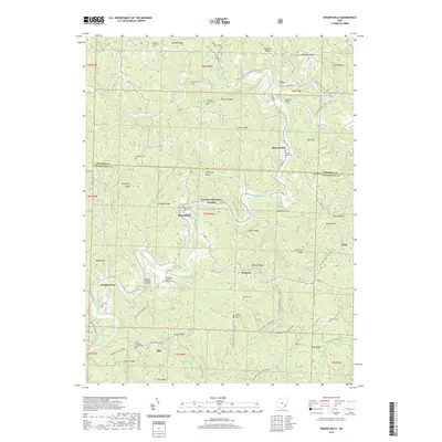
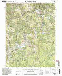 2002 Rinard Mills2006 Print · USGSThe Little Muskingum River valley at the turn of the millennium remains a landscape of historic river crossings and ridge-top homesteads. Trace the location of Knowlton Covered Bridge, the Rinard Mills settlement, and rural churches like Mt Hope Ch.
 - 2011 Map of Rinard Mills, 2011 Print
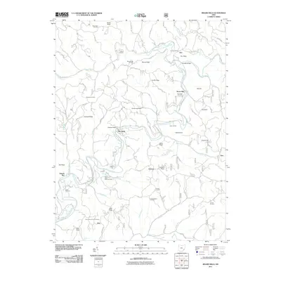 2011 Rinard Mills2011 Print · USGSCovers Bloomfield, including Shay, Cline, and other nearby areas
 - 2013 Map of Rinard Mills, 2013 Print
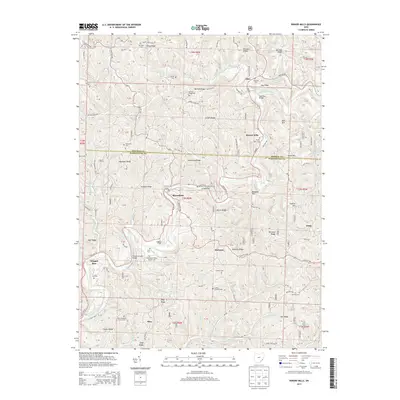 2013 Rinard Mills2013 Print · USGSCovers Bloomfield, including Shay, Cline, and other nearby areas
 - 2016 Map of Rinard Mills, 2016 Print
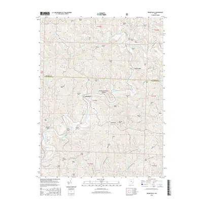 2016 Rinard Mills2016 Print · USGSCovers Bloomfield, including Shay, Cline, and other nearby areas
 - 2019 Map of Rinard Mills, 2019 Print
 2019 Rinard Mills2019 Print · USGSCovers Bloomfield, including Shay, Cline, and other nearby areas
 - 2023 Map of Rinard Mills, 2023 Print
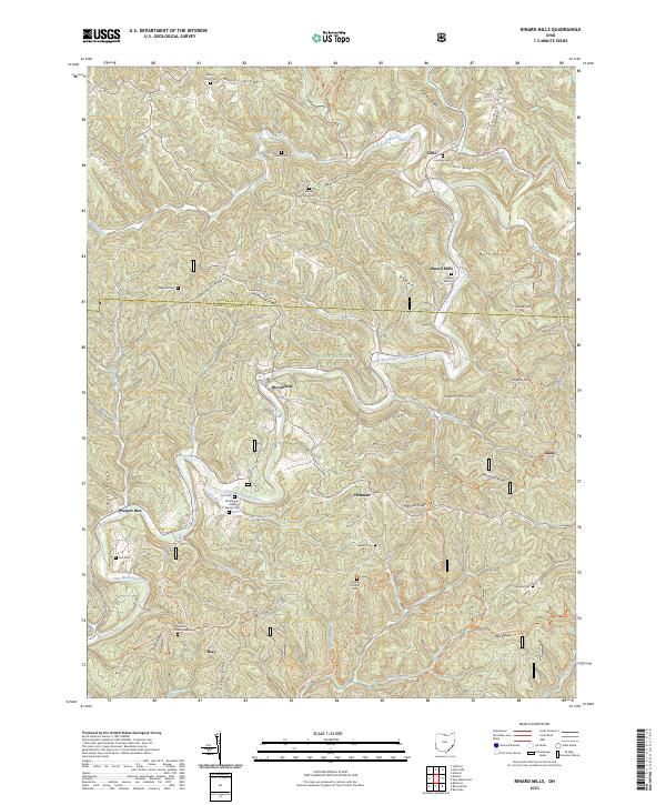 2023 Rinard Mills2023 Print · USGSCrossing the Monroe and Washington County line in southeastern Ohio, this area centers on the winding Little Muskingum River and its rural valley settlements. Genealogists can locate family burial sites like Rinard Mills Cem and Ludlow Catholic Cem or trace the early paths of Shay and Hohman.
End of results
Showing maps 1-6 of 6
Top cities near Bloomfield
- Marietta historical maps
- Woodsfield historical maps
- Newport historical maps
- Grandview historical maps
- Sistersville historical maps
- Belmont historical maps
See more
Frequently asked questions
- What are the different types of historical maps available for Bloomfield?
- What is the oldest map of Bloomfield?
- Where can I purchase historical maps of Bloomfield for my home or office?
- Where can I download high-res historical maps of Bloomfield?
- Are there historical topographic maps available for Bloomfield?
- Is there historical aerial imagery available for Bloomfield?
- Where are historical maps of Bloomfield sourced from?