2020s Maps of Kinta, Oklahoma
Explore 2 historic maps of Kinta from the 2020s. These maps offer a rare glimpse into what life looked like during the 2020s — showing old roads, neighborhoods, homes, and landmarks that have changed or disappeared over time.
Whether you're researching your family's past, planning a metal detecting trip, or studying how Kinta's landscape evolved across the 2020s, these high-resolution maps are a powerful tool for exploring the history of this region.
- Focus on a specific era: All maps on this page are from the 2020s, giving you a focused view of this time period.
- See what’s changed: Compare century-old streets, trails, and buildings to today's modern landscape using overlays and satellite layers.
- Research with precision: Use these maps for genealogy, historical research, land use analysis, or educational projects.
- View, download, or print: Maps are fully viewable online in high resolution, and can be downloaded or printed for your own records.
Start exploring Kinta's history through authentic maps from the 2020s. This is your window into the past.
Kinta, OK maps
(2)- 2022 Map of Sans Bois, 2022 Print
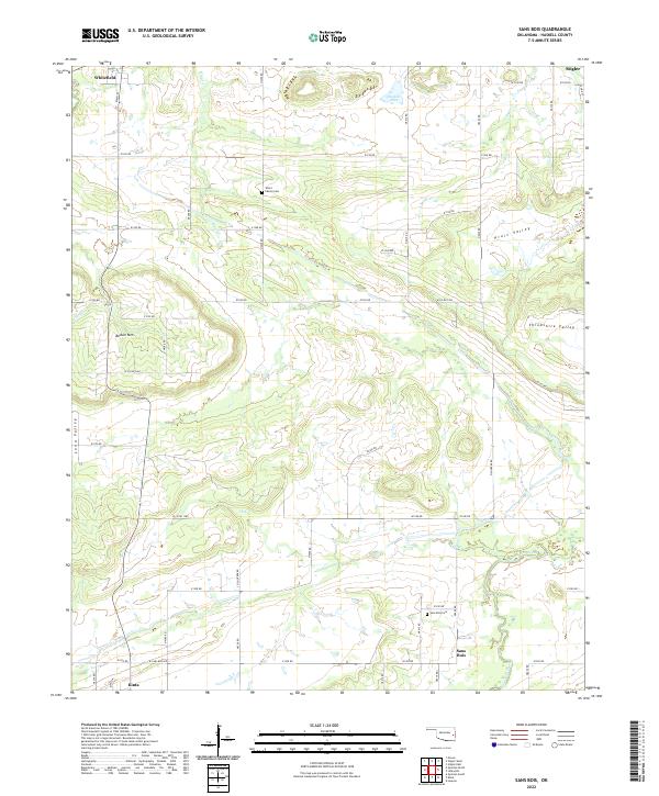 2022 Sans Bois2022 Print · USGSHaskell County's rural landscape is captured here in the early twenty-first century, showing the dispersed settlements and family lands of the Oklahoma countryside. Genealogists and local historians can locate the Sans Bois Cem, Vance Family Cem, and the communities of Whitefield and Sans Bois.
 - 2022 Map of Kinta, 2022 Print
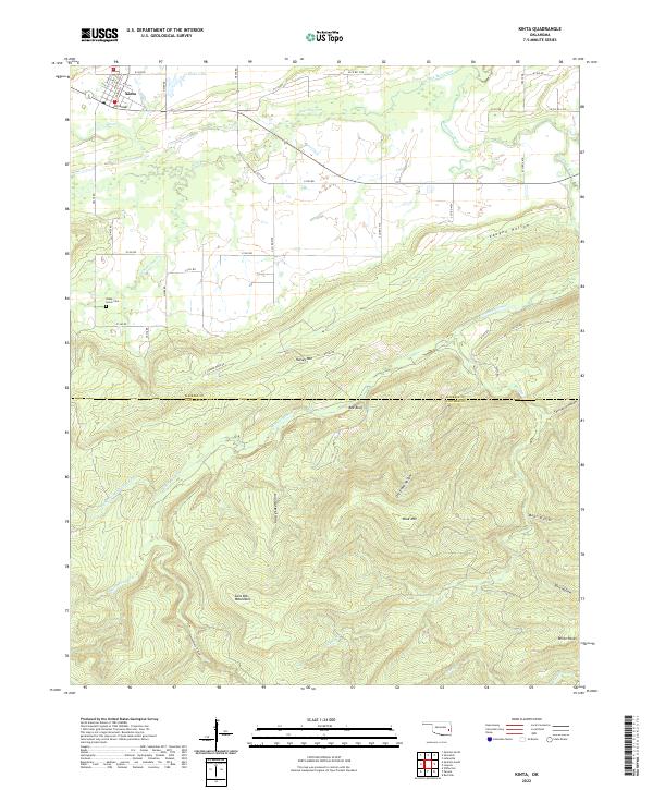 2022 Kinta2022 Print · USGSKinta and the surrounding Sans Bois Mountains are shown here in the early twenty-first century, where the prairie meets the high ridges. Genealogists can locate Shady Grove Cem while topographical researchers trace Mountain Fork and the heights of Blue Mtn.
End of results
Showing maps 1-2 of 2
Top cities near Kinta
- Wilburton historical maps
- Stigler historical maps
- Quinton historical maps
- Red Oak historical maps
- Whitefield historical maps
Frequently asked questions
- What are the different types of historical maps available for Kinta?
- What is the oldest map of Kinta?
- Where can I purchase historical maps of Kinta for my home or office?
- Where can I download high-res historical maps of Kinta?
- Are there historical topographic maps available for Kinta?
- Is there historical aerial imagery available for Kinta?
- Where are historical maps of Kinta sourced from?