Old Maps of Prue, Oklahoma for Metal Detecting
Plan your next treasure hunt with 18 historic maps of Prue. Find old homesites, ghost towns, trails, and gathering spots that may be lost to time — perfect for identifying promising metal detecting locations.
- Locate forgotten sites: Uncover places like long-lost settlements, abandoned rail lines, or gathering spots.
- Plan better hunts: Use map overlays combined with LiDAR or satellite views to narrow in on historically rich areas.
- Made for detectorists: Thousands of hobbyists use these maps to discover relics, coins, and hidden history.
Use these historic maps to boost your research and find new opportunities beneath the surface of Prue.
Prue, OK maps
(18)- 1912 Map of Hominy, 1960 Print
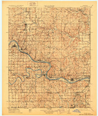
 1912 Hominy1960 Print · USGSNortheastern Oklahoma comes alive in this pre-reservoir survey, documenting the river-valley settlements and tribal lands of the early statehood era. Genealogists can locate dozens of country schools and sites like Black Dog (Indian Village) or the early Oil City Barnsdall P O.
 - 1915 Map of Hominy
 1915 Hominy1915 Print · USGSOsage and Creek counties come to life in the years before the Great War, showing a landscape defined by river confluences and the expansion of the rail industry. Genealogists can locate early settlements like Black Dog and schools like Dripping Spring School or Sunset School.2 unique versions available
 - 1915 Map of Hominy, 1928 Print
 1915 Hominy1928 Print · USGSNortheast Oklahoma during the early oil and rail boom is captured here as the Osage and Creek county lines meet the great river bends. Genealogists can trace early homesteads near Black Dog, Oil City, and Union Chapel.2 unique versions available
 - 1955 Map of Enid, 1966 Print
 1955 Enid1966 Print · USGSNorth-central Oklahoma's transition from open plains to the blackjack hills of the Osage Indian Reservation is captured in the mid-1950s. Researchers can trace the development of the Naval Reserve Oil Field, the grounds of Vance AFB, and the early footprints of Tulsa and Stillwater.4 unique versions available
 - 1958 Map of Enid
 1958 Enid1958 Print · USGSNorthern Oklahoma is mapped here in the late fifties, showcasing a dense network of petroleum production and historic tribal lands. Researchers can trace the legacy of the Osage Indian Reservation, early energy hubs like the Cushing Oil Field, and the Chilocco Indian Agricultural School.2 unique versions available
 - 1958 Map of Keystone Dam, 1959 Print
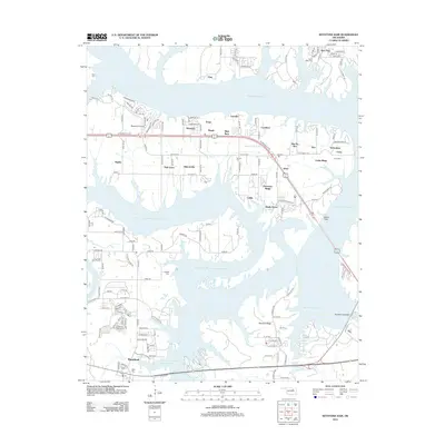
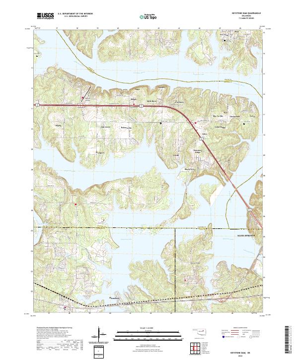
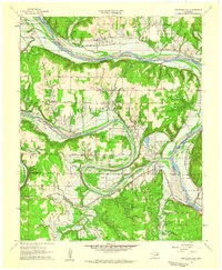 1958 Keystone Dam1959 Print · USGSOklahoma's river valleys underwent a massive transformation in the late fifties as the Keystone Dam Under Construction project began. Researchers can trace the original locations of Prue, Appalachia, and Keystone along with family-named sites like Dixie Cem.4 unique versions available
 - 1966 Map of New Prue, 1967 Print
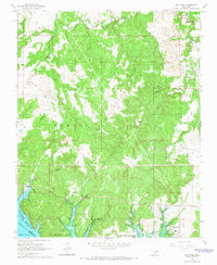 1966 New Prue1967 Print · USGSOsage County was undergoing a major geographic shift in the mid-sixties as the newly formed Keystone Reservoir altered the valley floor. Genealogists and historians can trace the early layout of New Prue and find industrial footprints in the Osage City Oil Field or near Wildhorse.3 unique versions available
 - 1990 Map of Keystone Lake
 1990 Keystone Lake1990 Print · USGSNorth-central Oklahoma's landscape is captured here in the 1990s as the vast waters of Keystone Lake meet the Osage Indian Reservation. Researchers can trace old rail corridors like the St Louis-San Francisco Railway and find local landmarks such as Pawnee Bill State Park or the Oil Field at Oilton.
 - 2010 Map of New Prue, 2010 Print
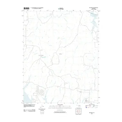 2010 New Prue2010 Print · USGSCovers Prue, including Skiatook, Frontier Shores, and other nearby areas
 - 2010 Map of Keystone Dam, 2010 Print
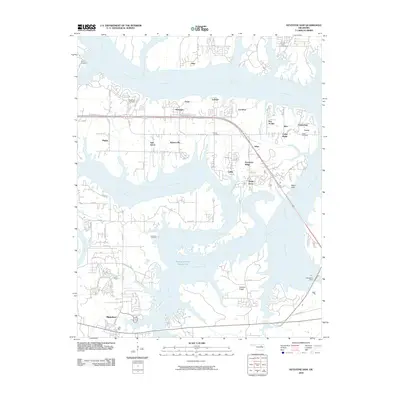 2010 Keystone Dam2010 Print · USGSCovers Prue, including Sand Springs, Sand Creek, and other nearby areas
 - 2012 Map of Keystone Dam, 2012 Print
 2012 Keystone Dam2012 Print · USGSCovers Prue, including Sand Springs, Sand Creek, and other nearby areas
 - 2012 Map of New Prue, 2012 Print
 2012 New Prue2012 Print · USGSCovers Prue, including Skiatook, Frontier Shores, and other nearby areas
 - 2016 Map of New Prue, 2016 Print
 2016 New Prue2016 Print · USGSCovers Prue, including Skiatook, Frontier Shores, and other nearby areas
 - 2016 Map of Keystone Dam, 2016 Print
 2016 Keystone Dam2016 Print · USGSCovers Prue, including Sand Springs, Sand Creek, and other nearby areas
 - 2018 Map of New Prue, 2018 Print
 2018 New Prue2018 Print · USGSCovers Prue, including Skiatook, Frontier Shores, and other nearby areas
 - 2018 Map of Keystone Dam, 2018 Print
 2018 Keystone Dam2018 Print · USGSCovers Prue, including Sand Springs, Sand Creek, and other nearby areas
 - 2022 Map of Keystone Dam, 2022 Print
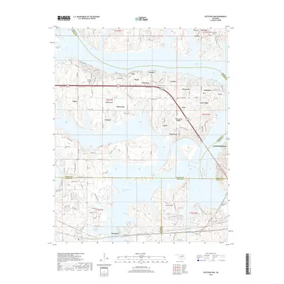
 2022 Keystone Dam2022 Print · USGSThe intricate shoreline of Keystone Lake and the Arkansas River define this corner of Oklahoma in 2022. Researchers can trace local landmarks like Westport Airport, family burial sites at Prairie View Cem, and the layout of Mannford.
 - 2022 Map of New Prue, 2022 Print
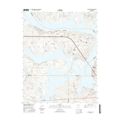
 2022 New Prue2022 Print · USGSThe Osage County hill country is captured here in the contemporary era, framed by the waters of two major reservoirs. Researchers can trace local landmarks and residential growth near Prue, Indian Station, and the winding course of Wildhorse Creek.
End of results
Showing maps 1-18 of 18
Top cities near Prue
- Tulsa historical maps
- Sapulpa historical maps
- Sand Springs historical maps
- Skiatook historical maps
- Hominy historical maps
- Cleveland historical maps
See more
Top neighborhoods of Prue
Frequently asked questions
- What are the different types of historical maps available for Prue?
- What is the oldest map of Prue?
- Where can I purchase historical maps of Prue for my home or office?
- Where can I download high-res historical maps of Prue?
- Are there historical topographic maps available for Prue?
- Is there historical aerial imagery available for Prue?
- Where are historical maps of Prue sourced from?