Old Maps of South Brook, Wagoner County for Genealogy
Trace your family roots with 16 historic maps of South Brook. These high-res maps reveal old neighborhoods, homesites, landmarks, and streets — helping you uncover where your ancestors lived and how the area evolved over time.
- Explore historic neighborhoods: Identify where your relatives may have lived in the 1800s or 1900s.
- Compare maps over time: Trace the changes in streets, buildings, and landmarks for multi-generational research.
- Perfect for genealogy & ancestry research: Used by family historians and researchers to map out lineage and migration.
These maps are an incredible resource for exploring your personal connection to South Brook's past.
South Brook, Wagoner County maps
(16)- 1896 Map of Okmulgee, 1954 Print
 1896 Okmulgee1954 Print · USGSCovers South Brook, including Tulsa, Bixby, and other nearby areas
 - 1900 Map of Okmulgee
 1900 Okmulgee1900 Print · USGSCovers South Brook, including Tulsa, Bixby, and other nearby areas4 unique versions available
 - 1901 Map of Claremore
 1901 Claremore1901 Print · USGSCovers South Brook, including Tulsa, Broken Arrow, and other nearby areas4 unique versions available
 - 1914 Map of Claremore, 1959 Print
 1914 Claremore1959 Print · USGSCovers South Brook, including Tulsa, Broken Arrow, and other nearby areas
 - 1916 Map of Claremore
 1916 Claremore1916 Print · USGSCovers South Brook, including Tulsa, Broken Arrow, and other nearby areas4 unique versions available
 - 1946 Map of Fort Smith
 1946 Fort Smith1946 Print · USGSCovers South Brook, including Tulsa, Fayetteville, and other nearby areas
 - 1954 Map of Tulsa
 1954 Tulsa1954 Print · USGSCovers South Brook, including Tulsa, Broken Arrow, and other nearby areas2 unique versions available
 - 1958 Map of Tulsa, 1968 Print
 1958 Tulsa1968 Print · USGSCovers South Brook, including Tulsa, Broken Arrow, and other nearby areas3 unique versions available
 - 1963 Map of Tulsa
 1963 Tulsa1963 Print · USGSCovers South Brook, including Tulsa, Broken Arrow, and other nearby areas
 - 1963 Map of Coweta, 1964 Print
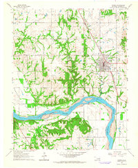 1963 Coweta1964 Print · USGSCovers South Brook, including Coweta, Stonebluff, and other nearby areas2 unique versions available
 - 1963 Map of Oneta, 1964 Print
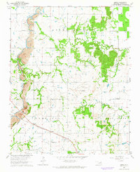 1963 Oneta1964 Print · USGSCovers South Brook, including Tulsa, Coweta, and other nearby areas3 unique versions available
 - 1965 Map of Fort Smith
 1965 Fort Smith1965 Print · USGSCovers South Brook, including Tulsa, Fayetteville, and other nearby areas
 - 1967 Map of Fort Smith
 1967 Fort Smith1967 Print · USGSCovers South Brook, including Tulsa, Fayetteville, and other nearby areas
 - 1978 Map of Muskogee, 1979 Print
 1978 Muskogee1979 Print · USGSCovers South Brook, including Tulsa, Muskogee, and other nearby areas
 - 1978 Map of Fort Smith, 1979 Print
 1978 Fort Smith1979 Print · USGSCovers South Brook, including Tulsa, Fayetteville, and other nearby areas2 unique versions available
 - 1985 Map of Tulsa
 1985 Tulsa1985 Print · USGSCovers South Brook, including Tulsa, Broken Arrow, and other nearby areas2 unique versions available
End of results
Showing maps 1-16 of 16
Frequently asked questions
- What are the different types of historical maps available for South Brook?
- What is the oldest map of South Brook?
- Where can I purchase historical maps of South Brook for my home or office?
- Where can I download high-res historical maps of South Brook?
- Are there historical topographic maps available for South Brook?
- Is there historical aerial imagery available for South Brook?
- Where are historical maps of South Brook sourced from?