Old Maps of China Town, Oregon for Hiking & Exploration
Hike through history with 9 historic maps of China Town. Explore old trails, ghost towns, and forgotten backroads — perfect for outdoor adventurers and local explorers.
- Rediscover forgotten places: Map out old mining camps, roads, and footpaths that no longer exist on modern maps.
- Layer with modern tools: Combine with LiDAR or satellite views to plan hikes through historical terrain.
- Made for exploration: Popular among hikers, overlanders, and local history lovers.
Use these maps to find adventure and explore the hidden past of China Town.
China Town, OR maps
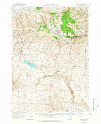
(9)- 1955 Map of Baker, 1964 Print
 1955 Baker1964 Print · USGSThe Oregon-Idaho borderlands are captured here in the mid-fifties as the Snake River underwent massive changes from dam construction. Trace the Oregon Trail Memorial Monument near Baker, find early mines like Virtue Mine, and follow the Union Pacific Railroad through Huntington.4 unique versions available
 - 1959 Map of Baker
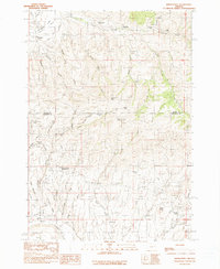
 1959 Baker1959 Print · USGSThe Oregon and Idaho borderlands come alive in the late fifties, showing the rugged corridor along the Snake River and the high peaks of the Wallowa Mountains. Researchers can trace the legacy of the Union Pacific railroad or locate historic mining sites like the Flagstaff Mine and Virtue Mine.2 unique versions available
 - 1964 Map of Bridgeport, 1966 Print
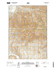
 1964 Bridgeport1966 Print · USGSEastern Oregon gold country comes into sharp focus during the mid-1960s, showing a landscape shaped by early mining and water management. Researchers can trace the ruins of Malheur City and Eldorado or locate specific workings like the Humboldt Mine and Iron Door Mine.2 unique versions available
 - 1980 Map of Brogan, 1997 Print
 1980 Brogan1997 Print · USGSThe Oregon-Idaho borderlands come alive in this late-century survey of the high desert and river valleys. Researchers can trace the legacy of ranching and transport through sites like Malheur City, the Union Pacific rail lines, and the Snake River crossings.
 - 1990 Map of Bridgeport
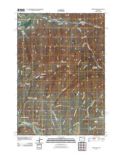
 1990 Bridgeport1990 Print · USGSEastern Oregon mining history is etched into this late twentieth-century landscape where Baker and Malheur counties meet. Researchers can trace the footprints of old hydraulic systems like the Eldorado Ditch and locate historic hubs including China Town and Malheur City.
 - 2011 Map of Bridgeport, 2011 Print
 2011 Bridgeport2011 Print · USGSCovers China Town, including Eldorado, Bridgeport, and other nearby areas
 - 2014 Map of Bridgeport, 2014 Print
 2014 Bridgeport2014 Print · USGSCovers China Town, including Eldorado, Bridgeport, and other nearby areas
 - 2020 Map of Bridgeport, 2020 Print
 2020 Bridgeport2020 Print · USGSCovers China Town, including Eldorado, Bridgeport, and other nearby areas
 - 2023 Map of Bridgeport, 2023 Print
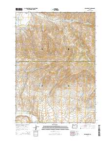
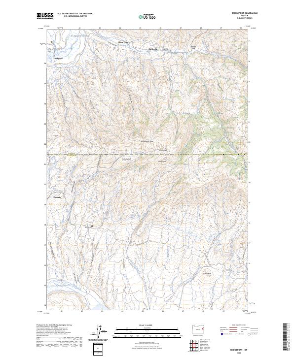 2023 Bridgeport2023 Print · USGSThe Baker and Malheur county line is captured here in the contemporary era, showing a landscape shaped by historic water diversions. Researchers can trace the paths of the Eldorado Ditch and find local history at the Bridgeport Cem and China Town.
End of results
Showing maps 1-9 of 9
Frequently asked questions
- What are the different types of historical maps available for China Town?
- What is the oldest map of China Town?
- Where can I purchase historical maps of China Town for my home or office?
- Where can I download high-res historical maps of China Town?
- Are there historical topographic maps available for China Town?
- Is there historical aerial imagery available for China Town?
- Where are historical maps of China Town sourced from?