1980s Maps of Durkee, Oregon
Explore 2 historic maps of Durkee from the 1980s. These maps offer a rare glimpse into what life looked like during the 1980s — showing old roads, neighborhoods, homes, and landmarks that have changed or disappeared over time.
Whether you're researching your family's past, planning a metal detecting trip, or studying how Durkee's landscape evolved across the 1980s, these high-resolution maps are a powerful tool for exploring the history of this region.
- Focus on a specific era: All maps on this page are from the 1980s, giving you a focused view of this time period.
- See what’s changed: Compare century-old streets, trails, and buildings to today's modern landscape using overlays and satellite layers.
- Research with precision: Use these maps for genealogy, historical research, land use analysis, or educational projects.
- View, download, or print: Maps are fully viewable online in high resolution, and can be downloaded or printed for your own records.
Start exploring Durkee's history through authentic maps from the 1980s. This is your window into the past.
Durkee, OR maps
(2)- 1981 Map of Baker
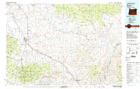 1981 Baker1981 Print · USGSEastern Oregon in the early eighties shows a landscape of deep canyons and high mountain mining districts. Genealogists and researchers can trace the Union Pacific corridor through Baker or locate remote operations like the Young American Mine and Rachel Mine.2 unique versions available
 - 1988 Map of Durkee
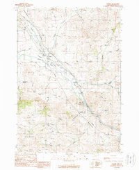 1988 Durkee1988 Print · USGSThe Burnt River Valley in the late 1980s reveals a landscape of enduring pioneer trails and active rail infrastructure. Researchers can trace the Oregon Trail, locate the Clay Pit Graves, and explore mining sites like Gold Ridge Mine.
End of results
Showing maps 1-2 of 2
Frequently asked questions
- What are the different types of historical maps available for Durkee?
- What is the oldest map of Durkee?
- Where can I purchase historical maps of Durkee for my home or office?
- Where can I download high-res historical maps of Durkee?
- Are there historical topographic maps available for Durkee?
- Is there historical aerial imagery available for Durkee?
- Where are historical maps of Durkee sourced from?