Old Maps of Fernwood, Oregon for Metal Detecting
Plan your next treasure hunt with 14 historic maps of Fernwood. Find old homesites, ghost towns, trails, and gathering spots that may be lost to time — perfect for identifying promising metal detecting locations.
- Locate forgotten sites: Uncover places like long-lost settlements, abandoned rail lines, or gathering spots.
- Plan better hunts: Use map overlays combined with LiDAR or satellite views to narrow in on historically rich areas.
- Made for detectorists: Thousands of hobbyists use these maps to discover relics, coins, and hidden history.
Use these historic maps to boost your research and find new opportunities beneath the surface of Fernwood.
Fernwood, OR maps
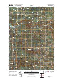
(14)- 1916 Map of Estacada
 1916 Estacada1916 Print · USGSClackamas County is captured here during a period of rapid hydroelectric and rail development just before the First World War. Researchers can trace early family homesteads near Fishers Mill, the old Feldbimer Ferry crossing, and the rail line serving Boring and Estacada.5 unique versions available
 - 1948 Map of Vancouver, 1957 Print
 1948 Vancouver1957 Print · USGSPost-war growth transforms the river valleys of the Pacific Northwest as the timber and rail economy thrives. Trace family roots in Tillamook or Oregon City, and locate vanished landmarks like the spit at Bayocean or the Skamania Mine.
 - 1950 Map of Vancouver
 1950 Vancouver1950 Print · USGSCoastal Oregon and the lower Columbia River valley are captured in detail just after the war. Researchers can trace historic rail routes like the Southern Pacific or locate early settlements such as Vernonia, Gaston, and the Grand Ronde Indian Reservation.
 - 1950 Map of Vancouver, 1951 Print
 1950 Vancouver1951 Print · USGSThe Pacific Northwest urban corridor meets the rugged coast in the years following the war, showing the expansion of Portland and Vancouver. Genealogists and historians can trace the reach of the Southern Pacific RR and locate coastal communities like Tillamook, Seaside, and Tolovana Park.
 - 1955 Map of Colton, 1957 Print
 1955 Colton1957 Print · USGSClackamas County saw a blend of timber management and small-town life in the mid-1950s. Researchers can trace the layout of Colton, find family-named routes like Dhooghe Rd, and locate remote sites like Windy City or the Hillockburn Guard Sta.3 unique versions available
 - 1958 Map of Vancouver, 1968 Print
 1958 Vancouver1968 Print · USGSThe Lower Columbia and Willamette valleys thrive in the late sixties as major rail and river hubs. Genealogists and historians can trace the development of Portland, identify the grounds of Camp Withycombe, and locate coastal landmarks from Tillamook Head to Garibaldi.3 unique versions available
 - 1964 Map of Vancouver
 1964 Vancouver1964 Print · USGSThe Pacific Northwest interior and coast are shown here in the 1960s, from the Portland metropolitan hub to the rugged Pacific shoreline. Researchers can trace the legacy of the Grand Ronde Indian Reservation, the early layout of McMinnville, and the maritime approaches near Tillamook Head.
 - 1982 Map of Oregon City, 1983 Print
 1982 Oregon City1983 Print · USGSGreater Portland and the Willamette Valley are shown in the early eighties as the region's urban and rural landscapes converged. Genealogists and historians can trace family-named sites across French Prairie, visit St Paul Ch, or locate the grounds of Dammasch State Hospital.
 - 1986 Map of Fernwood
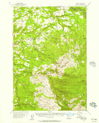
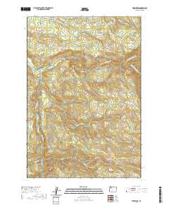
 1986 Fernwood1986 Print · USGSClackamas County in the mid-eighties was a hub for river management and mountain resource extraction. Researchers can trace the drainage of the Molalla River, locate early industrial sites like the Barrow Pit, and find local landmarks such as Beeres Pond and Fernwood.
 - 2011 Map of Fernwood, 2011 Print
 2011 Fernwood2011 Print · USGSCovers Fernwood, including Glen Avon, Clackamas County, and other nearby areas
 - 2014 Map of Fernwood, 2014 Print
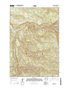 2014 Fernwood2014 Print · USGSCovers Fernwood, including Glen Avon, Clackamas County, and other nearby areas
 - 2017 Map of Fernwood, 2017 Print
 2017 Fernwood2017 Print · USGSCovers Fernwood, including Glen Avon, Clackamas County, and other nearby areas
 - 2020 Map of Fernwood, 2020 Print
 2020 Fernwood2020 Print · USGSCovers Fernwood, including Glen Avon, Clackamas County, and other nearby areas
 - 2023 Map of Fernwood, 2023 Print
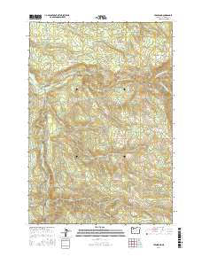
 2023 Fernwood2023 Print · USGSClackamas County forest lands and river corridors are charted here in the early twenty-first century. Genealogists and hikers can trace family sites at Fern Hill Cem or navigate the extensive trail system including the Molalla-Rim Tr.
End of results
Showing maps 1-14 of 14
Top cities near Fernwood
- Oregon City historical maps
- West Linn historical maps
- Canby historical maps
- Molalla historical maps
- Estacada historical maps
- Scotts Mills historical maps
Frequently asked questions
- What are the different types of historical maps available for Fernwood?
- What is the oldest map of Fernwood?
- Where can I purchase historical maps of Fernwood for my home or office?
- Where can I download high-res historical maps of Fernwood?
- Are there historical topographic maps available for Fernwood?
- Is there historical aerial imagery available for Fernwood?
- Where are historical maps of Fernwood sourced from?