1970s Maps of Coos Bay, Oregon
Explore 4 historic maps of Coos Bay from the 1970s. These maps offer a rare glimpse into what life looked like during the 1970s — showing old roads, neighborhoods, homes, and landmarks that have changed or disappeared over time.
Whether you're researching your family's past, planning a metal detecting trip, or studying how Coos Bay's landscape evolved across the 1970s, these high-resolution maps are a powerful tool for exploring the history of this region.
- Focus on a specific era: All maps on this page are from the 1970s, giving you a focused view of this time period.
- See what’s changed: Compare century-old streets, trails, and buildings to today's modern landscape using overlays and satellite layers.
- Research with precision: Use these maps for genealogy, historical research, land use analysis, or educational projects.
- View, download, or print: Maps are fully viewable online in high resolution, and can be downloaded or printed for your own records.
Start exploring Coos Bay's history through authentic maps from the 1970s. This is your window into the past.
Coos Bay, OR maps
(4)- 1970 Map of Empire, 1973 Print
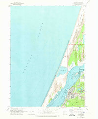 1970 Empire1973 Print · USGSThe Coos Bay shoreline at the start of the 1970s reveals a landscape defined by industrial expansion and coastal preservation. Researchers can trace the layout of the Empire settlement, the campus of Southwestern Oregon Community College, and the sprawling North Spit.2 unique versions available
 - 1970 Map of Charleston, 1974 Print
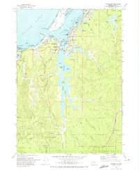 1970 Charleston1974 Print · USGSThe Oregon coast at Coos Bay comes alive in this 1970s survey, detailing a landscape defined by maritime research and military installations. Trace the coastal developments from the Cape Arago Lighthouse to the Cranberry Bogs and the US Naval Facility.
 - 1971 Map of Coos Bay, 1974 Print
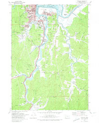 1971 Coos Bay1974 Print · USGSThe Coos Bay shoreline in the early seventies was a bustling network of timber shipping, rail transport, and mining. Genealogists and local historians can trace family-named sites and old communities like Libby, Southport, and the Sumner Pioneer Cem.2 unique versions available
 - 1971 Map of North Bend, 1974 Print
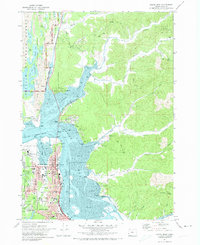 1971 North Bend1974 Print · USGSThe Coos Bay shoreline was a hub of industrial and timber activity in the early seventies, centered on the growing port cities. Genealogists and researchers can trace local neighborhoods and schools like Sunny Hill Sch, the historic McCullough Bridge, and rural corners such as Cooston.
End of results
Showing maps 1-4 of 4
Top cities near Coos Bay
- North Bend historical maps
- Coquille historical maps
- Barview historical maps
- Lakeside historical maps
- Charleston historical maps
Top neighborhoods of Coos Bay
Frequently asked questions
- What are the different types of historical maps available for Coos Bay?
- What is the oldest map of Coos Bay?
- Where can I purchase historical maps of Coos Bay for my home or office?
- Where can I download high-res historical maps of Coos Bay?
- Are there historical topographic maps available for Coos Bay?
- Is there historical aerial imagery available for Coos Bay?
- Where are historical maps of Coos Bay sourced from?