Old Maps of Anlauf, Oregon for Genealogy
Trace your family roots with 10 historic maps of Anlauf. These high-res maps reveal old neighborhoods, homesites, landmarks, and streets — helping you uncover where your ancestors lived and how the area evolved over time.
- Explore historic neighborhoods: Identify where your relatives may have lived in the 1800s or 1900s.
- Compare maps over time: Trace the changes in streets, buildings, and landmarks for multi-generational research.
- Perfect for genealogy & ancestry research: Used by family historians and researchers to map out lineage and migration.
These maps are an incredible resource for exploring your personal connection to Anlauf's past.
Anlauf, OR maps
(10)- 1954 Map of Anlauf, 1956 Print
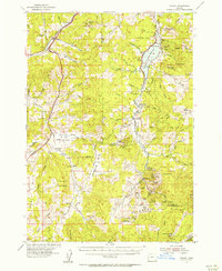 1954 Anlauf1956 Print · USGSThe Southern Pacific railroad and the Calapooya Divide define this Douglas County landscape in the mid-1950s. Trace old mercury mining operations at Elkhead Mines, locate the Anlauf Cemetery, or follow the early boundaries of the Cottage Grove Reservoir.3 unique versions available
 - 1958 Map of Roseburg, 1960 Print
 1958 Roseburg1960 Print · USGSThe timber valleys and high volcanic peaks of Southern Oregon are captured here in the late fifties. Researchers can trace the Southern Pacific rail line through historic settlements like Cottage Grove, Yoncalla, and Oakridge near the Cascade Range crest.4 unique versions available
 - 1959 Map of Roseburg
 1959 Roseburg1959 Print · USGSThe Umpqua and Willamette valleys meet the high Cascades in this late-fifties study of Southern Oregon's timber and rail corridors. Genealogists and researchers can trace the Southern Pacific RR through historic towns like Roseburg, Yoncalla, and Cottage Grove.
 - 1979 Map of Cottage Grove
 1979 Cottage Grove1979 Print · USGSThe Oregon timber and rail corridors of the late seventies are documented here, centered on the Coast Fork Willamette River and the growing hub of Cottage Grove. Researchers can trace the path of the Southern Pacific railroad as it connects small stations like Divide, Saginaw, and Yoncalla.2 unique versions available
 - 1987 Map of Curtin
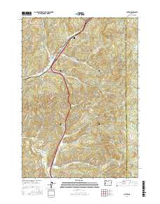
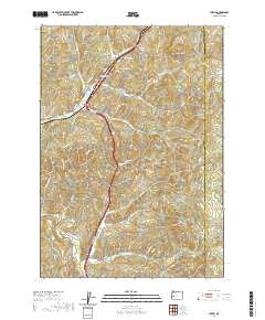
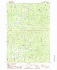 1987 Curtin1987 Print · USGSDouglas County settlements line the canyon floor during the late eighties, where the rail and road follow the winding path of Pass Creek. Genealogists and local historians can trace the small communities of Anlauf, Comstock, and Curtin along the Southern Pacific line.
 - 2011 Map of Curtin, 2011 Print
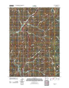 2011 Curtin2011 Print · USGSCovers Anlauf, including Curtin, Comstock, and other nearby areas
 - 2014 Map of Curtin, 2014 Print
 2014 Curtin2014 Print · USGSCovers Anlauf, including Curtin, Comstock, and other nearby areas
 - 2017 Map of Curtin, 2017 Print
 2017 Curtin2017 Print · USGSCovers Anlauf, including Curtin, Comstock, and other nearby areas
 - 2020 Map of Curtin, 2020 Print
 2020 Curtin2020 Print · USGSCovers Anlauf, including Curtin, Comstock, and other nearby areas
 - 2023 Map of Curtin, 2023 Print
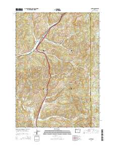
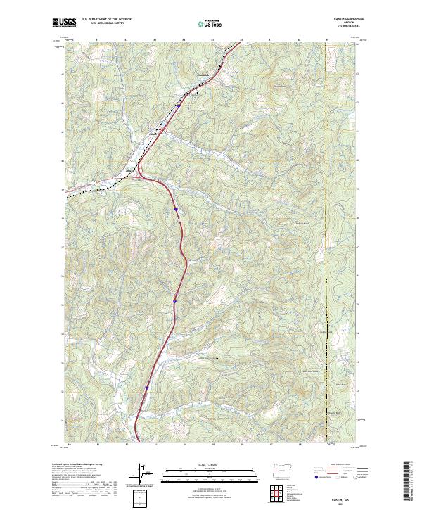 2023 Curtin2023 Print · USGSDouglas County and the Lane County border area are shown in this modern topographic study, centered on the historic mountain corridors. Genealogists and researchers can trace local landmarks like Comstock Cem, the Indian Burial Ground, and the small settlement of Anlauf.
End of results
Showing maps 1-10 of 10
Top cities near Anlauf
Frequently asked questions
- What are the different types of historical maps available for Anlauf?
- What is the oldest map of Anlauf?
- Where can I purchase historical maps of Anlauf for my home or office?
- Where can I download high-res historical maps of Anlauf?
- Are there historical topographic maps available for Anlauf?
- Is there historical aerial imagery available for Anlauf?
- Where are historical maps of Anlauf sourced from?