Old Maps of Azalea, Oregon for Hiking & Exploration
Hike through history with 12 historic maps of Azalea. Explore old trails, ghost towns, and forgotten backroads — perfect for outdoor adventurers and local explorers.
- Rediscover forgotten places: Map out old mining camps, roads, and footpaths that no longer exist on modern maps.
- Layer with modern tools: Combine with LiDAR or satellite views to plan hikes through historical terrain.
- Made for exploration: Popular among hikers, overlanders, and local history lovers.
Use these maps to find adventure and explore the hidden past of Azalea.
Azalea, OR maps
(12)- 1904 Map of Riddle
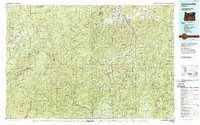
 1904 Riddle1904 Print · USGSSouthern Oregon's mining and railroad corridor is captured here at the start of the twentieth century. Genealogists can trace family footprints through early settlements like Riddles and Galesville or locate specific claims like the Placer Star Mine.5 unique versions available
 - 1954 Map of Canyonville, 1956 Print
 1954 Canyonville1956 Print · USGSSouthern Douglas County at mid-century shows a landscape shaped by timber, mining, and the vital rail corridor of the Southern Pacific. Researchers can trace the development of Riddle and Canyonville, locate the industrial site at Nickel Mine, and identify historical locations like Galesville.2 unique versions available
 - 1955 Map of Medford, 1964 Print
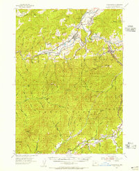
 1955 Medford1964 Print · USGSSouthern Oregon's valley towns and high peaks are captured here in the mid-1950s, showing the region before the completion of the modern interstate system. Genealogists and historians can trace the development of timber and mining outposts from Wolf Creek to Butte Falls and the early roads to Crater Lake.3 unique versions available
 - 1957 Map of Medford
 1957 Medford1957 Print · USGSSouthern Oregon during the mid-fifties is captured here as a region of growing valley cities and vast timberlands. Genealogists and historians can trace the rail-and-road corridors connecting Medford, Jacksonville, and Grants Pass to more remote locales like Wolf Creek or Butte Falls.
 - 1958 Map of Medford
 1958 Medford1958 Print · USGSSouthern Oregon's Rogue River valley thrived in the 1950s as a crossroads of rail and road. Researchers can trace the legacy of timber and tourism through Southern Pacific RR lines and landmarks like Crater Lake and Oregon Caves National Monument.
 - 1986 Map of Quines Creek
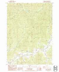 1986 Quines Creek1986 Print · USGSDouglas County's rugged drainage basins come into focus in the 1980s, centered on the intersection of Quines Creek and Cow Creek. Genealogists and local historians can trace family-named landmarks and rural sites like Azalea, Schoolhouse Spring, and the Cem.
 - 1989 Map of Canyonville
 1989 Canyonville1989 Print · USGSSouthern Oregon's timber and rail corridors come into focus during the late eighties as communities like Canyonville and Riddle anchor the local economy. Researchers can trace the path of the Southern Pacific Railroad and locate early settlements such as Placer, Leland, and Sunny Valley.2 unique versions available
 - 2011 Map of Quines Creek, 2011 Print
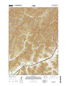
 2011 Quines Creek2011 Print · USGSCovers Azalea, including Quines Creek, Galesville, and other nearby areas
 - 2014 Map of Quines Creek, 2014 Print
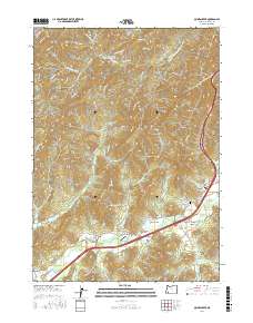
 2014 Quines Creek2014 Print · USGSCovers Azalea, including Quines Creek, Galesville, and other nearby areas
 - 2017 Map of Quines Creek, 2017 Print
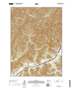
 2017 Quines Creek2017 Print · USGSCovers Azalea, including Quines Creek, Galesville, and other nearby areas
 - 2020 Map of Quines Creek, 2020 Print
 2020 Quines Creek2020 Print · USGSCovers Azalea, including Quines Creek, Galesville, and other nearby areas
 - 2024 Map of Quines Creek, 2024 Print
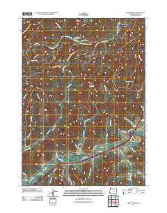
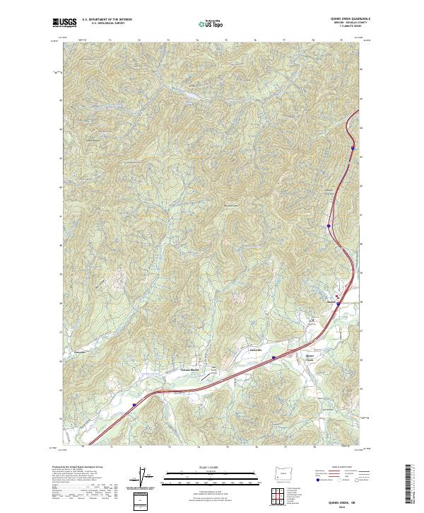 2024 Quines Creek2024 Print · USGSDouglas County’s southern canyon country is captured here in the early twenty-first century, showing the rugged intersection of timber management and valley settlements. Researchers can locate family landmarks like the Quines Creek Cem, the Nace Family Airstrip, and the community of Azalea.
End of results
Showing maps 1-12 of 12
Top cities near Azalea
- Myrtle Creek historical maps
- Canyonville historical maps
- Riddle historical maps
- Glendale historical maps
Frequently asked questions
- What are the different types of historical maps available for Azalea?
- What is the oldest map of Azalea?
- Where can I purchase historical maps of Azalea for my home or office?
- Where can I download high-res historical maps of Azalea?
- Are there historical topographic maps available for Azalea?
- Is there historical aerial imagery available for Azalea?
- Where are historical maps of Azalea sourced from?