Old Maps of Cow Creek, Oregon for Genealogy
Trace your family roots with 12 historic maps of Cow Creek. These high-res maps reveal old neighborhoods, homesites, landmarks, and streets — helping you uncover where your ancestors lived and how the area evolved over time.
- Explore historic neighborhoods: Identify where your relatives may have lived in the 1800s or 1900s.
- Compare maps over time: Trace the changes in streets, buildings, and landmarks for multi-generational research.
- Perfect for genealogy & ancestry research: Used by family historians and researchers to map out lineage and migration.
These maps are an incredible resource for exploring your personal connection to Cow Creek's past.
Cow Creek, OR maps
(12)- 1946 Map of Dutchman Butte, 1958 Print
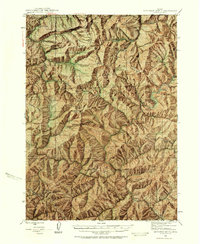 1946 Dutchman Butte1958 Print · USGSThe high timber country of Douglas and Josephine counties is captured here in the mid-1940s during the height of fire-watch forestry. Researchers can trace the early Pacific Trail and locate isolated outposts like the Dutchman Butte Lookout and Bradford Warden Sta.6 unique versions available
 - 1948 Map of Dutchman Butte
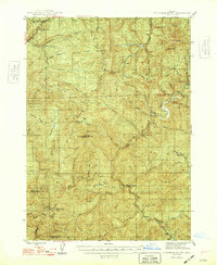 1948 Dutchman Butte1948 Print · USGSThe Oregon backcountry of Douglas and Curry counties is captured here in the late 1940s, showing a landscape of forest management and rail transport. Researchers can locate early fire lookouts and stations like Dutchman Butte Lookout and Bradford Warden Sta alongside the Southern Pacific line.2 unique versions available
 - 1955 Map of Medford, 1964 Print
 1955 Medford1964 Print · USGSSouthern Oregon's valley towns and high peaks are captured here in the mid-1950s, showing the region before the completion of the modern interstate system. Genealogists and historians can trace the development of timber and mining outposts from Wolf Creek to Butte Falls and the early roads to Crater Lake.3 unique versions available
 - 1957 Map of Medford
 1957 Medford1957 Print · USGSSouthern Oregon during the mid-fifties is captured here as a region of growing valley cities and vast timberlands. Genealogists and historians can trace the rail-and-road corridors connecting Medford, Jacksonville, and Grants Pass to more remote locales like Wolf Creek or Butte Falls.
 - 1958 Map of Medford
 1958 Medford1958 Print · USGSSouthern Oregon's Rogue River valley thrived in the 1950s as a crossroads of rail and road. Researchers can trace the legacy of timber and tourism through Southern Pacific RR lines and landmarks like Crater Lake and Oregon Caves National Monument.
 - 1989 Map of Canyonville
 1989 Canyonville1989 Print · USGSSouthern Oregon's timber and rail corridors come into focus during the late eighties as communities like Canyonville and Riddle anchor the local economy. Researchers can trace the path of the Southern Pacific Railroad and locate early settlements such as Placer, Leland, and Sunny Valley.2 unique versions available
 - 1990 Map of Rabbit Mountain
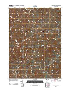
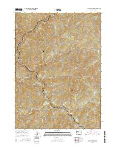
 1990 Rabbit Mountain1990 Print · USGSDouglas County’s rugged interior is documented here in the late twentieth century as timber and mining roads crisscross the ridges. Researchers can identify former habitation points like Cow Creek (Site) and Brandt (Site) or trace the winding course of the West Fork.
 - 2011 Map of Rabbit Mountain, 2011 Print
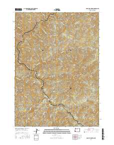
 2011 Rabbit Mountain2011 Print · USGSCovers Cow Creek, including Douglas County, United States, and other nearby areas
 - 2014 Map of Rabbit Mountain, 2014 Print
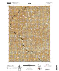
 2014 Rabbit Mountain2014 Print · USGSCovers Cow Creek, including Douglas County, United States, and other nearby areas
 - 2017 Map of Rabbit Mountain, 2017 Print
 2017 Rabbit Mountain2017 Print · USGSCovers Cow Creek, including Douglas County, United States, and other nearby areas
 - 2020 Map of Rabbit Mountain, 2020 Print
 2020 Rabbit Mountain2020 Print · USGSCovers Cow Creek, including Douglas County, United States, and other nearby areas
 - 2023 Map of Rabbit Mountain, 2023 Print
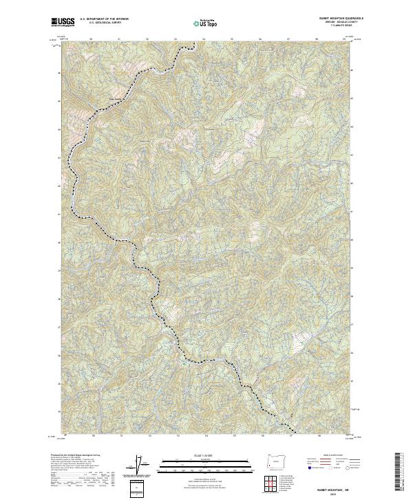 2023 Rabbit Mountain2023 Print · USGSDouglas County’s timberlands and steep drainage basins are captured here in the early twenty-first century. Researchers can trace forest access routes and water sources like Cow Creek Rd, Sledge Rdg, and Brandt Crossing Sp.
End of results
Showing maps 1-12 of 12
Top cities near Cow Creek
Frequently asked questions
- What are the different types of historical maps available for Cow Creek?
- What is the oldest map of Cow Creek?
- Where can I purchase historical maps of Cow Creek for my home or office?
- Where can I download high-res historical maps of Cow Creek?
- Are there historical topographic maps available for Cow Creek?
- Is there historical aerial imagery available for Cow Creek?
- Where are historical maps of Cow Creek sourced from?