Old Maps of Elkton, Oregon for Academic Research
Study the evolution of Elkton with 8 high-resolution historic maps. Whether you're teaching, researching, or modeling changes in land use, these maps provide essential visual documentation of urban, environmental, and geographic change.
- Analyze long-term change: Track patterns in development, transportation, and natural features.
- Ideal for environmental or urban studies: Support academic projects with primary historical map data.
- Use in the classroom or lab: Educators and researchers rely on these maps to bring historical context to life.
These maps are a powerful tool for teaching, research, and visualizing how Elkton has changed over the decades.
Elkton, OR maps
(8)- 1955 Map of Elkton, 1957 Print
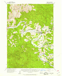 1955 Elkton1957 Print · USGSThe Umpqua River bends sharply through Douglas County in the mid-1950s, anchoring a landscape of timber and river-bottom settlements. Researchers can trace local genealogy and land use through Kellogg Grange Cem, the Elk Creek Guard Sta, and the historic Elkton township.2 unique versions available
 - 1958 Map of Roseburg, 1960 Print
 1958 Roseburg1960 Print · USGSThe timber valleys and high volcanic peaks of Southern Oregon are captured here in the late fifties. Researchers can trace the Southern Pacific rail line through historic settlements like Cottage Grove, Yoncalla, and Oakridge near the Cascade Range crest.4 unique versions available
 - 1959 Map of Roseburg
 1959 Roseburg1959 Print · USGSThe Umpqua and Willamette valleys meet the high Cascades in this late-fifties study of Southern Oregon's timber and rail corridors. Genealogists and researchers can trace the Southern Pacific RR through historic towns like Roseburg, Yoncalla, and Cottage Grove.
 - 1979 Map of Cottage Grove
 1979 Cottage Grove1979 Print · USGSThe Oregon timber and rail corridors of the late seventies are documented here, centered on the Coast Fork Willamette River and the growing hub of Cottage Grove. Researchers can trace the path of the Southern Pacific railroad as it connects small stations like Divide, Saginaw, and Yoncalla.2 unique versions available
 - 1990 Map of Elkton
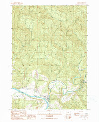 1990 Elkton1990 Print · USGSThe Umpqua River and Elk Creek wind through Douglas County in the 1990s, centering on the town of Elkton. Researchers can trace old family sites near Grubbe, locate the Cem, and explore the terrain around Elk Creek Tunnel State Park.
 - 2014 Map of Elkton, 2014 Print
 2014 Elkton2014 Print · USGSCovers Elkton, including Douglas County, United States, and other nearby areas
 - 2017 Map of Elkton, 2017 Print
 2017 Elkton2017 Print · USGSCovers Elkton, including Douglas County, United States, and other nearby areas
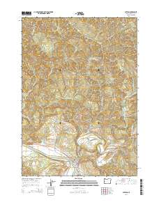
 - 2023 Map of Elkton, 2023 Print
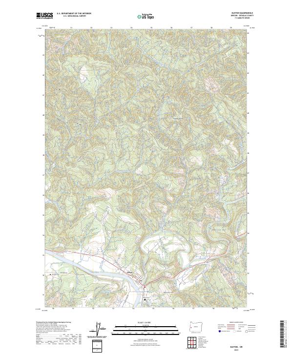 2023 Elkton2023 Print · USGSElkton sits at the historic meeting of river and creek in this modern survey of Douglas County. Genealogists and local historians can trace family sites at Henderer Cem and Elkton Cem or follow the winding course of the Umpqua River and Elk Creek.
End of results
Showing maps 1-8 of 8
Frequently asked questions
- What are the different types of historical maps available for Elkton?
- What is the oldest map of Elkton?
- Where can I purchase historical maps of Elkton for my home or office?
- Where can I download high-res historical maps of Elkton?
- Are there historical topographic maps available for Elkton?
- Is there historical aerial imagery available for Elkton?
- Where are historical maps of Elkton sourced from?