
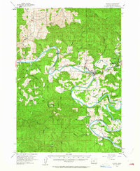
1955 Map of Elkton
USGS Topo · Published 1957About this map
The Umpqua River dominates this Douglas County landscape, its deep, winding oxbows carving through the heavily timbered terrain of the Oregon Coast Range. In the mid-1950s, the small town of Elkton serves as the primary hub at the confluence of Little Elk Creek, while the settlement of Kellogg sits further south along a tight bend in the river. This era represents a time of established forestry and early conservation, evidenced by the Elk Creek Tunnel Forest State Park and the Elk Creek Guard Sta near the eastern boundary. Local history is anchored by family-named landmarks and rural infrastructure, including Henderer Road and multiple burial sites like Wells Cem and the Kellogg Grange Cem. High points such as Rainy Peak and the Old Blue Lookout Tower provide a sense of the vertical scale and the importance of fire lookout stations in this densely forested region.
Find a feature on this map
43 named features on this map. Tap any name to fly to it.
Don’t see what you’re looking for? This feature index may not catch every label — zoom into the map to look around manually.
Map Details
Editions of this 1955 Elkton Map
2 editions found
Other maps of this area

1897 · Roseburg
USGS Topo · 1:125,000

1900 · Roseburg
USGS Topo · 1:125,000

1919 · Earl
USGS Topo · 1:48,000

1928 · Sitkum
USGS Topo · 1:125,000

1942 · Crow
USGS Topo · 1:62,500

1942 · Roman Nose Mtn
USGS Topo · 1:62,500

1943 · Goodwin Peak
USGS Topo · 1:62,500

1945 · Crow
USGS Topo · 1:62,500

1945 · Roman Nose Mtn
USGS Topo · 1:62,500

1954 · Sutherlin
USGS Topo · 1:62,500