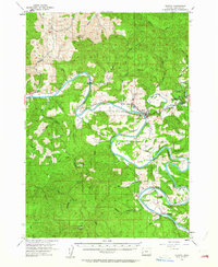
1955 Map of Elkton
USGS Topo · Published 1964About this map
The Umpqua River carves deep, winding oxbows through this portion of Douglas County, defining the settlement patterns of the mid-1950s. The town of Elkton serves as the central hub where Highway 38 meets the river, while the smaller community of Kellogg sits further south along a sharp river bend near the Kellogg Grange. These riverbank settlements are connected by local arteries like Henderer Road, which trace the narrow valley floors between high ridges such as Rainy Peak and the curiously named Devils Graveyard.
Find a feature on this map
42 named features on this map. Tap any name to fly to it.
Don’t see what you’re looking for? This feature index may not catch every label — zoom into the map to look around manually.
Map Details
Editions of this 1955 Elkton Map
2 editions found

Other maps of this area

1897 · Roseburg
USGS Topo · 1:125,000

1900 · Roseburg
USGS Topo · 1:125,000

1919 · Earl
USGS Topo · 1:48,000

1928 · Sitkum
USGS Topo · 1:125,000

1942 · Crow
USGS Topo · 1:62,500

1942 · Roman Nose Mtn
USGS Topo · 1:62,500

1943 · Goodwin Peak
USGS Topo · 1:62,500

1945 · Crow
USGS Topo · 1:62,500

1945 · Roman Nose Mtn
USGS Topo · 1:62,500

1954 · Sutherlin
USGS Topo · 1:62,500