Old Maps of Tenmile, Oregon for Genealogy
Trace your family roots with 11 historic maps of Tenmile. These high-res maps reveal old neighborhoods, homesites, landmarks, and streets — helping you uncover where your ancestors lived and how the area evolved over time.
- Explore historic neighborhoods: Identify where your relatives may have lived in the 1800s or 1900s.
- Compare maps over time: Trace the changes in streets, buildings, and landmarks for multi-generational research.
- Perfect for genealogy & ancestry research: Used by family historians and researchers to map out lineage and migration.
These maps are an incredible resource for exploring your personal connection to Tenmile's past.
Tenmile, OR maps
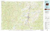
(11)- 1928 Map of Sitkum, 1939 Print
 1928 Sitkum1939 Print · USGSThe Oregon Coast Range in the late twenties was a land of timber and trails, where the Umpqua River met the edge of the Umpqua National Forest. Genealogists and historians can trace early river crossings at Shorts Ferry and follow the route of the Old Coos Trail through Camas Valley.
 - 1955 Map of Camas Valley, 1957 Print
 1955 Camas Valley1957 Print · USGSDouglas County’s timber country comes into focus in the mid-1950s, showing the networks of water and road that sustained these mountain communities. Researchers can locate early family burial sites like Noah Cem and Patterson Cemetery or trace the early paths of Wagon Road and Callahan Rd.3 unique versions available
 - 1958 Map of Roseburg, 1960 Print
 1958 Roseburg1960 Print · USGSThe timber valleys and high volcanic peaks of Southern Oregon are captured here in the late fifties. Researchers can trace the Southern Pacific rail line through historic settlements like Cottage Grove, Yoncalla, and Oakridge near the Cascade Range crest.4 unique versions available
 - 1959 Map of Roseburg
 1959 Roseburg1959 Print · USGSThe Umpqua and Willamette valleys meet the high Cascades in this late-fifties study of Southern Oregon's timber and rail corridors. Genealogists and researchers can trace the Southern Pacific RR through historic towns like Roseburg, Yoncalla, and Cottage Grove.
 - 1979 Map of Roseburg
 1979 Roseburg1979 Print · USGSThe Umpqua River valley and the foothills of the Coast Range are captured here during a period of active timber and mineral production in the late seventies. Researchers can trace the paths of the Southern Pacific and the Bonanza Mine alongside small settlements like Coles Valley and Nonpareil.
 - 1990 Map of Tenmile
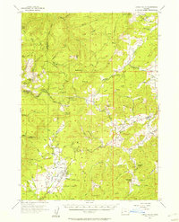
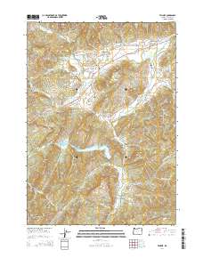
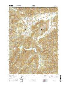
 1990 Tenmile1990 Print · USGSDouglas County’s rural valleys come into focus in the early nineties, showing a landscape defined by water and family history. Researchers can locate the Ben Irving Reservoir, tracing old homesteads near Byron and cemeteries like McGuire Cemetery and McCulloch Cemetery.
 - 2011 Map of Tenmile, 2011 Print
 2011 Tenmile2011 Print · USGSCovers Tenmile, including Porter Creek, Olalla, and other nearby areas
 - 2014 Map of Tenmile, 2014 Print
 2014 Tenmile2014 Print · USGSCovers Tenmile, including Porter Creek, Olalla, and other nearby areas
 - 2017 Map of Tenmile, 2017 Print
 2017 Tenmile2017 Print · USGSCovers Tenmile, including Porter Creek, Olalla, and other nearby areas
 - 2020 Map of Tenmile, 2020 Print
 2020 Tenmile2020 Print · USGSCovers Tenmile, including Porter Creek, Olalla, and other nearby areas
 - 2024 Map of Tenmile, 2024 Print
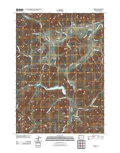
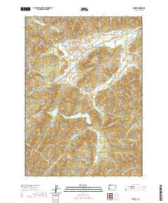
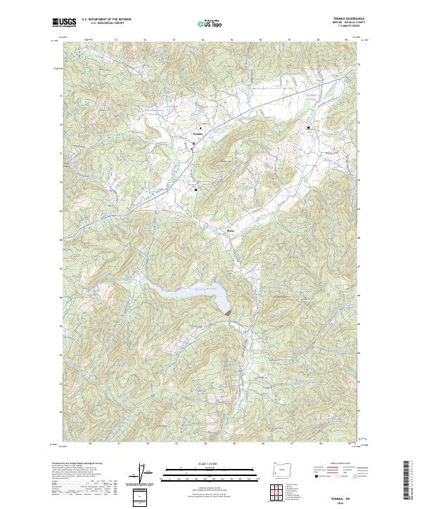 2024 Tenmile2024 Print · USGSDouglas County's rural interior is documented here in recent decades, showing the evolution of the Tenmile and Olalla communities. Researchers can trace local lineage at Tenmile Cem and McGuire Cem or follow the waters of Ben Irving Reservoir.
End of results
Showing maps 1-11 of 11
Top cities near Tenmile
Frequently asked questions
- What are the different types of historical maps available for Tenmile?
- What is the oldest map of Tenmile?
- Where can I purchase historical maps of Tenmile for my home or office?
- Where can I download high-res historical maps of Tenmile?
- Are there historical topographic maps available for Tenmile?
- Is there historical aerial imagery available for Tenmile?
- Where are historical maps of Tenmile sourced from?