Old Maps of Three Forks, Oregon for Academic Research
Study the evolution of Three Forks with 12 high-resolution historic maps. Whether you're teaching, researching, or modeling changes in land use, these maps provide essential visual documentation of urban, environmental, and geographic change.
- Analyze long-term change: Track patterns in development, transportation, and natural features.
- Ideal for environmental or urban studies: Support academic projects with primary historical map data.
- Use in the classroom or lab: Educators and researchers rely on these maps to bring historical context to life.
These maps are a powerful tool for teaching, research, and visualizing how Three Forks has changed over the decades.
Three Forks, OR maps
(12)- 1932 Map of Dayville, 1958 Print
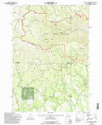
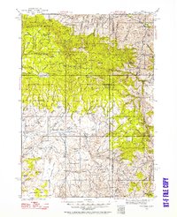 1932 Dayville1958 Print · USGSCentral Oregon ranching and timber frontiers are captured here in the early 1930s, documenting a remote landscape of high plateaus and river valleys. Genealogists and historians can locate family landmarks like Congleton Ranch, the ruins of Camp Watson, and early rural school sites like Beaver Creek Sch.
 - 1936 Map of Dayville
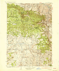 1936 Dayville1936 Print · USGSIn the early 1930s, this portion of Central Oregon was a landscape of high timber and remote cattle ranches along the John Day River. Researchers can trace the era's ranching families at Dexter Ranch and Mills Ranch, or find the location of the Old Bear Creek Sawmill and Fort Camp Watson.3 unique versions available
 - 1955 Map of Canyon City, 1966 Print
 1955 Canyon City1966 Print · USGSCentral Oregon's high desert and timber country are captured here in the mid-fifties, showing the rugged ranching and logging landscape. Trace the path of the Sumpter Valley Ry or locate remote settlements like Izee, Whitney, and Ritter.4 unique versions available
 - 1959 Map of Canyon City
 1959 Canyon City1959 Print · USGSEastern Oregon in the late fifties was a landscape of high timber and remote river valleys shaped by the cattle and mining trades. Genealogists and historians can trace the paths of the Sumpter Valley RR and find early settlements like Antone, Richmond, and Dayville.2 unique versions available
 - 1972 Map of Wolf Mountain, 1976 Print
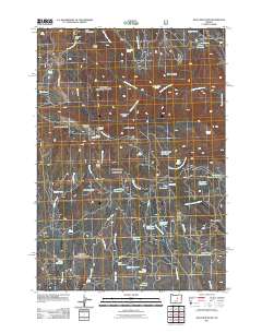
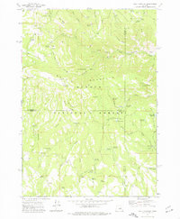 1972 Wolf Mountain1976 Print · USGSThe high country of central Oregon is mapped here in the early seventies, centered on the lookout atop Wolf Mountain. Trace historic backcountry access via the Black Canyon Trail and remote camps like Mud Springs Campground.2 unique versions available
 - 1981 Map of Dayville
 1981 Dayville1981 Print · USGSEastern Oregon’s high-desert rangeland and timber country are captured here in the early eighties, centered on the John Day River valley. Genealogists and historians can trace isolated settlements like Izee and Suplee alongside historical mining sites including Chambers Mine.2 unique versions available
 - 1992 Map of Wolf Mountain, 1997 Print
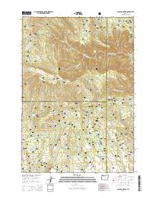
 1992 Wolf Mountain1997 Print · USGSHigh-country timber and wilderness management define this Wheeler County landscape during the early nineties. Researchers can trace the network of forest infrastructure and water resources, from the Wolf Mountain Lookout to remote camps like Humphreys Camp and Dusty Camp Spring.
 - 2011 Map of Wolf Mountain, 2011 Print
 2011 Wolf Mountain2011 Print · USGSCovers Three Forks, including Crook County, Wheeler County, and other nearby areas
 - 2014 Map of Wolf Mountain, 2014 Print
 2014 Wolf Mountain2014 Print · USGSCovers Three Forks, including Crook County, Wheeler County, and other nearby areas
 - 2017 Map of Wolf Mountain, 2017 Print
 2017 Wolf Mountain2017 Print · USGSCovers Three Forks, including Crook County, Wheeler County, and other nearby areas
 - 2020 Map of Wolf Mountain, 2020 Print
 2020 Wolf Mountain2020 Print · USGSCovers Three Forks, including Crook County, Wheeler County, and other nearby areas
 - 2023 Map of Wolf Mountain, 2023 Print
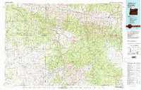
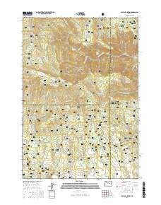
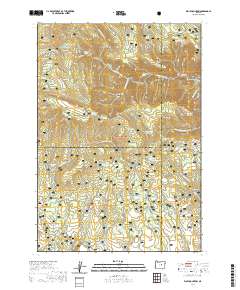
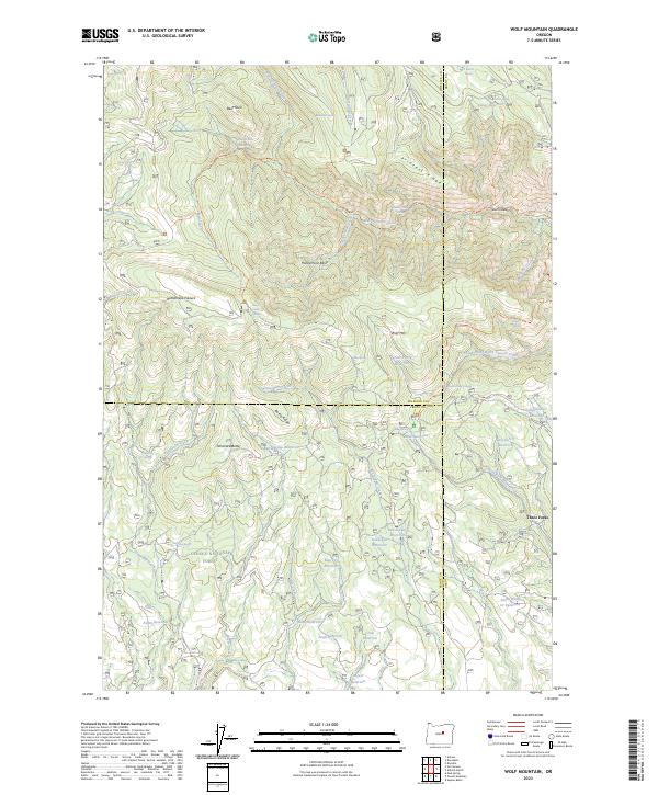 2023 Wolf Mountain2023 Print · USGSHigh-altitude ridges and wilderness basins define this Wheeler County landscape as it appeared in recent years. Researchers can trace remote trails and spring-fed watersheds across Honeymoon Basin, Princess Ridge, and the Black Canyon Wilderness.
End of results
Showing maps 1-12 of 12
Top cities near Three Forks
Frequently asked questions
- What are the different types of historical maps available for Three Forks?
- What is the oldest map of Three Forks?
- Where can I purchase historical maps of Three Forks for my home or office?
- Where can I download high-res historical maps of Three Forks?
- Are there historical topographic maps available for Three Forks?
- Is there historical aerial imagery available for Three Forks?
- Where are historical maps of Three Forks sourced from?