1970s Maps of Dunnean, Oregon
Explore 2 historic maps of Dunnean from the 1970s. These maps offer a rare glimpse into what life looked like during the 1970s — showing old roads, neighborhoods, homes, and landmarks that have changed or disappeared over time.
Whether you're researching your family's past, planning a metal detecting trip, or studying how Dunnean's landscape evolved across the 1970s, these high-resolution maps are a powerful tool for exploring the history of this region.
- Focus on a specific era: All maps on this page are from the 1970s, giving you a focused view of this time period.
- See what’s changed: Compare century-old streets, trails, and buildings to today's modern landscape using overlays and satellite layers.
- Research with precision: Use these maps for genealogy, historical research, land use analysis, or educational projects.
- View, download, or print: Maps are fully viewable online in high resolution, and can be downloaded or printed for your own records.
Start exploring Dunnean's history through authentic maps from the 1970s. This is your window into the past.
Dunnean, OR maps
(2)- 1972 Map of Dunnean, 1977 Print
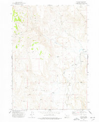 1972 Dunnean1977 Print · USGSHigh-desert Harney County in the early seventies centers on the rail siding of Dunnean along the Union Pacific line. Researchers can trace the importance of water rights through features like the Carey Reservoir, Diversion Dam, and the Springs (Hot) near the Malheur River South Fork.
 - 1978 Map of Malheur Lake, 1997 Print
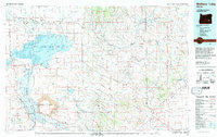 1978 Malheur Lake1997 Print · USGSThe Harney Basin in the late seventies reveals a land of vast wetlands and volcanic remnants. Researchers can trace isolated outposts like New Princeton and Venator or the unique geological formations of Diamond Craters.
End of results
Showing maps 1-2 of 2
Frequently asked questions
- What are the different types of historical maps available for Dunnean?
- What is the oldest map of Dunnean?
- Where can I purchase historical maps of Dunnean for my home or office?
- Where can I download high-res historical maps of Dunnean?
- Are there historical topographic maps available for Dunnean?
- Is there historical aerial imagery available for Dunnean?
- Where are historical maps of Dunnean sourced from?