Old Maps of Lorella, Oregon for Academic Research
Study the evolution of Lorella with 12 high-resolution historic maps. Whether you're teaching, researching, or modeling changes in land use, these maps provide essential visual documentation of urban, environmental, and geographic change.
- Analyze long-term change: Track patterns in development, transportation, and natural features.
- Ideal for environmental or urban studies: Support academic projects with primary historical map data.
- Use in the classroom or lab: Educators and researchers rely on these maps to bring historical context to life.
These maps are a powerful tool for teaching, research, and visualizing how Lorella has changed over the decades.
Lorella, OR maps
(12)- 1889 Map of Klamath
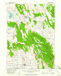
 1889 Klamath1889 Print · USGSSouthern Oregon in the late nineteenth century is a land of vast marshes and emerging frontier towns like Linkville. Historians can trace early government outposts at Ft. Klamath and Yainax Agency or locate family-named sites like Applegate Spr. and Olene.
 - 1894 Map of Klamath
 1894 Klamath1894 Print · USGSSouthern Oregon's high desert and lake country are captured in the 1880s, revealing a landscape of remote agencies and early frontier outposts. Genealogists and historians can trace the foundations of Linkville or locate the Yainax Agency and Ft. Klamath.6 unique versions available
 - 1955 Map of Klamath Falls, 1963 Print
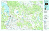
 1955 Klamath Falls1963 Print · USGSSouthern Oregon's high desert and timber country are captured here during the mid-fifties, showing the rail-dependent economies of the basin. Genealogists and researchers can locate old outposts like the Keno Guard Station, the Bly Ranger Station, and the campus of the Oregon Technical Institute.4 unique versions available
 - 1957 Map of Malin, 1961 Print
 1957 Malin1961 Print · USGSSouthern Klamath County and the California borderlands are seen here in the mid-fifties as the local irrigation and ranching economy thrived. Researchers can trace family sites like McCartie Ranch, locate the Bedfield Cemetery, or study the early layout of Malin and Bonanza.2 unique versions available
 - 1958 Map of Klamath Falls
 1958 Klamath Falls1958 Print · USGSSouthern Oregon and the California borderlands are captured here in the mid-1950s during a peak era for the region's timber and rail industries. Trace the historic Klamath Indian Reservation boundaries and the rail lines of the Great Northern RR and the Oregon California and Eastern RR that connected remote towns like Bly and Beatty.3 unique versions available
 - 1988 Map of Lorella
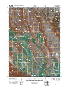
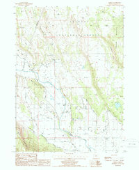 1988 Lorella1988 Print · USGSSouthern Oregon's high desert reveals its complex irrigation and timber history in the late 1980s. Local researchers can trace the hydraulic infrastructure around Lorella and family-named landmarks like Dead Indian Hill or the slopes of Bryant Mountain.
 - 1991 Map of Klamath Falls, 1992 Print
 1991 Klamath Falls1992 Print · USGSSouthern Oregon's high desert and timber basins are captured here in the early nineties, centered on the rail and river networks of the Klamath Basin. Genealogists and researchers can trace local settlements from Beatty and Bly to the agricultural grids of Merrill and Dairy.
 - 2004 Map of Lorella, 2007 Print
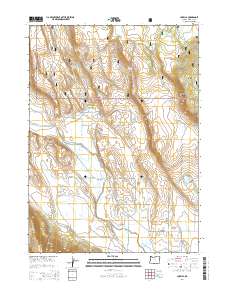
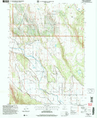 2004 Lorella2007 Print · USGSAgricultural and forest lands in Klamath County come to life in this early 2000s survey of the Lost River basin. Researchers can trace the intricate irrigation network of the West Canal and find local landmarks like Keller Bridge and Lorella.
 - 2011 Map of Lorella, 2011 Print
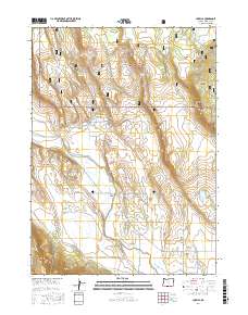
 2011 Lorella2011 Print · USGSCovers Lorella, including Klamath County, United States, and other nearby areas
 - 2014 Map of Lorella, 2014 Print
 2014 Lorella2014 Print · USGSCovers Lorella, including Klamath County, United States, and other nearby areas
 - 2017 Map of Lorella, 2017 Print
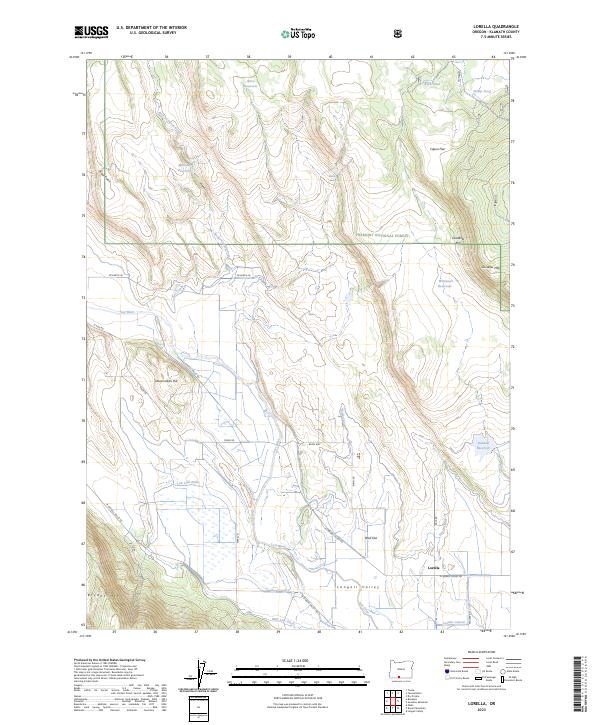
 2017 Lorella2017 Print · USGSCovers Lorella, including Klamath County, United States, and other nearby areas
 - 2023 Map of Lorella, 2023 Print
 2023 Lorella2023 Print · USGSThe Klamath County high desert comes into focus in the 2020s, showing a landscape defined by ranching and extensive irrigation. Trace family-named routes and water systems from Lorella to the foothills of Bryant Mtn, Goodlow Mtn, and the Fremont National Forest.
End of results
Showing maps 1-12 of 12
Top cities near Lorella
Frequently asked questions
- What are the different types of historical maps available for Lorella?
- What is the oldest map of Lorella?
- Where can I purchase historical maps of Lorella for my home or office?
- Where can I download high-res historical maps of Lorella?
- Are there historical topographic maps available for Lorella?
- Is there historical aerial imagery available for Lorella?
- Where are historical maps of Lorella sourced from?