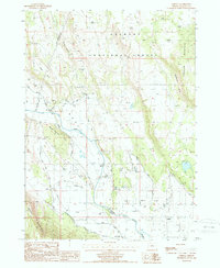
1988 Map of Lorella
USGS Topo · Published 1988About this map
Lost River meanders through this high-desert basin, defining a landscape of intensive water management and timbered highlands. In the late 1980s, the small community of Lorella sat at the junction of the irrigated flats and the rising slopes of Bryant Mountain. The map reveals a complex hydraulic network of levees, ditches, and pumping installations, including the Jones No 2 Pump and the West Canal, essential for supporting agriculture on Wolf Flat and Capon Flat.
Find a feature on this map
33 named features on this map. Tap any name to fly to it.
Don’t see what you’re looking for? This feature index may not catch every label — zoom into the map to look around manually.
Map Details
Editions of this 1988 Lorella Map
This is the sole edition of this map. No revisions or reprints were ever made.
Other maps of this area

1889 · Klamath
USGS Topo · 1:250,000

1894 · Klamath
USGS Topo · 1:250,000

1955 · Klamath Falls
USGS Topo · 1:250,000

1957 · Malin
USGS Topo · 1:62,500

1958 · Klamath Falls
USGS Topo · 1:250,000

1960 · Gerber Reservoir
USGS Topo · 1:62,500

1960 · Bly
USGS Topo · 1:62,500

1960 · Beatty
USGS Topo · 1:62,500
1988 · Bryant Mountain
USGS Topo · 1:24,000
1988 · Malin
USGS Topo · 1:24,000