
1955 Map of Klamath Falls
USGS Topo · Published 1963About this map
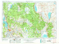
Klamath Falls and Altamont anchor the western edge of this mid-century survey, positioned at the intersection of the Southern Pacific and Great Northern railroads. The landscape transitions from the aquatic systems of Upper Klamath Lake and the Lower Klamath National Wildlife Refuge into the timbered heights of the Winema National Forest and Fremont National Forest. Evidence of regional water management is visible through the Gerber Reservoir, Drews Reservoir, and the complex drainage of the Lost River and Sprague River. Local infrastructure for land management and education is marked by the Bly Ranger Station and the Oregon Technical Institute. High desert features like Summer Lake and Lake Abert define the eastern reach, where smaller settlements such as Paisley and Adel sit along the corridors of U.S. 395 and Oregon 31.
Find a feature on this map
76 named features on this map. Tap any name to fly to it.
Don’t see what you’re looking for? This feature index may not catch every label — zoom into the map to look around manually.
Map Details
Editions of this 1955 Klamath Falls Map
4 editions found
Other maps of this area

1886 · Alturas
USGS Topo · 1:250,000

1886 · Modoc Lava Bed
USGS Topo · 1:250,000

1886 · Shasta
USGS Topo · 1:250,000

1889 · Klamath
USGS Topo · 1:250,000

1889 · Long Valley
USGS Topo · 1:250,000

1891 · Ashland
USGS Topo · 1:250,000

1892 · Modoc Lava-Bed
USGS Topo · 1:250,000

1892 · Alturas
USGS Topo · 1:250,000

1893 · Ashland
USGS Topo · 1:250,000

1894 · Klamath
USGS Topo · 1:250,000