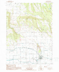
1988 Map of Malin
USGS Topo · Published 1988About this map
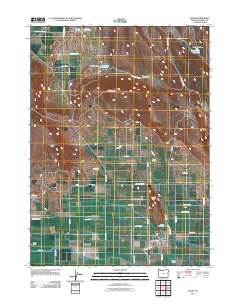
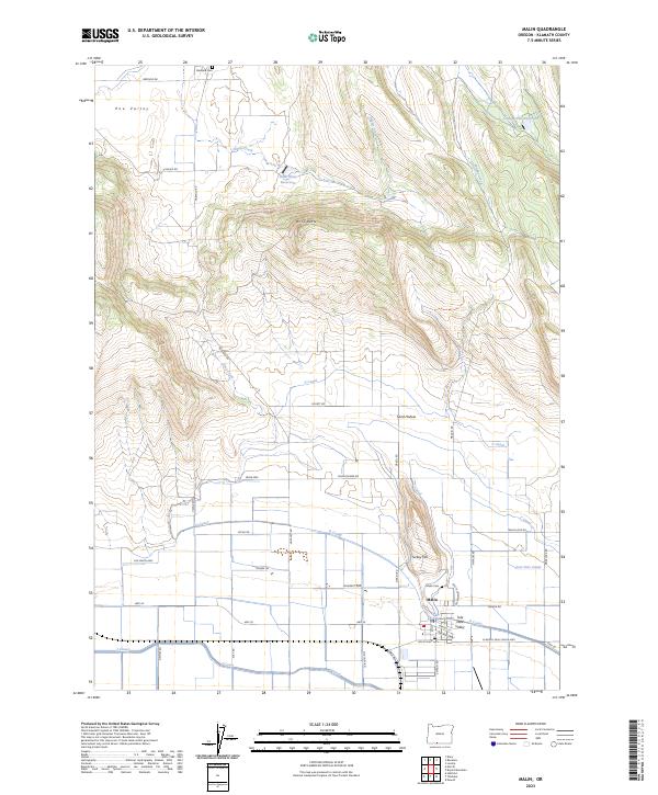
Malin sits at the heart of an engineered agricultural landscape in the Tule Lake Valley, where the transition from high desert buttes to fertile basin floor is defined by an extensive water management system. The map reveals the intricate network of Canal lines, Levee structures, and a Flume that sustain the local economy, alongside technical landmarks such as a Pumping Sta and a power Substation. This late-twentieth-century survey documents the area's infrastructure, from the Steel Tower Trans Lines crossing Buck Butte to the municipal facilities serving the town, including the Sew Disp Pond and the local Malin Airfield. Local history is anchored by the Cem located north of the settlement and the prominent geological rise of Turkey Hill which overlooks the valley's drainage works. To the northeast, the terrain becomes more isolated, featuring the McFall Reservoir and evidence of resource extraction at an Open Pit mine.
Find a feature on this map
20 named features on this map. Tap any name to fly to it.
Don’t see what you’re looking for? This feature index may not catch every label — zoom into the map to look around manually.
Map Details
Editions of this 1988 Malin Map
This is the sole edition of this map. No revisions or reprints were ever made.
Historical Maps of Malin Through Time
7 maps found