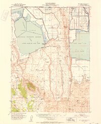
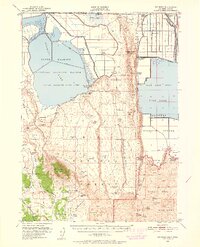
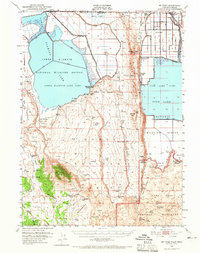
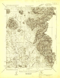
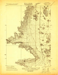
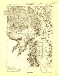
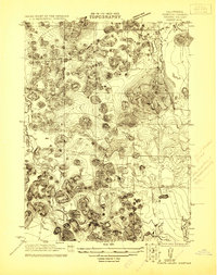
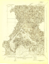
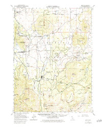
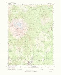
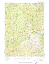
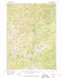
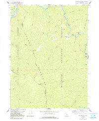
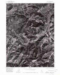
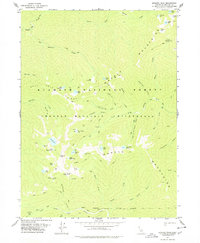
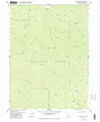
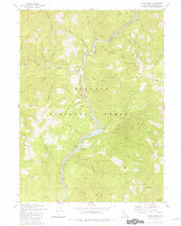
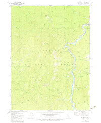
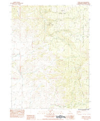
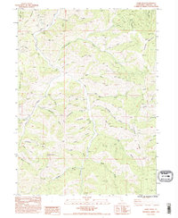
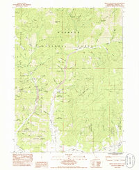
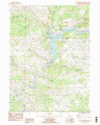
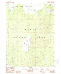
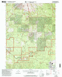
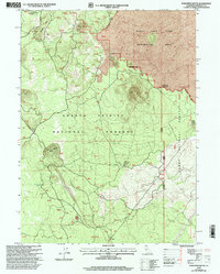
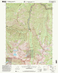
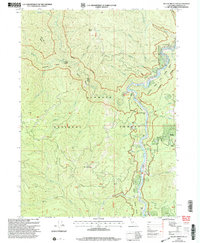
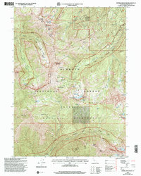
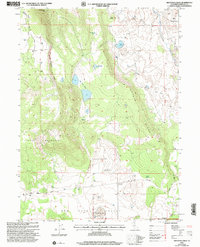
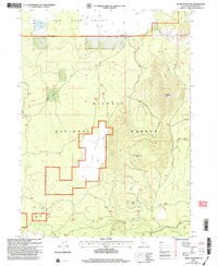
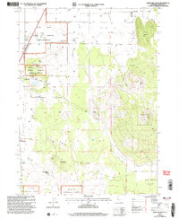
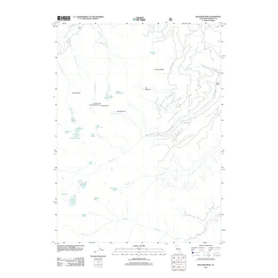
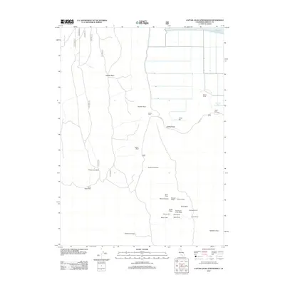
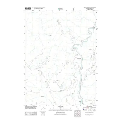
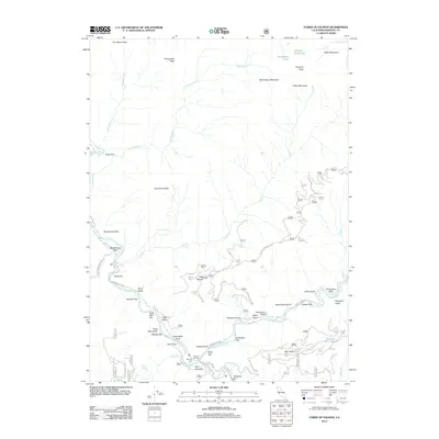
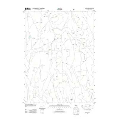
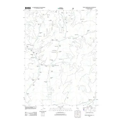
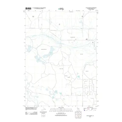
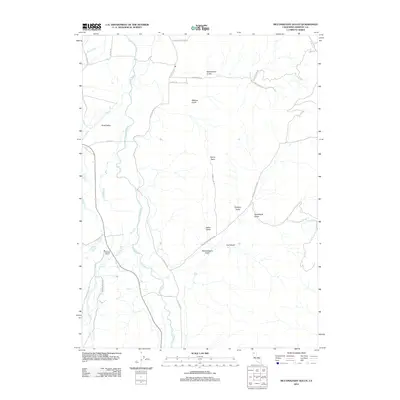
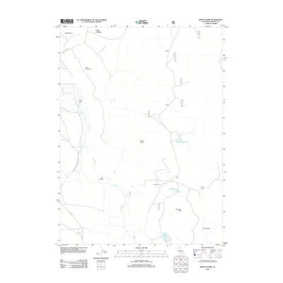
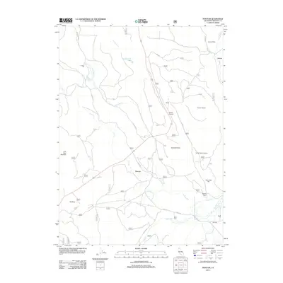
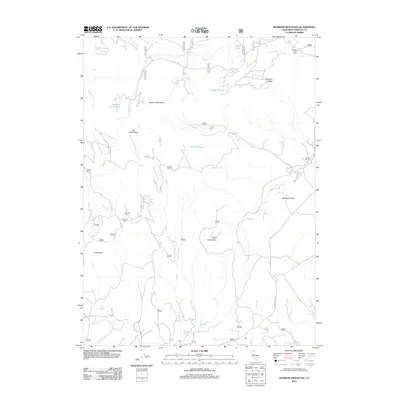
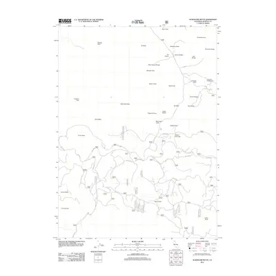
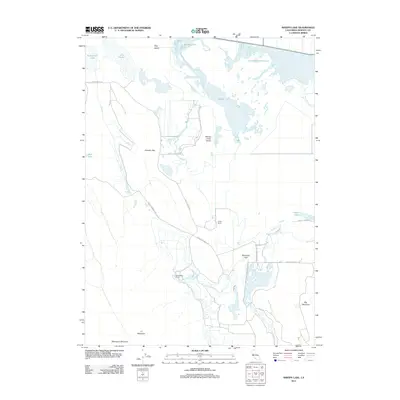
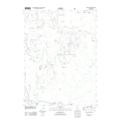
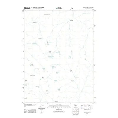
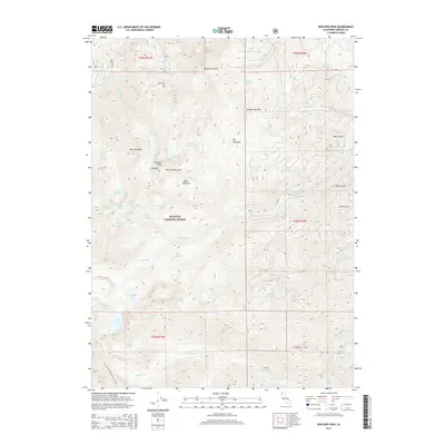
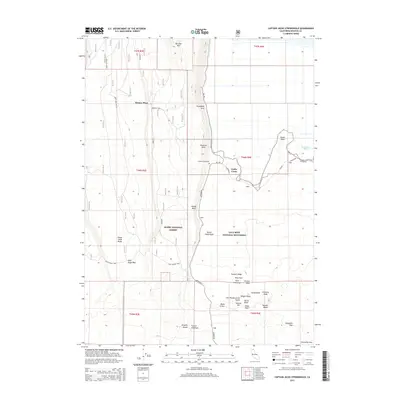
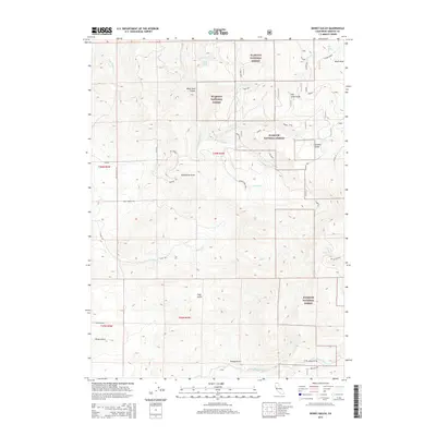
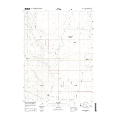
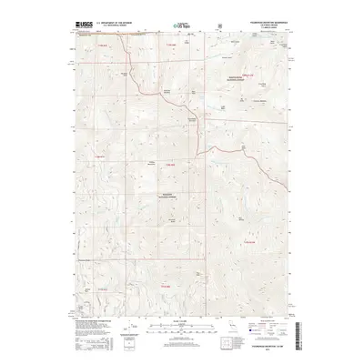
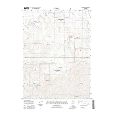
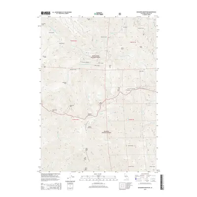
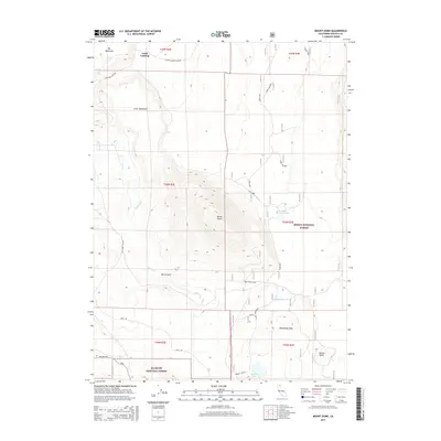
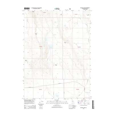
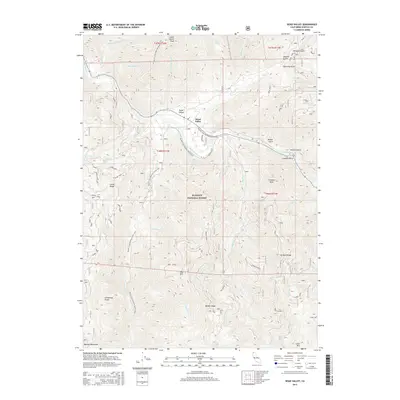
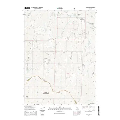
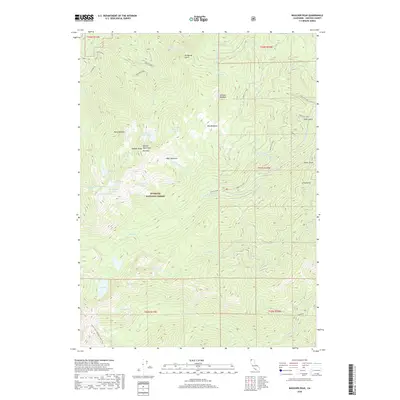
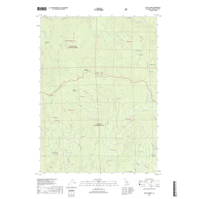
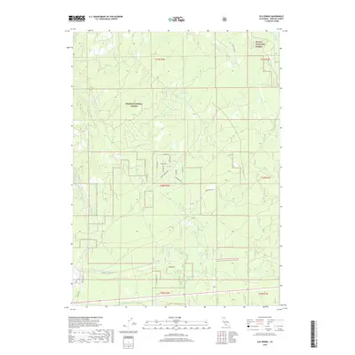
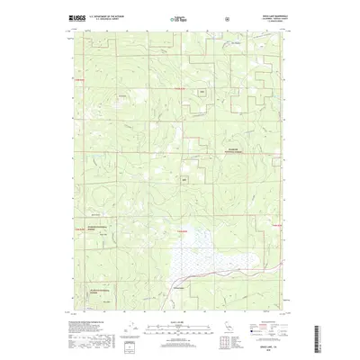
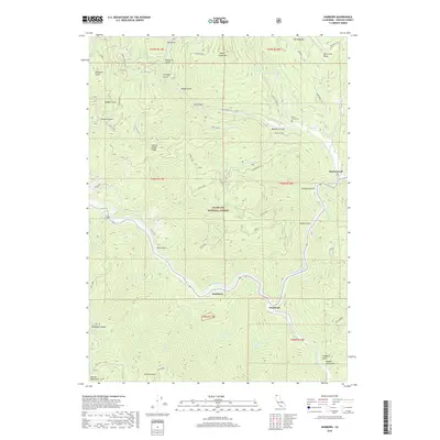
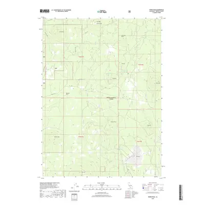
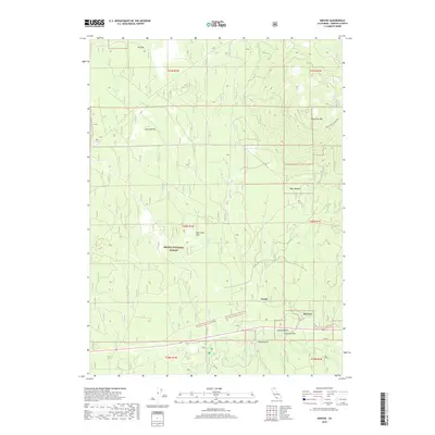
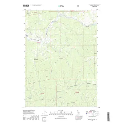
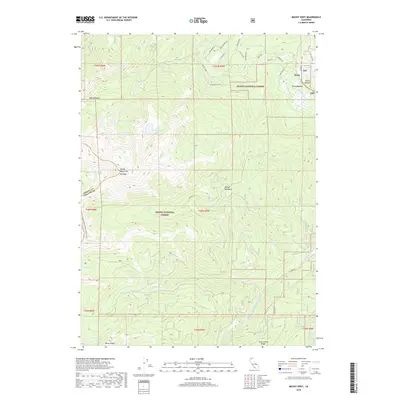
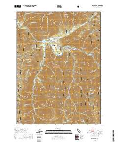
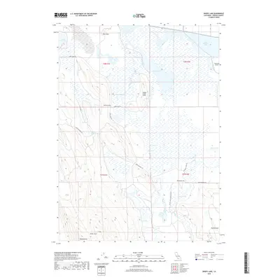
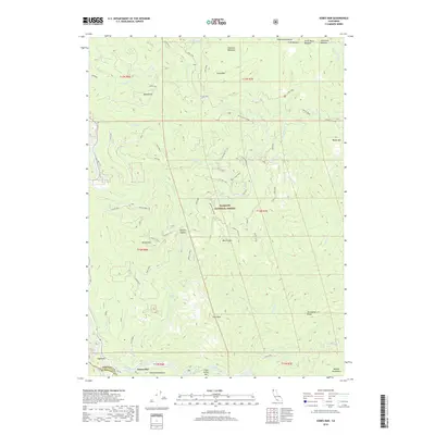
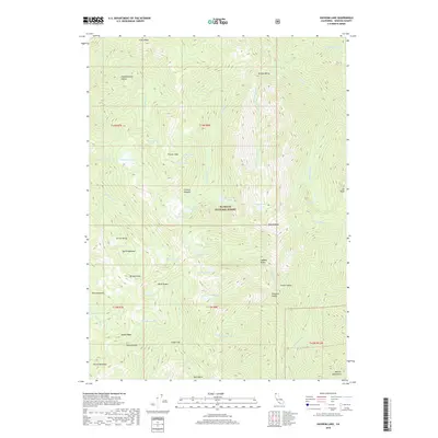
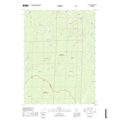
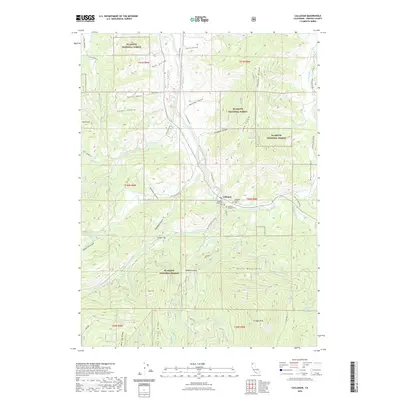
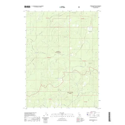
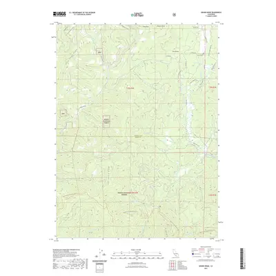
1950 Map of Mt. Dome
USGS Topo · Published 1952About this map
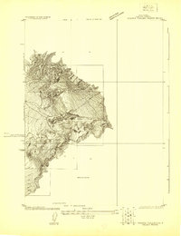
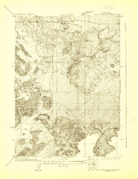
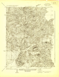
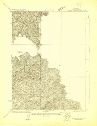
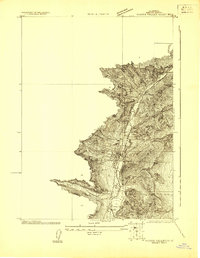
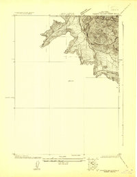
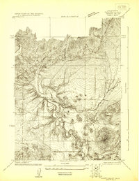
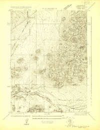
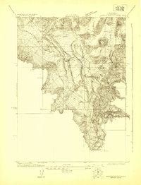
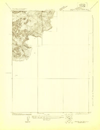
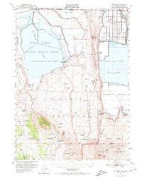
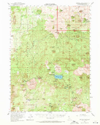
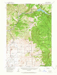
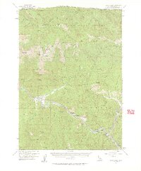
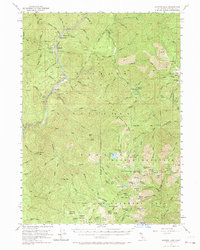
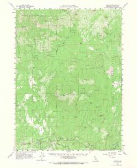
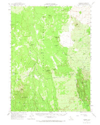
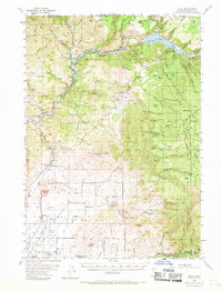
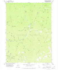
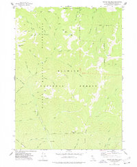
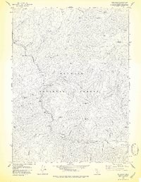
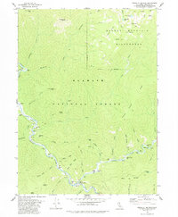
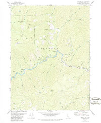
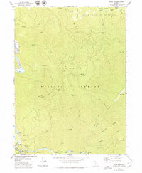
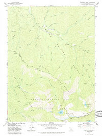
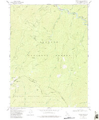
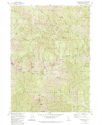
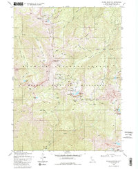
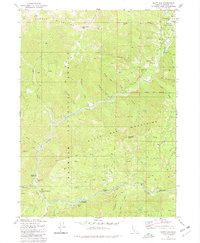
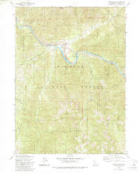
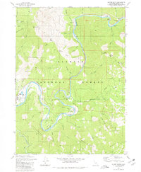
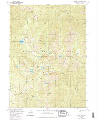
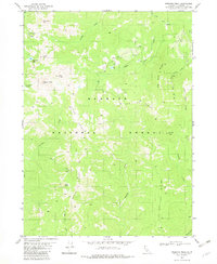
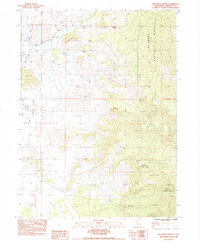
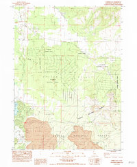
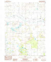
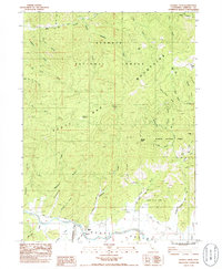
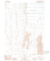
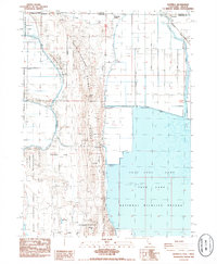
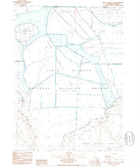
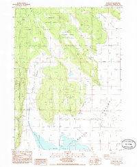
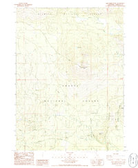
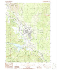
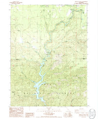
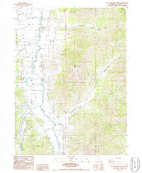
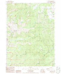
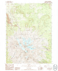
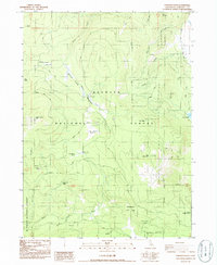
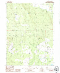
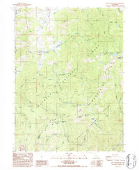
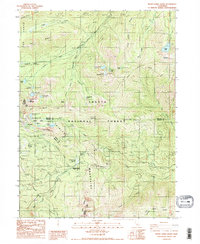
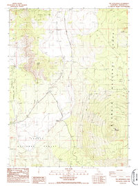
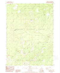
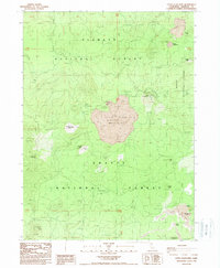
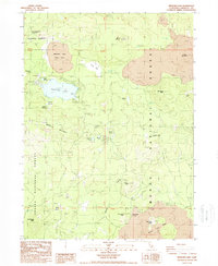
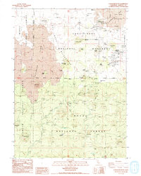
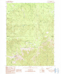
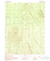
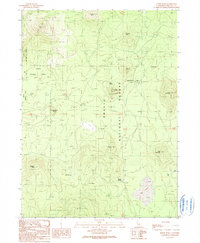
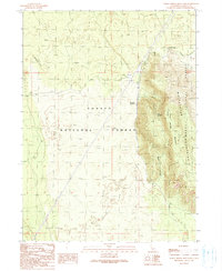
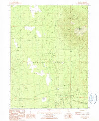
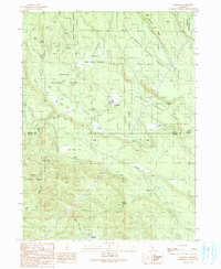
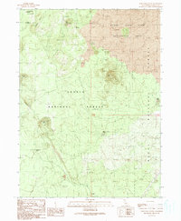
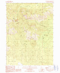
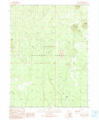
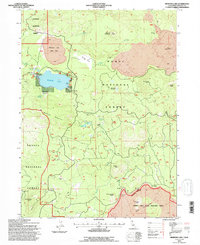
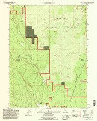
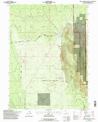
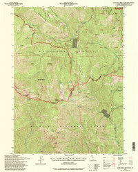
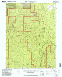
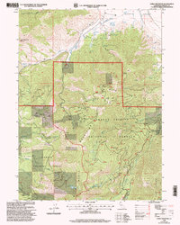
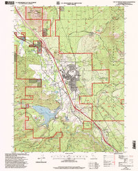
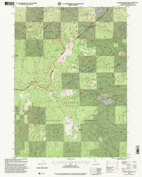
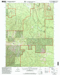
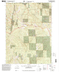
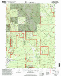
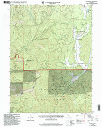
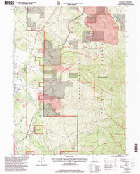
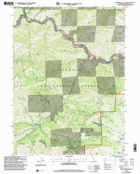
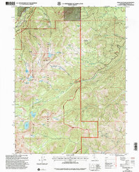
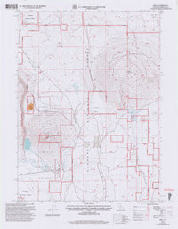
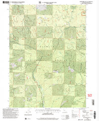
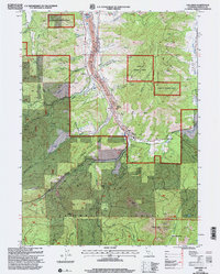
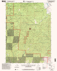
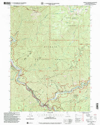
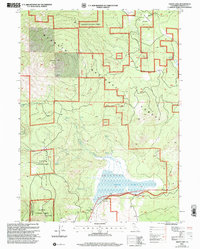
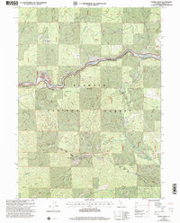
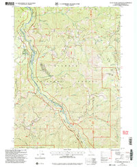
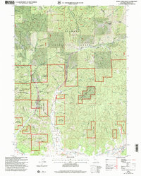
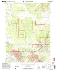
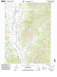
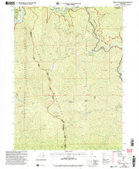
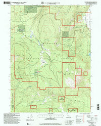
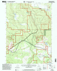
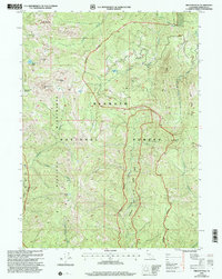
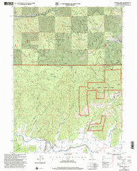
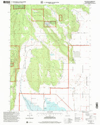
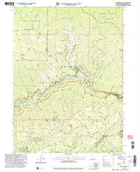
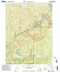
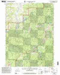
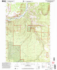
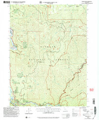
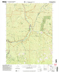
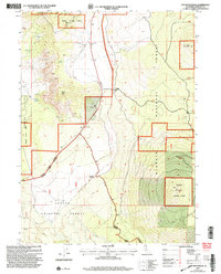
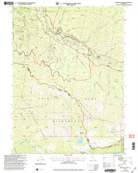
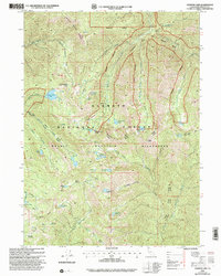
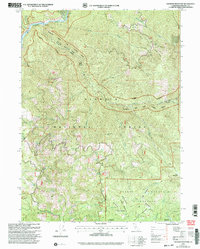
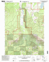
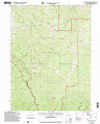
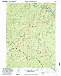
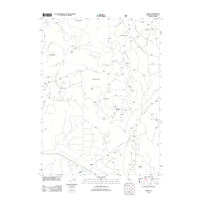
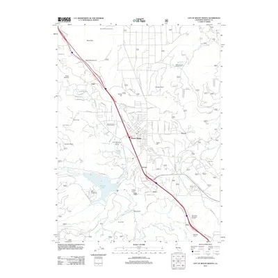
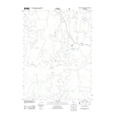
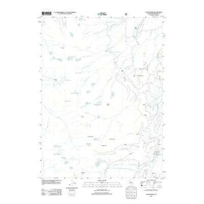
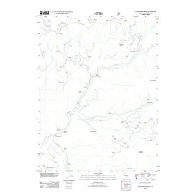
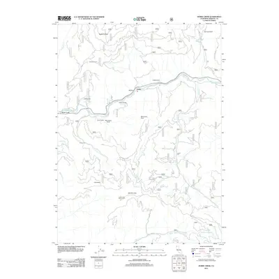
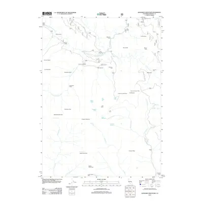
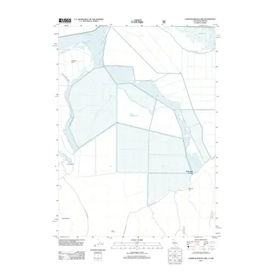
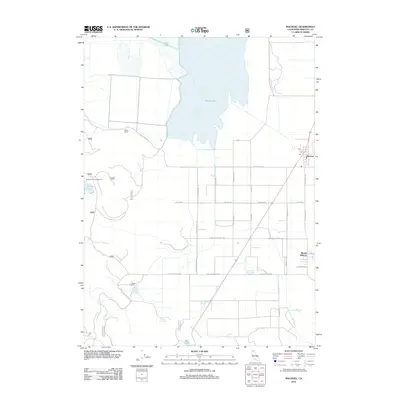
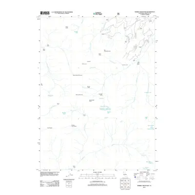
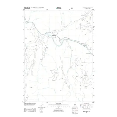
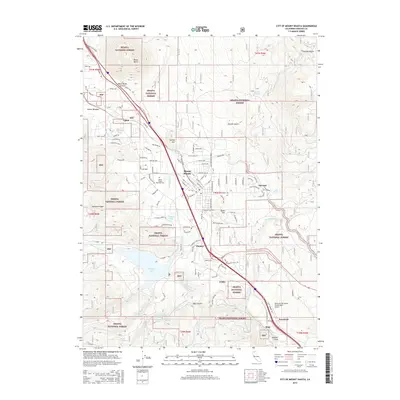
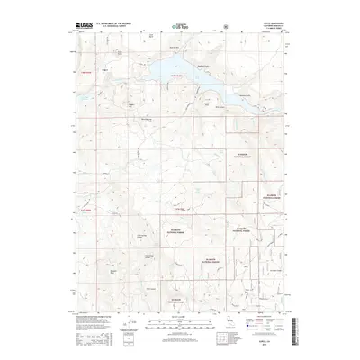
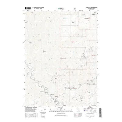
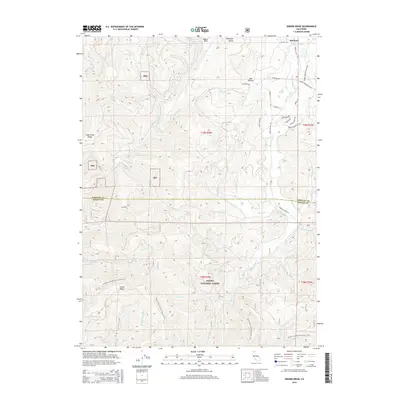
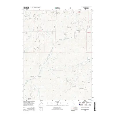
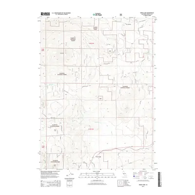
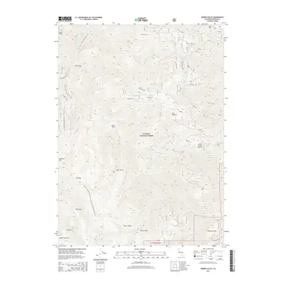
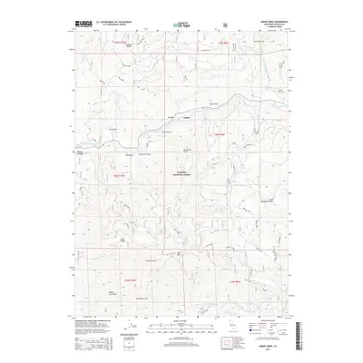
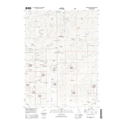
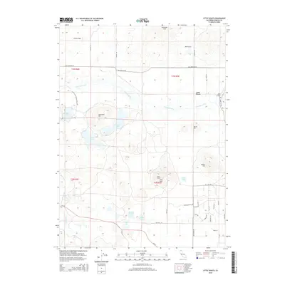
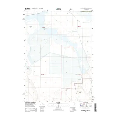
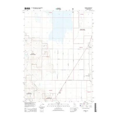
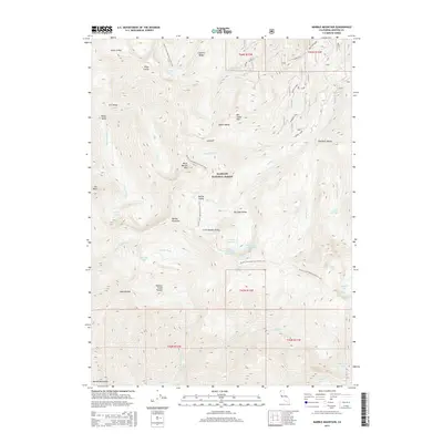
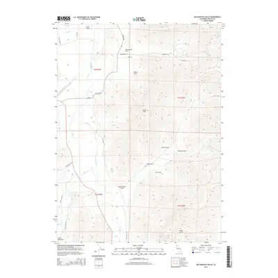
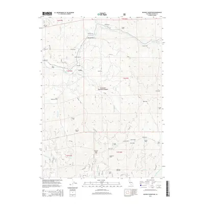
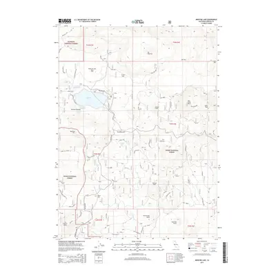
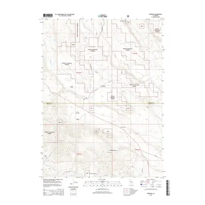
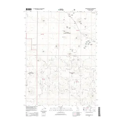
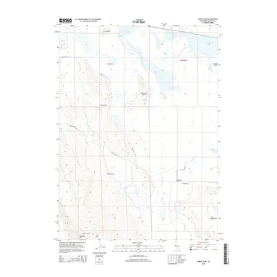
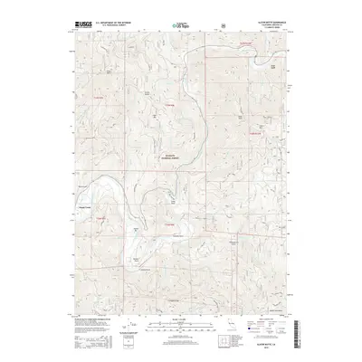
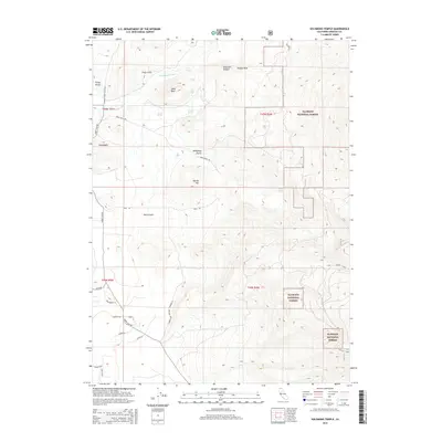
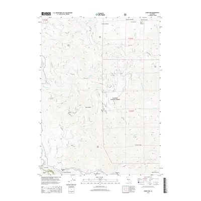
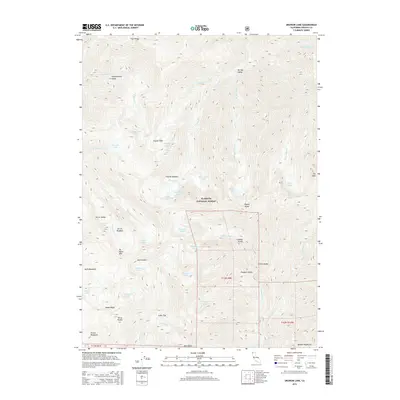
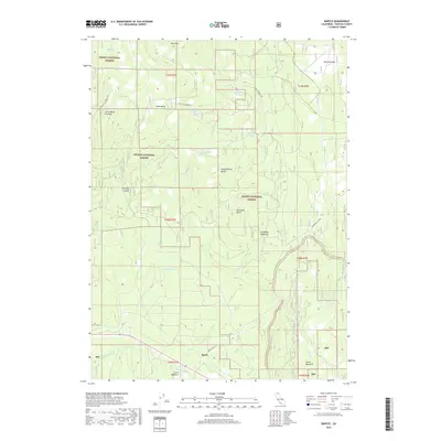
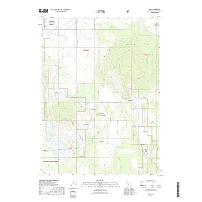
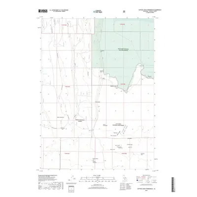
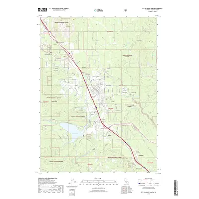
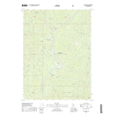
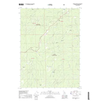
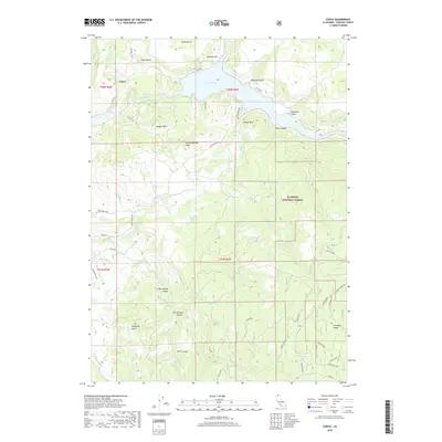
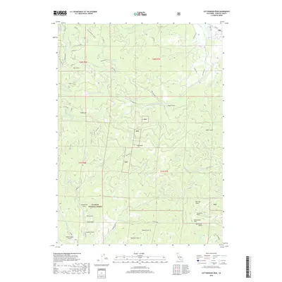
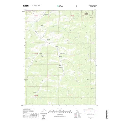
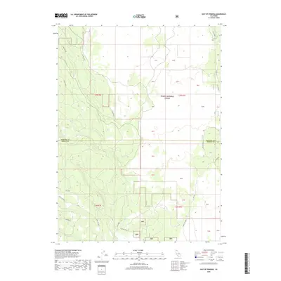
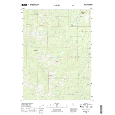
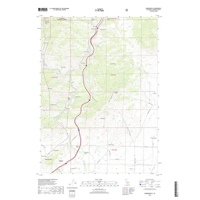
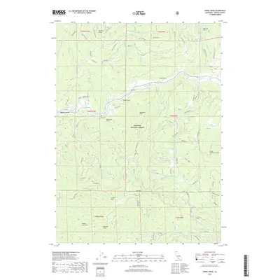
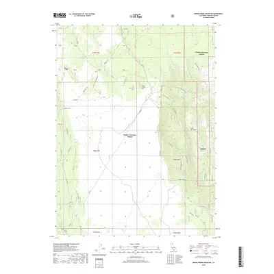
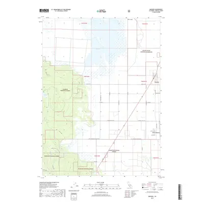
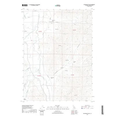
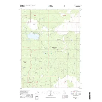
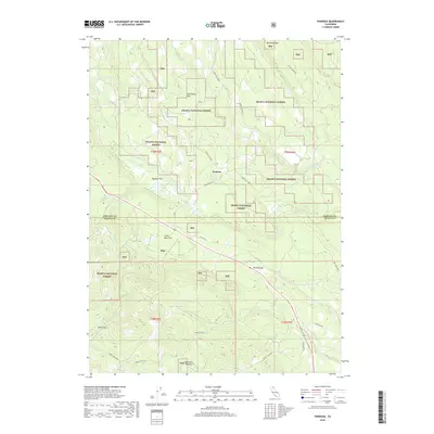
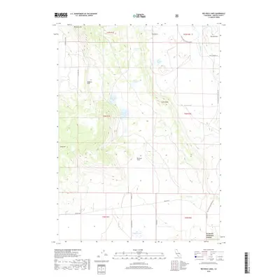
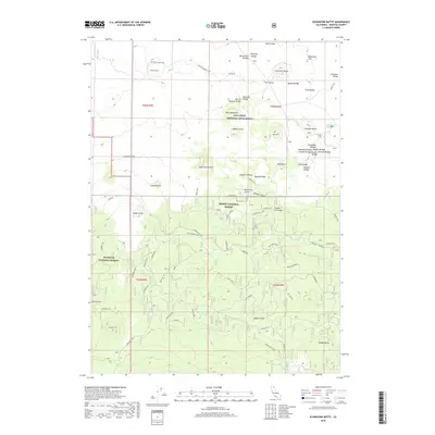
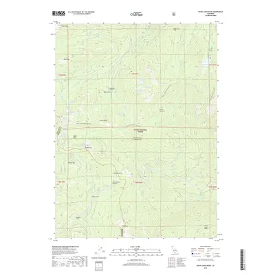
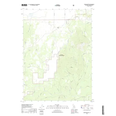
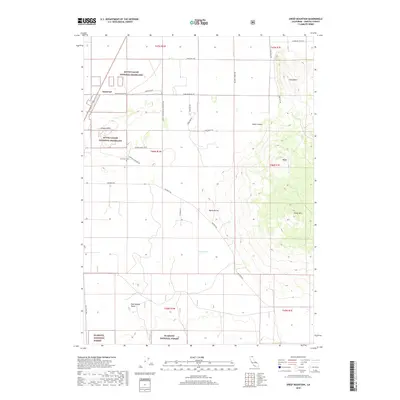
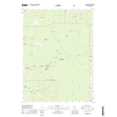
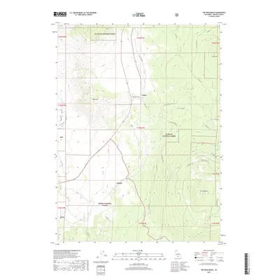
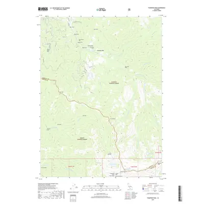
The California-Oregon border country in the 1950s reveals a complex landscape shaped by water reclamation and volcanic history. The northern portion of the quadrangle is defined by the Lower Klamath National Wildlife Refuge and the expansive Tule Lake basin, where a network of irrigation roads like Granger Road and Fensler Road serves the agricultural outposts of Ainsworth Corner and Hatfield. Evidence of the region's storied past is preserved at the Site of Thomas & Wright Massacre and Captain Jacks Stronghold within the Lava Beds National Monument. The terrain transitions from the marshy Lower Klamath Lake Sump to high volcanic features like Mt Dome and Sheepy Peak, while engineering feats like the Tulelake Tunnel highlight the effort to manage the local hydrology for settlements such as Winema Farms.
Find a feature on this map
64 named features on this map. Tap any name to fly to it.
Don’t see what you’re looking for? This feature index may not catch every label — zoom into the map to look around manually.
Map Details
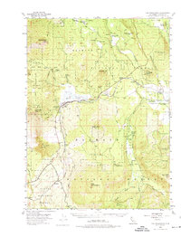
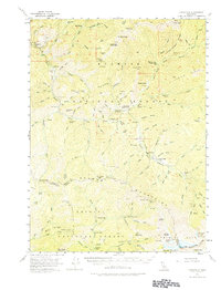
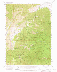
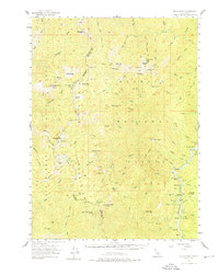
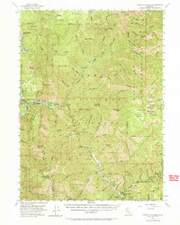
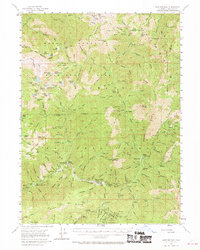
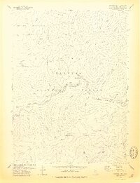
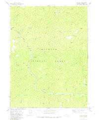
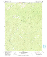
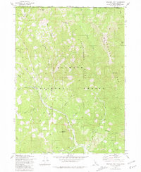
Editions of this 1950 Mt. Dome Map
4 editions found
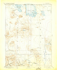
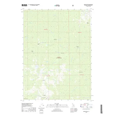
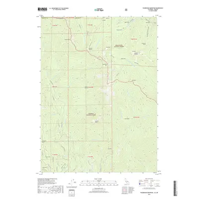
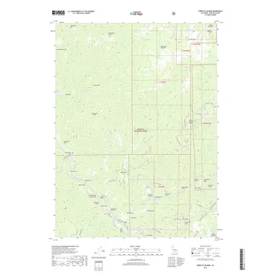
Historical Maps of Fleener Place Through Time
639 maps found

1886 Modoc Lava Bed
Siskiyou County, CA
1892 Modoc Lava Bed
Siskiyou County, CA

1914 Seiad
Siskiyou County, CA
1921 Shasta Valley Sheet No 11
Siskiyou County, CA
1921 Shasta Valley Sheet No 1
Siskiyou County, CA
1921 Shasta Valley Sheet No 2
Siskiyou County, CA
1921 Shasta Valley Sheet No 6
Siskiyou County, CA

1921 Shasta Valley Sheet No 7
Siskiyou County, CA

1922 Seiad
Siskiyou County, CA
1922 Shasta Valley Sheet No 10 E
Siskiyou County, CA
1922 Shasta Valley Sheet No 10
Siskiyou County, CA
1922 Shasta Valley Sheet No 12
Siskiyou County, CA
1922 Shasta Valley Sheet No 13
Siskiyou County, CA
1922 Shasta Valley Sheet No 14
Siskiyou County, CA
1922 Shasta Valley Sheet No 15
Siskiyou County, CA
1922 Shasta Valley Sheet No 16
Siskiyou County, CA
1922 Shasta Valley Sheet No 1 S
Siskiyou County, CA
1922 Shasta Valley Sheet No 3
Siskiyou County, CA
1922 Shasta Valley Sheet No 3 S
Siskiyou County, CA
1922 Shasta Valley Sheet No 4
Siskiyou County, CA
1922 Shasta Valley Sheet No 5
Siskiyou County, CA
1922 Shasta Valley Sheet No 8
Siskiyou County, CA
1922 Shasta Valley Sheet No 9
Siskiyou County, CA
1923 Sawyers Bar
Siskiyou County, CA

1932 Bartle
Siskiyou County, CA
1939 Bartle
Siskiyou County, CA
1950 Bray
Siskiyou County, CA
1950 Mt Dome
Siskiyou County, CA
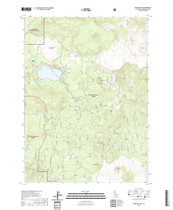
1952 Medicine Lake
Siskiyou County, CA
1954 Copco
Siskiyou County, CA
1954 Shasta
Siskiyou County, CA
1954 The Whaleback
Siskiyou County, CA
1955 Cecilville
Siskiyou County, CA
1955 China Mountain
Siskiyou County, CA
1955 Condrey Mtn
Siskiyou County, CA
1955 Dillon Mtn
Siskiyou County, CA
1955 Forks of Salmon
Siskiyou County, CA
1955 Sawyers Bar
Siskiyou County, CA
1955 Scott Bar
Siskiyou County, CA
1955 Seiad Valley
Siskiyou County, CA
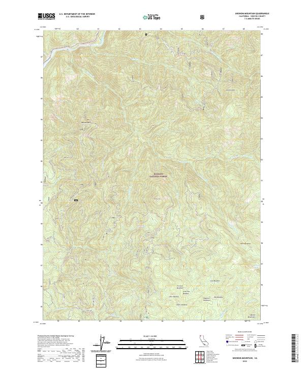
1955 Ukonom Lake
Siskiyou County, CA
1961 Bartle
Siskiyou County, CA
1961 Hambone
Siskiyou County, CA
1962 Copco
Siskiyou County, CA
1974 Bark Shanty Gulch
Siskiyou County, CA
1974 Lake Shastina SW
Siskiyou County, CA
1974 Orleans Mtn.
Siskiyou County, CA
1974 Yreka NW
Siskiyou County, CA
1975 Medicine Lake NE
Siskiyou County, CA
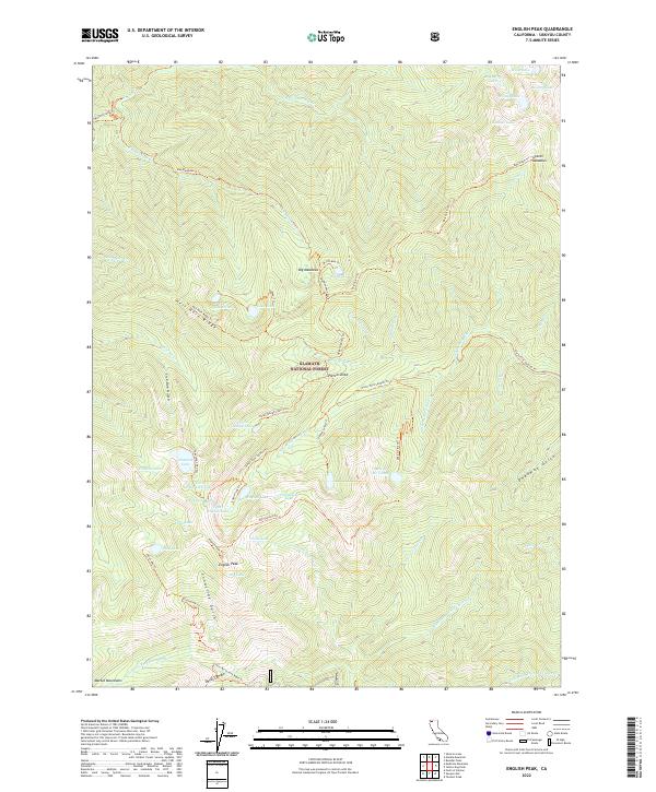
1977 English Peak
Siskiyou County, CA
1977 Tanners Peak
Siskiyou County, CA
1977 Yellow Dog Peak
Siskiyou County, CA
1978 Cecilville
Siskiyou County, CA
1978 Forks of Salmon
Siskiyou County, CA
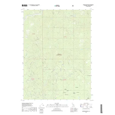
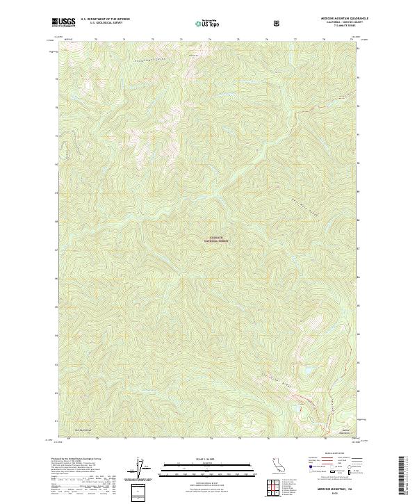
1978 Medicine Mtn
Siskiyou County, CA
1978 Sawyers Bar
Siskiyou County, CA
1979 Cecilville
Siskiyou County, CA
1979 Grasshopper Ridge
Siskiyou County, CA
1979 Sawyers Bar
Siskiyou County, CA
1979 Somes Bar
Siskiyou County, CA
1979 Thompson Peak
Siskiyou County, CA
1979 Youngs Peak
Siskiyou County, CA
1980 Dutch Creek
Siskiyou County, CA
1980 Figurehead Mtn
Siskiyou County, CA
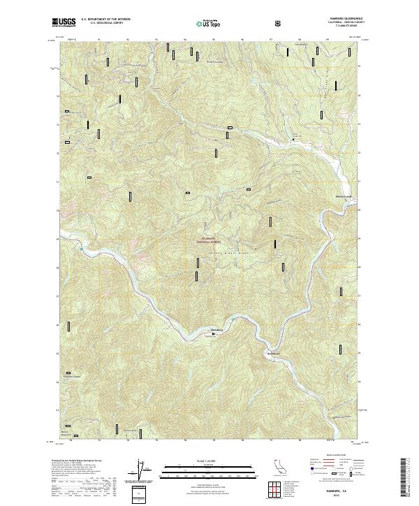
1980 Hamburg
Siskiyou County, CA
1980 Huckleberry Mtn.
Siskiyou County, CA
1980 Kangaroo Mtn.
Siskiyou County, CA
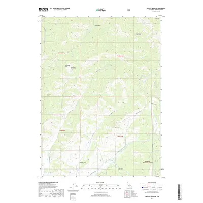
1980 Marble Mountain
Siskiyou County, CA
1980 Scott Bar
Siskiyou County, CA
1980 Seiad Valley
Siskiyou County, CA
1980 Slater Butte
Siskiyou County, CA
1980 Ukonom Lake
Siskiyou County, CA
1980 Ukonom Mountain
Siskiyou County, CA
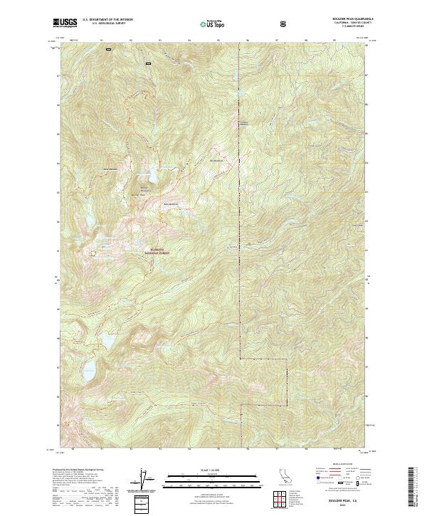
1981 Boulder Peak
Siskiyou County, CA
1981 Clear Creek
Siskiyou County, CA
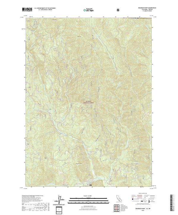
1981 Deadman Point
Siskiyou County, CA
1981 Grider Valley
Siskiyou County, CA
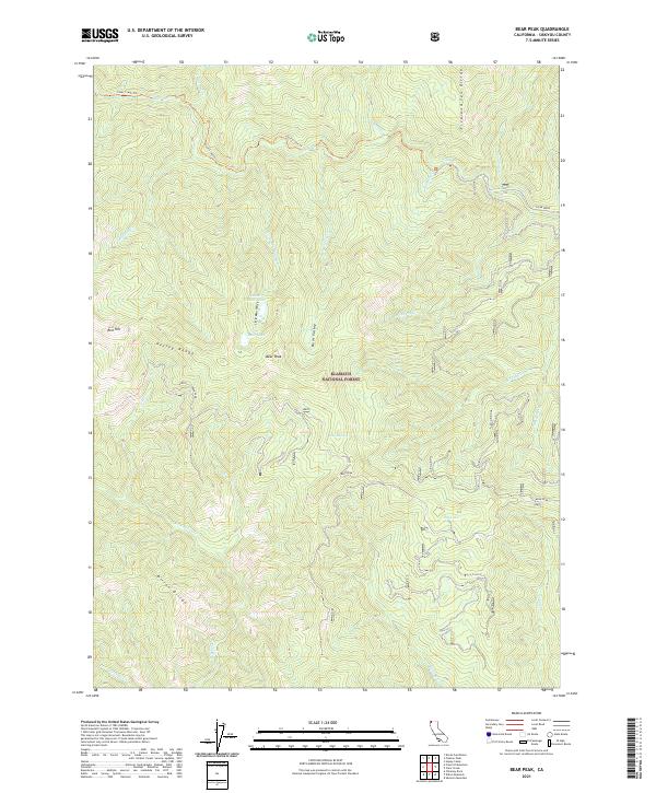
1982 Bear Peak
Siskiyou County, CA
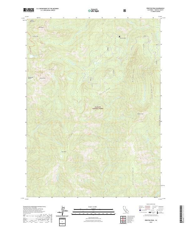
1982 Preston Peak
Siskiyou County, CA
1983 Buckhorn Bally
Siskiyou County, CA
1983 Condrey Mtn
Siskiyou County, CA
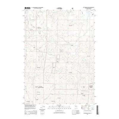
1983 Cottonwood Peak
Siskiyou County, CA
1983 Dillon Mtn
Siskiyou County, CA
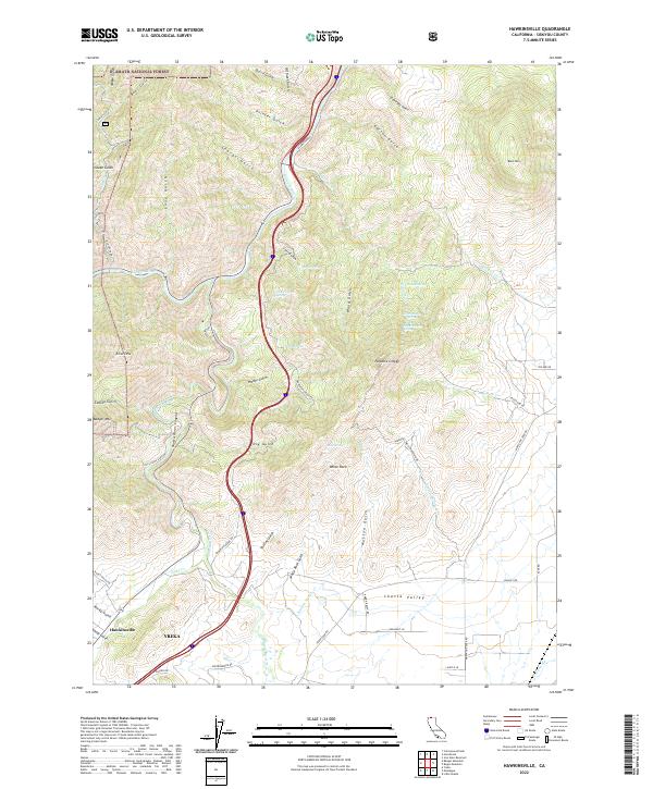
1983 Hawkinsville
Siskiyou County, CA
1983 Horse Creek
Siskiyou County, CA
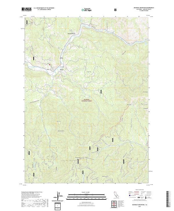
1983 Mc Kinley Mtn
Siskiyou County, CA
1983 Solomons Temple
Siskiyou County, CA
1984 Badger Mtn.
Siskiyou County, CA
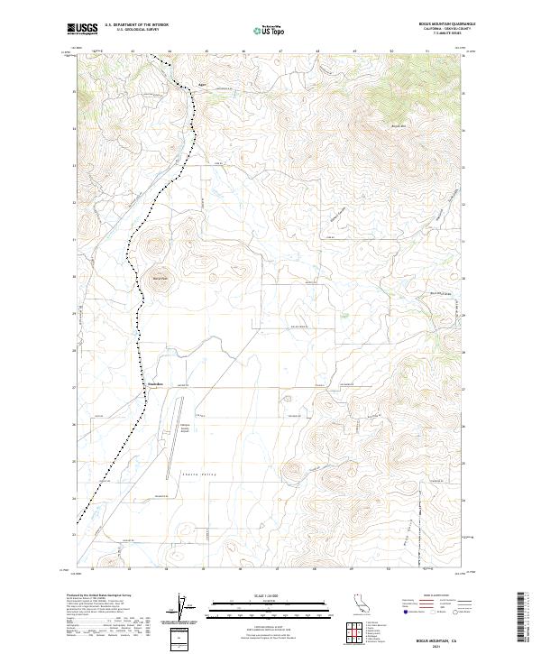
1984 Bogus Mountain
Siskiyou County, CA
1984 Copco
Siskiyou County, CA
1984 Dewey Gulch
Siskiyou County, CA
1984 Duzel Rock
Siskiyou County, CA
1984 Indian Creek Baldy
Siskiyou County, CA
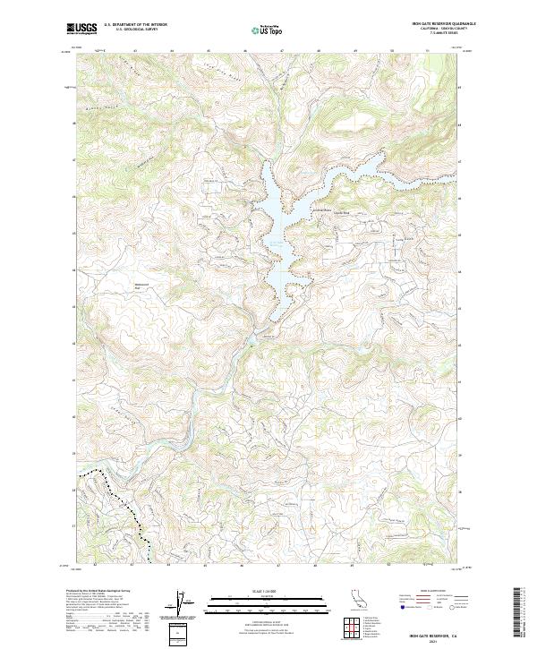
1984 Iron Gate Reservoir
Siskiyou County, CA
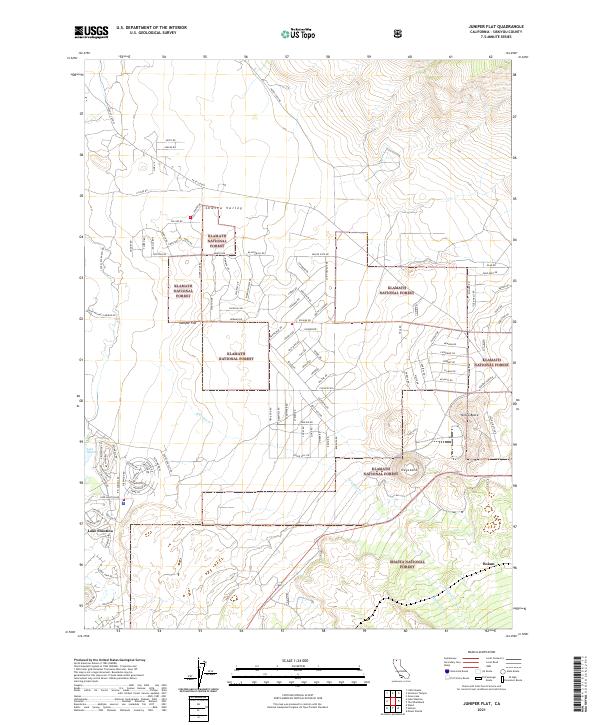
1984 Juniper Flat
Siskiyou County, CA
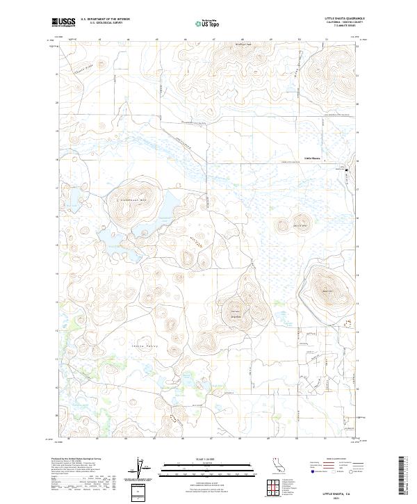
1984 Little Shasta
Siskiyou County, CA
1984 Russell Peak
Siskiyou County, CA
1985 Captain Jacks Stronghold
Siskiyou County, CA
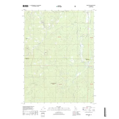
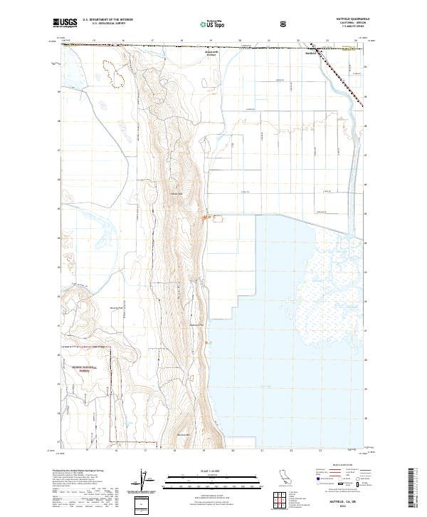
1985 Hatfield
Siskiyou County, CA
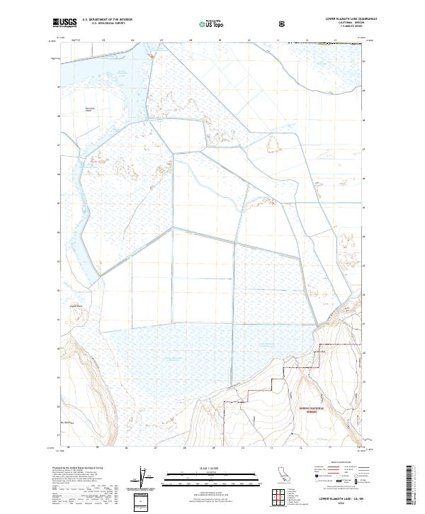
1985 Lower Klamath Lake
Siskiyou County, CA
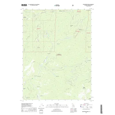
1985 Mount Dome
Siskiyou County, CA
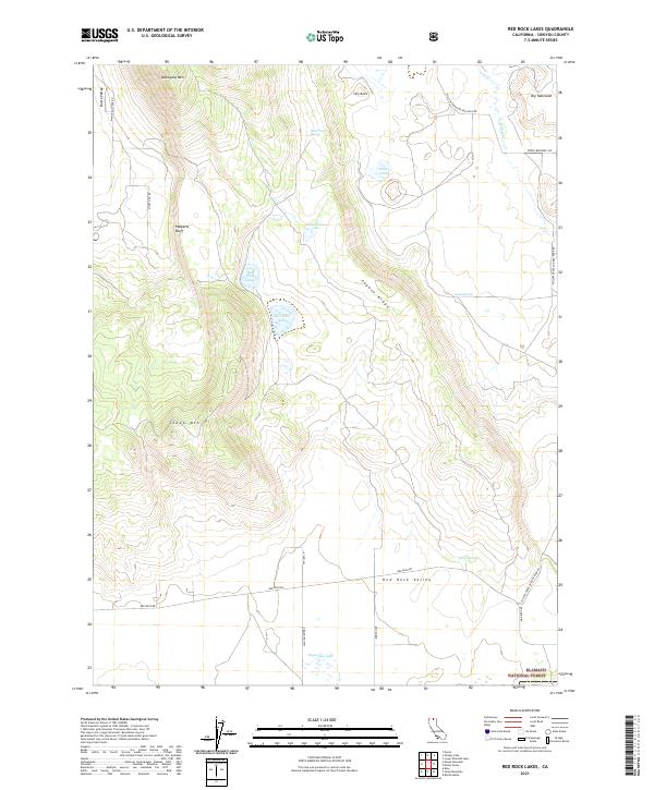
1985 Red Rock Lakes
Siskiyou County, CA
1985 Sams Neck
Siskiyou County, CA
1985 Secret Spring Mtn
Siskiyou County, CA
1985 Sheep Mountain
Siskiyou County, CA
1985 Sheepy Lake
Siskiyou County, CA
1986 Ash Creek Butte
Siskiyou County, CA
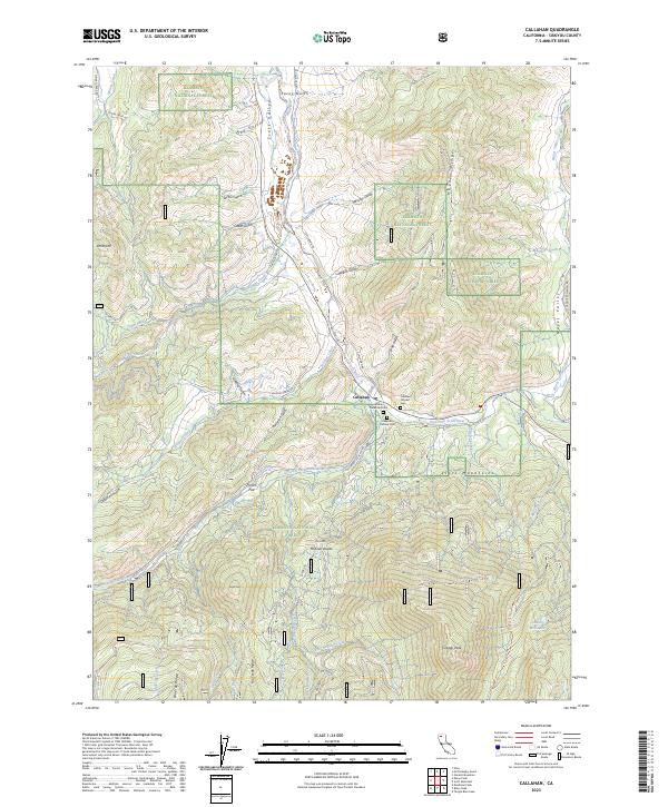
1986 Callahan
Siskiyou County, CA
1986 Caribou Lake
Siskiyou County, CA
1986 China Mtn
Siskiyou County, CA
1986 City of Mount Shasta
Siskiyou County, CA
1986 Deadman Peak
Siskiyou County, CA
1986 Eaton Peak
Siskiyou County, CA
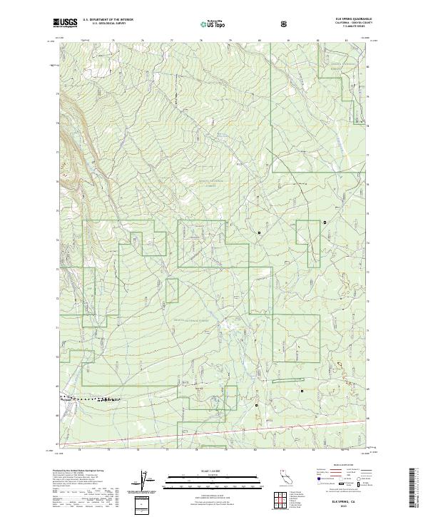
1986 Elk Spring
Siskiyou County, CA
1986 Gazelle Mtn
Siskiyou County, CA
1986 Girard Ridge
Siskiyou County, CA
1986 Grass Lake
Siskiyou County, CA
1986 Hotlum
Siskiyou County, CA
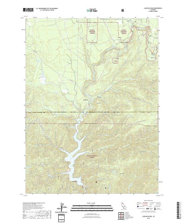
1986 Lake McCloud
Siskiyou County, CA
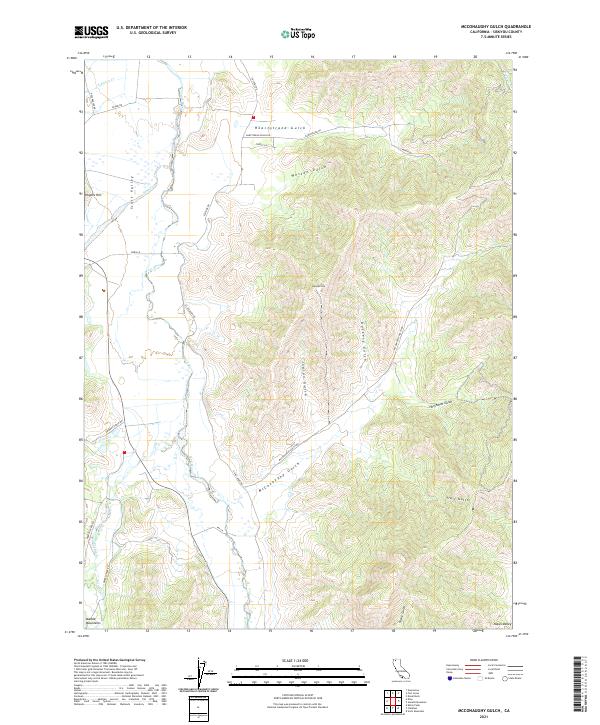
1986 Mc Conaughy Gulch
Siskiyou County, CA
1986 Mount Eddy
Siskiyou County, CA
1986 Mt. Shasta
Siskiyou County, CA
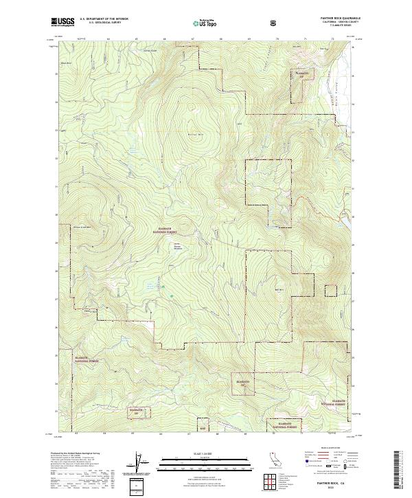
1986 Panther Rock
Siskiyou County, CA
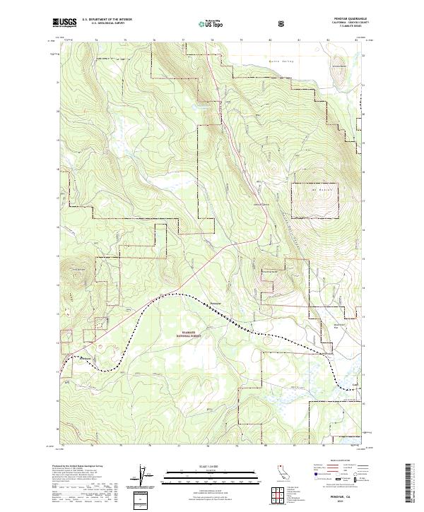
1986 Penoyar
Siskiyou County, CA
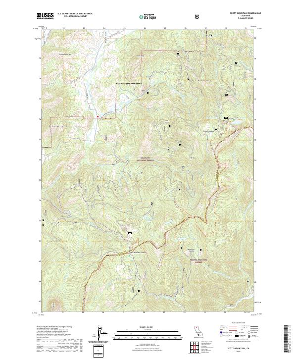
1986 Scott Mountain
Siskiyou County, CA
1986 Seven Lakes Basin
Siskiyou County, CA
1986 The Whaleback
Siskiyou County, CA
1986 West Haight Mtn
Siskiyou County, CA
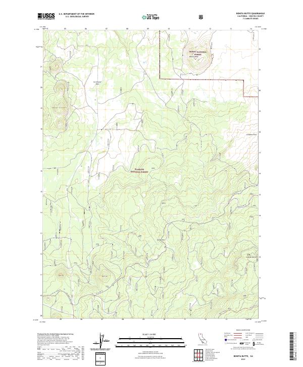
1988 Bonita Butte
Siskiyou County, CA
1988 Bray
Siskiyou County, CA
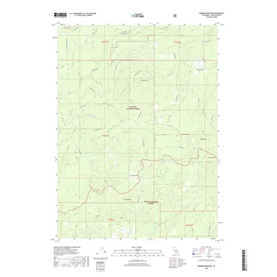
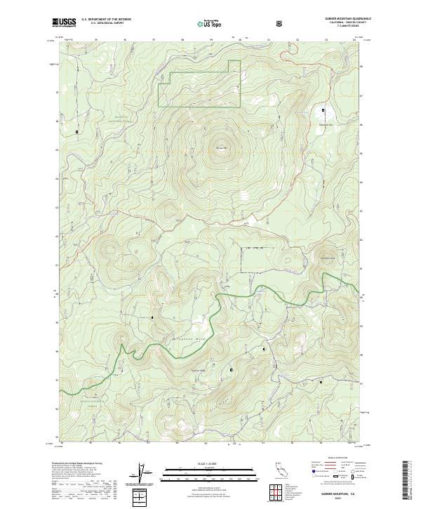
1988 Garner Mountain
Siskiyou County, CA
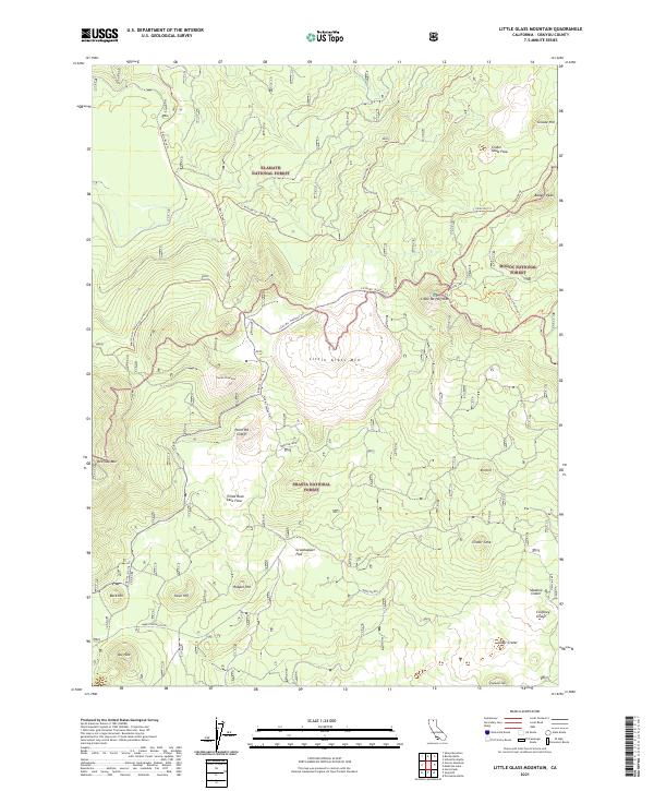
1988 Little Glass Mountain
Siskiyou County, CA
1988 Medicine Lake
Siskiyou County, CA
1988 Schonchin Butte
Siskiyou County, CA
1988 Sharp Mountain
Siskiyou County, CA
1990 Bartle
Siskiyou County, CA
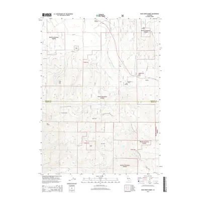
1990 Dead Horse Summit
Siskiyou County, CA
1990 East of Pondosa
Siskiyou County, CA
1990 Grizzly Peak
Siskiyou County, CA
1990 Hambone
Siskiyou County, CA
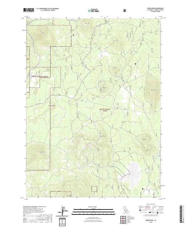
1990 Horse Peak
Siskiyou County, CA
1990 Indian Spring Mountain
Siskiyou County, CA
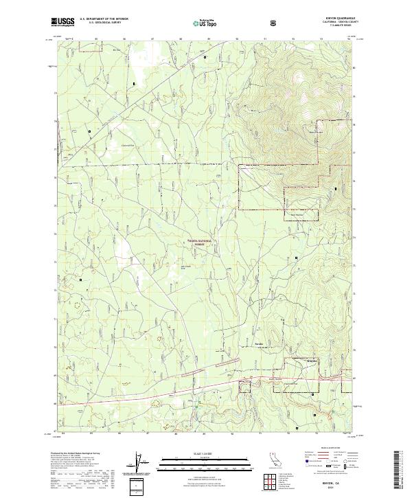
1990 Kinyon
Siskiyou County, CA
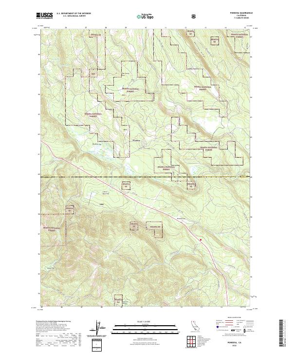
1990 Pondosa
Siskiyou County, CA
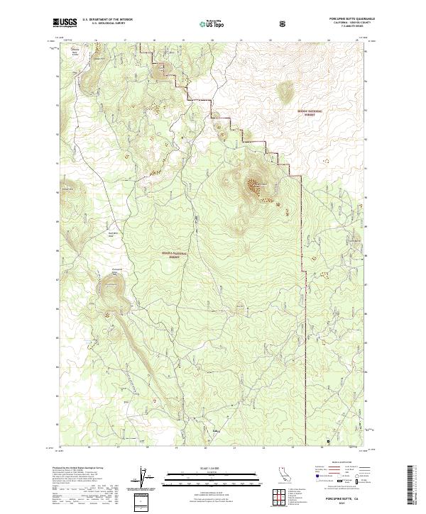
1990 Porcupine Butte
Siskiyou County, CA
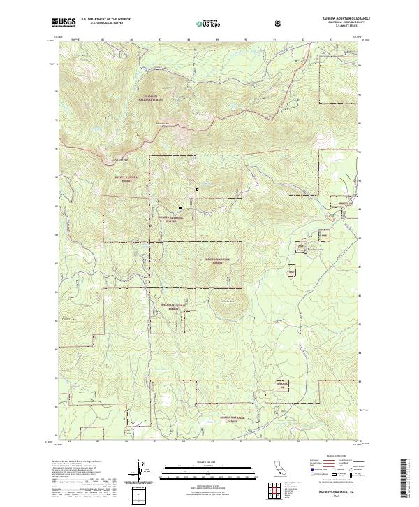
1990 Rainbow Mountain
Siskiyou County, CA
1990 Snag Hill
Siskiyou County, CA
1993 Captain Jacks Stronghold
Siskiyou County, CA
1993 Hatfield
Siskiyou County, CA
1993 Lower Klamath Lake
Siskiyou County, CA
1993 Medicine Lake
Siskiyou County, CA
1993 Mount Dome
Siskiyou County, CA
1993 Porcupine Butte
Siskiyou County, CA
1993 Schonchin Butte
Siskiyou County, CA
1995 East of Pondosa
Siskiyou County, CA
1995 Indian Spring Mountain
Siskiyou County, CA
1996 Kangaroo Mountain
Siskiyou County, CA
1998 Ash Creek Butte
Siskiyou County, CA
1998 Bartle
Siskiyou County, CA
1998 China Mountain
Siskiyou County, CA
1998 City of Mount Shasta
Siskiyou County, CA
1998 Condrey Mountain
Siskiyou County, CA
1998 Dead Horse Summit
Siskiyou County, CA
1998 Dutch Creek
Siskiyou County, CA
1998 Elk Spring
Siskiyou County, CA
1998 Figurehead Mountain
Siskiyou County, CA
1998 Girard Ridge
Siskiyou County, CA
1998 Grizzly Peak
Siskiyou County, CA
1998 Hambone
Siskiyou County, CA
1998 Horse Peak
Siskiyou County, CA
1998 Hotlum
Siskiyou County, CA
1998 Kinyon
Siskiyou County, CA
1998 Lake McCloud
Siskiyou County, CA
1998 Little Glass Mountain
Siskiyou County, CA
1998 Mc Cloud
Siskiyou County, CA
1998 Mount Eddy
Siskiyou County, CA
1998 Mt. Shasta
Siskiyou County, CA
1998 Pondosa
Siskiyou County, CA
1998 Porcupine Butte
Siskiyou County, CA
1998 Rainbow Mountain
Siskiyou County, CA
1998 Seven Lakes Basin
Siskiyou County, CA
1998 Snag Hill
Siskiyou County, CA
2001 Badger Mountain
Siskiyou County, CA
2001 Bark Shanty Gulch
Siskiyou County, CA
2001 Bear Peak
Siskiyou County, CA
2001 Bonita Butte
Siskiyou County, CA
2001 Boulder Peak
Siskiyou County, CA
2001 Bray
Siskiyou County, CA
2001 Buckhorn Bally
Siskiyou County, CA
2001 Callahan
Siskiyou County, CA
2001 Caribou Lake
Siskiyou County, CA
2001 Cecilville
Siskiyou County, CA
2001 Clear Creek
Siskiyou County, CA
2001 Copco
Siskiyou County, CA
2001 Cottonwood Peak
Siskiyou County, CA
2001 Deadman Peak
Siskiyou County, CA
2001 Deadman Point
Siskiyou County, CA
2001 Dewey Gulch
Siskiyou County, CA
2001 Dillon Mountain
Siskiyou County, CA
2001 Duzel Rock
Siskiyou County, CA
2001 Eaton Peak
Siskiyou County, CA
2001 English Peak
Siskiyou County, CA
2001 Forks of Salmon
Siskiyou County, CA
2001 Garner Mountain
Siskiyou County, CA
2001 Gazelle Mountain
Siskiyou County, CA
2001 Grasshopper Ridge
Siskiyou County, CA
2001 Grass Lake
Siskiyou County, CA
2001 Grider Valley
Siskiyou County, CA
2001 Hamburg
Siskiyou County, CA
2001 Hawkinsville
Siskiyou County, CA
2001 Horse Creek
Siskiyou County, CA
2001 Huckleberry Mountain
Siskiyou County, CA
2001 Indian Creek Baldy
Siskiyou County, CA
2001 Juniper Flat
Siskiyou County, CA
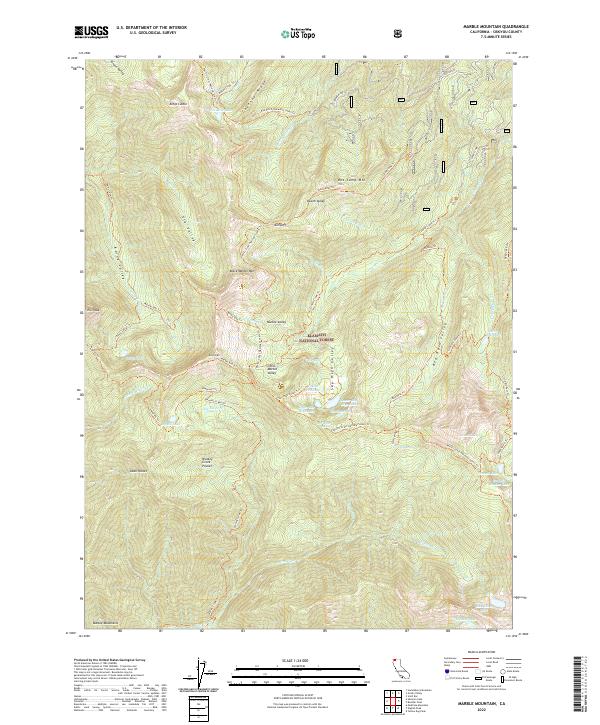
2001 Marble Mountain
Siskiyou County, CA
2001 Mcconaughy Gulch
Siskiyou County, CA
2001 Mckinley Mountain
Siskiyou County, CA
2001 Medicine Mountain
Siskiyou County, CA
2001 Orleans Mountain
Siskiyou County, CA
2001 Panther Rock
Siskiyou County, CA
2001 Penoyar
Siskiyou County, CA
2001 Preston Peak
Siskiyou County, CA
2001 Red Rock Lakes
Siskiyou County, CA
2001 Russell Peak
Siskiyou County, CA
2001 Sams Neck
Siskiyou County, CA
2001 Sawyers Bar
Siskiyou County, CA
2001 Scott Bar
Siskiyou County, CA
2001 Scott Mountain
Siskiyou County, CA
2001 Secret Spring Mountain
Siskiyou County, CA
2001 Seiad Valley
Siskiyou County, CA
2001 Sharp Mountain
Siskiyou County, CA
2001 Sheep Mountain
Siskiyou County, CA
2001 Slater Butte
Siskiyou County, CA
2001 Solomons Temple
Siskiyou County, CA
2001 Somes Bar
Siskiyou County, CA
2001 Tanners Peak
Siskiyou County, CA
2001 The Whaleback
Siskiyou County, CA
2001 Thompson Peak
Siskiyou County, CA
2001 Ukonom Lake
Siskiyou County, CA
2001 Ukonom Mountain
Siskiyou County, CA
2001 West Haight Mountain
Siskiyou County, CA
2001 Yellow Dog Peak
Siskiyou County, CA
2001 Youngs Peak
Siskiyou County, CA
2012 Ash Creek Butte
Siskiyou County, CA
2012 Badger Mountain
Siskiyou County, CA
2012 Bark Shanty Gulch
Siskiyou County, CA
2012 Bartle
Siskiyou County, CA
2012 Bear Peak
Siskiyou County, CA
2012 Bogus Mountain
Siskiyou County, CA
2012 Bonita Butte
Siskiyou County, CA
2012 Boulder Peak
Siskiyou County, CA
2012 Bray
Siskiyou County, CA
2012 Buckhorn Bally
Siskiyou County, CA
2012 Callahan
Siskiyou County, CA
2012 Captain Jacks Stronghold
Siskiyou County, CA
2012 Caribou Lake
Siskiyou County, CA
2012 Cecilville
Siskiyou County, CA
2012 China Mountain
Siskiyou County, CA
2012 City of Mount Shasta
Siskiyou County, CA
2012 Clear Creek
Siskiyou County, CA
2012 Condrey Mountain
Siskiyou County, CA

2012 Copco
Siskiyou County, CA
2012 Cottonwood Peak
Siskiyou County, CA
2012 Dead Horse Summit
Siskiyou County, CA
2012 Deadman Peak
Siskiyou County, CA
2012 Deadman Point
Siskiyou County, CA
2012 Dewey Gulch
Siskiyou County, CA
2012 Dillon Mountain
Siskiyou County, CA
2012 Dutch Creek
Siskiyou County, CA
2012 Duzel Rock
Siskiyou County, CA
2012 East of Pondosa
Siskiyou County, CA
2012 Eaton Peak
Siskiyou County, CA
2012 Elk Spring
Siskiyou County, CA
2012 English Peak
Siskiyou County, CA
2012 Figurehead Mountain
Siskiyou County, CA
2012 Forks of Salmon
Siskiyou County, CA
2012 Garner Mountain
Siskiyou County, CA
2012 Gazelle Mountain
Siskiyou County, CA
2012 Girard Ridge
Siskiyou County, CA
2012 Grasshopper Ridge
Siskiyou County, CA
2012 Grass Lake
Siskiyou County, CA
2012 Grider Valley
Siskiyou County, CA
2012 Grizzly Peak
Siskiyou County, CA
2012 Hambone
Siskiyou County, CA
2012 Hamburg
Siskiyou County, CA
2012 Hatfield
Siskiyou County, CA
2012 Hawkinsville
Siskiyou County, CA
2012 Horse Creek
Siskiyou County, CA
2012 Horse Peak
Siskiyou County, CA
2012 Hotlum
Siskiyou County, CA
2012 Huckleberry Mountain
Siskiyou County, CA
2012 Indian Creek Baldy
Siskiyou County, CA
2012 Indian Spring Mountain
Siskiyou County, CA
2012 Iron Gate Reservoir
Siskiyou County, CA
2012 Juniper Flat
Siskiyou County, CA
2012 Kangaroo Mountain
Siskiyou County, CA
2012 Kinyon
Siskiyou County, CA
2012 Lake McCloud
Siskiyou County, CA
2012 Little Glass Mountain
Siskiyou County, CA
2012 Little Shasta
Siskiyou County, CA
2012 Lower Klamath Lake
Siskiyou County, CA
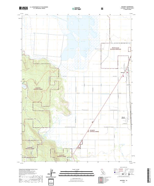
2012 MacDoel
Siskiyou County, CA
2012 Marble Mountain
Siskiyou County, CA
2012 McConaughy Gulch
Siskiyou County, CA
2012 McKinley Mountain
Siskiyou County, CA
2012 Medicine Lake
Siskiyou County, CA
2012 Medicine Mountain
Siskiyou County, CA
2012 Mount Dome
Siskiyou County, CA
2012 Mount Eddy
Siskiyou County, CA
2012 Orleans Mountain
Siskiyou County, CA
2012 Panther Rock
Siskiyou County, CA
2012 Penoyar
Siskiyou County, CA
2012 Pondosa
Siskiyou County, CA
2012 Porcupine Butte
Siskiyou County, CA
2012 Preston Peak
Siskiyou County, CA
2012 Rainbow Mountain
Siskiyou County, CA
2012 Red Rock Lakes
Siskiyou County, CA
2012 Russell Peak
Siskiyou County, CA

2012 Sams Neck
Siskiyou County, CA
2012 Sawyers Bar
Siskiyou County, CA
2012 Schonchin Butte
Siskiyou County, CA
2012 Scott Bar
Siskiyou County, CA
2012 Scott Mountain
Siskiyou County, CA
2012 Secret Spring Mountain
Siskiyou County, CA
2012 Seiad Valley
Siskiyou County, CA
2012 Seven Lakes Basin
Siskiyou County, CA
2012 Sharp Mountain
Siskiyou County, CA
2012 Sheep Mountain
Siskiyou County, CA
2012 Sheepy Lake
Siskiyou County, CA
2012 Slater Butte
Siskiyou County, CA
2012 Snag Hill
Siskiyou County, CA
2012 Solomons Temple
Siskiyou County, CA
2012 Somes Bar
Siskiyou County, CA
2012 Tanners Peak
Siskiyou County, CA
2012 The Whaleback
Siskiyou County, CA
2012 Thompson Peak
Siskiyou County, CA
2012 Ukonom Lake
Siskiyou County, CA
2012 Ukonom Mountain
Siskiyou County, CA
2012 West Haight Mountain
Siskiyou County, CA
2012 Yellow Dog Peak
Siskiyou County, CA
2012 Youngs Peak
Siskiyou County, CA
2015 Ash Creek Butte
Siskiyou County, CA
2015 Badger Mountain
Siskiyou County, CA
2015 Bark Shanty Gulch
Siskiyou County, CA
2015 Bartle
Siskiyou County, CA
2015 Bear Peak
Siskiyou County, CA
2015 Bogus Mountain
Siskiyou County, CA
2015 Bonita Butte
Siskiyou County, CA
2015 Boulder Peak
Siskiyou County, CA
2015 Bray
Siskiyou County, CA
2015 Buckhorn Bally
Siskiyou County, CA
2015 Callahan
Siskiyou County, CA
2015 Captain Jacks Stronghold
Siskiyou County, CA
2015 Caribou Lake
Siskiyou County, CA
2015 Cecilville
Siskiyou County, CA
2015 China Mountain
Siskiyou County, CA
2015 City of Mount Shasta
Siskiyou County, CA
2015 Clear Creek
Siskiyou County, CA
2015 Condrey Mountain
Siskiyou County, CA
2015 Copco
Siskiyou County, CA
2015 Cottonwood Peak
Siskiyou County, CA
2015 Dead Horse Summit
Siskiyou County, CA
2015 Deadman Peak
Siskiyou County, CA
2015 Deadman Point
Siskiyou County, CA
2015 Dewey Gulch
Siskiyou County, CA
2015 Dillon Mountain
Siskiyou County, CA
2015 Dutch Creek
Siskiyou County, CA
2015 Duzel Rock
Siskiyou County, CA
2015 East of Pondosa
Siskiyou County, CA
2015 Eaton Peak
Siskiyou County, CA
2015 Elk Spring
Siskiyou County, CA
2015 English Peak
Siskiyou County, CA
2015 Figurehead Mountain
Siskiyou County, CA
2015 Forks of Salmon
Siskiyou County, CA
2015 Garner Mountain
Siskiyou County, CA
2015 Gazelle Mountain
Siskiyou County, CA
2015 Girard Ridge
Siskiyou County, CA
2015 Grasshopper Ridge
Siskiyou County, CA
2015 Grass Lake
Siskiyou County, CA
2015 Grider Valley
Siskiyou County, CA
2015 Grizzly Peak
Siskiyou County, CA
2015 Hambone
Siskiyou County, CA
2015 Hamburg
Siskiyou County, CA

2015 Hatfield
Siskiyou County, CA
2015 Hawkinsville
Siskiyou County, CA
2015 Horse Creek
Siskiyou County, CA
2015 Horse Peak
Siskiyou County, CA
2015 Hotlum
Siskiyou County, CA
2015 Huckleberry Mountain
Siskiyou County, CA
2015 Indian Creek Baldy
Siskiyou County, CA
2015 Indian Spring Mountain
Siskiyou County, CA
2015 Iron Gate Reservoir
Siskiyou County, CA
2015 Juniper Flat
Siskiyou County, CA
2015 Kangaroo Mountain
Siskiyou County, CA
2015 Kinyon
Siskiyou County, CA
2015 Lake McCloud
Siskiyou County, CA
2015 Little Glass Mountain
Siskiyou County, CA
2015 Little Shasta
Siskiyou County, CA
2015 Lower Klamath Lake
Siskiyou County, CA
2015 MacDoel
Siskiyou County, CA
2015 Marble Mountain
Siskiyou County, CA
2015 McConaughy Gulch
Siskiyou County, CA
2015 McKinley Mountain
Siskiyou County, CA
2015 Medicine Lake
Siskiyou County, CA
2015 Medicine Mountain
Siskiyou County, CA
2015 Mount Dome
Siskiyou County, CA

2015 Mount Eddy
Siskiyou County, CA
2015 Orleans Mountain
Siskiyou County, CA
2015 Panther Rock
Siskiyou County, CA
2015 Penoyar
Siskiyou County, CA
2015 Pondosa
Siskiyou County, CA
2015 Porcupine Butte
Siskiyou County, CA
2015 Preston Peak
Siskiyou County, CA
2015 Rainbow Mountain
Siskiyou County, CA
2015 Red Rock Lakes
Siskiyou County, CA
2015 Russell Peak
Siskiyou County, CA
2015 Sams Neck
Siskiyou County, CA
2015 Sawyers Bar
Siskiyou County, CA
2015 Schonchin Butte
Siskiyou County, CA
2015 Scott Bar
Siskiyou County, CA
2015 Scott Mountain
Siskiyou County, CA
2015 Secret Spring Mountain
Siskiyou County, CA
2015 Seiad Valley
Siskiyou County, CA
2015 Seven Lakes Basin
Siskiyou County, CA
2015 Sharp Mountain
Siskiyou County, CA
2015 Sheep Mountain
Siskiyou County, CA
2015 Sheepy Lake
Siskiyou County, CA
2015 Slater Butte
Siskiyou County, CA
2015 Snag Hill
Siskiyou County, CA
2015 Solomons Temple
Siskiyou County, CA
2015 Somes Bar
Siskiyou County, CA
2015 Tanners Peak
Siskiyou County, CA
2015 The Whaleback
Siskiyou County, CA
2015 Thompson Peak
Siskiyou County, CA
2015 Ukonom Lake
Siskiyou County, CA
2015 Ukonom Mountain
Siskiyou County, CA
2015 West Haight Mountain
Siskiyou County, CA
2015 Yellow Dog Peak
Siskiyou County, CA
2015 Youngs Peak
Siskiyou County, CA
2018 Ash Creek Butte
Siskiyou County, CA
2018 Badger Mountain
Siskiyou County, CA
2018 Bark Shanty Gulch
Siskiyou County, CA
2018 Bartle
Siskiyou County, CA
2018 Bear Peak
Siskiyou County, CA
2018 Bogus Mountain
Siskiyou County, CA
2018 Bonita Butte
Siskiyou County, CA
2018 Boulder Peak
Siskiyou County, CA
2018 Bray
Siskiyou County, CA
2018 Buckhorn Bally
Siskiyou County, CA
2018 Callahan
Siskiyou County, CA
2018 Captain Jacks Stronghold
Siskiyou County, CA
2018 Caribou Lake
Siskiyou County, CA
2018 Cecilville
Siskiyou County, CA
2018 China Mountain
Siskiyou County, CA
2018 City of Mount Shasta
Siskiyou County, CA
2018 Clear Creek
Siskiyou County, CA
2018 Condrey Mountain
Siskiyou County, CA
2018 Copco
Siskiyou County, CA
2018 Cottonwood Peak
Siskiyou County, CA
2018 Dead Horse Summit
Siskiyou County, CA
2018 Deadman Peak
Siskiyou County, CA

2018 Deadman Point
Siskiyou County, CA
2018 Dewey Gulch
Siskiyou County, CA

2018 Dillon Mountain
Siskiyou County, CA
2018 Dutch Creek
Siskiyou County, CA
2018 Duzel Rock
Siskiyou County, CA
2018 East of Pondosa
Siskiyou County, CA
2018 Eaton Peak
Siskiyou County, CA
2018 Elk Spring
Siskiyou County, CA
2018 English Peak
Siskiyou County, CA
2018 Figurehead Mountain
Siskiyou County, CA
2018 Forks of Salmon
Siskiyou County, CA
2018 Garner Mountain
Siskiyou County, CA
2018 Gazelle Mountain
Siskiyou County, CA
2018 Girard Ridge
Siskiyou County, CA
2018 Grasshopper Ridge
Siskiyou County, CA
2018 Grass Lake
Siskiyou County, CA
2018 Grider Valley
Siskiyou County, CA
2018 Grizzly Peak
Siskiyou County, CA
2018 Hambone
Siskiyou County, CA
2018 Hamburg
Siskiyou County, CA
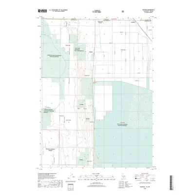
2018 Hatfield
Siskiyou County, CA
2018 Hawkinsville
Siskiyou County, CA
2018 Horse Creek
Siskiyou County, CA
2018 Horse Peak
Siskiyou County, CA
2018 Hotlum
Siskiyou County, CA
2018 Huckleberry Mountain
Siskiyou County, CA
2018 Indian Creek Baldy
Siskiyou County, CA
2018 Indian Spring Mountain
Siskiyou County, CA
2018 Iron Gate Reservoir
Siskiyou County, CA
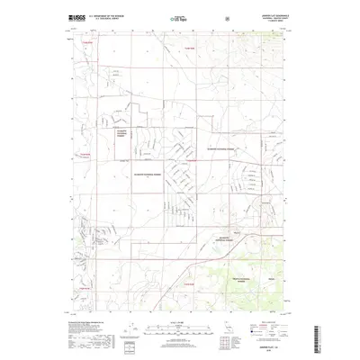
2018 Juniper Flat
Siskiyou County, CA
2018 Kangaroo Mountain
Siskiyou County, CA
2018 Kinyon
Siskiyou County, CA
2018 Lake McCloud
Siskiyou County, CA
2018 Little Glass Mountain
Siskiyou County, CA
2018 Little Shasta
Siskiyou County, CA
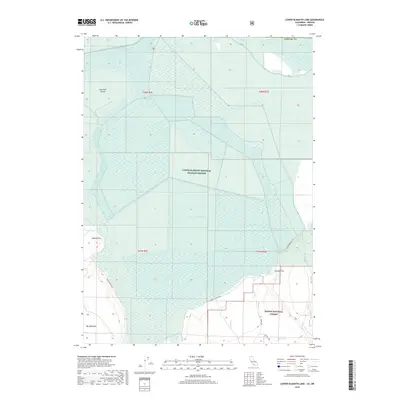
2018 Lower Klamath Lake
Siskiyou County, CA
2018 MacDoel
Siskiyou County, CA
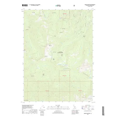
2018 Marble Mountain
Siskiyou County, CA
2018 McConaughy Gulch
Siskiyou County, CA
2018 McKinley Mountain
Siskiyou County, CA
2018 Medicine Lake
Siskiyou County, CA
2018 Medicine Mountain
Siskiyou County, CA
2018 Mount Dome
Siskiyou County, CA
2018 Mount Eddy
Siskiyou County, CA
2018 Orleans Mountain
Siskiyou County, CA
2018 Panther Rock
Siskiyou County, CA
2018 Penoyar
Siskiyou County, CA
2018 Pondosa
Siskiyou County, CA
2018 Porcupine Butte
Siskiyou County, CA
2018 Preston Peak
Siskiyou County, CA
2018 Rainbow Mountain
Siskiyou County, CA
2018 Red Rock Lakes
Siskiyou County, CA
2018 Russell Peak
Siskiyou County, CA
2018 Sams Neck
Siskiyou County, CA
2018 Sawyers Bar
Siskiyou County, CA
2018 Schonchin Butte
Siskiyou County, CA
2018 Scott Bar
Siskiyou County, CA
2018 Scott Mountain
Siskiyou County, CA
2018 Secret Spring Mountain
Siskiyou County, CA
2018 Seiad Valley
Siskiyou County, CA
2018 Seven Lakes Basin
Siskiyou County, CA
2018 Sharp Mountain
Siskiyou County, CA
2018 Sheep Mountain
Siskiyou County, CA
2018 Sheepy Lake
Siskiyou County, CA
2018 Slater Butte
Siskiyou County, CA
2018 Snag Hill
Siskiyou County, CA
2018 Solomons Temple
Siskiyou County, CA
2018 Somes Bar
Siskiyou County, CA
2018 Tanners Peak
Siskiyou County, CA
2018 The Whaleback
Siskiyou County, CA
2018 Thompson Peak
Siskiyou County, CA
2018 Ukonom Lake
Siskiyou County, CA
2018 Ukonom Mountain
Siskiyou County, CA
2018 West Haight Mountain
Siskiyou County, CA
2018 Yellow Dog Peak
Siskiyou County, CA
2018 Youngs Peak
Siskiyou County, CA
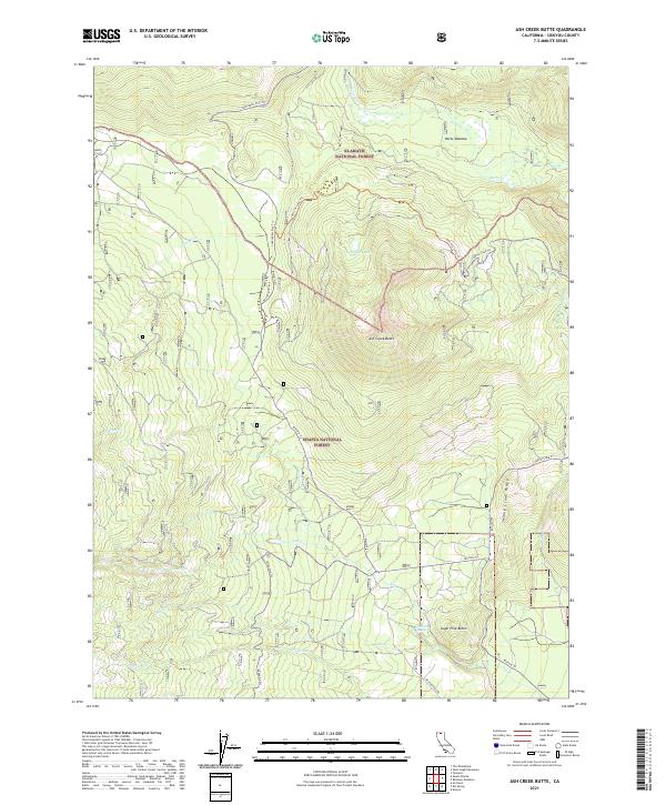
2021 Ash Creek Butte
Siskiyou County, CA
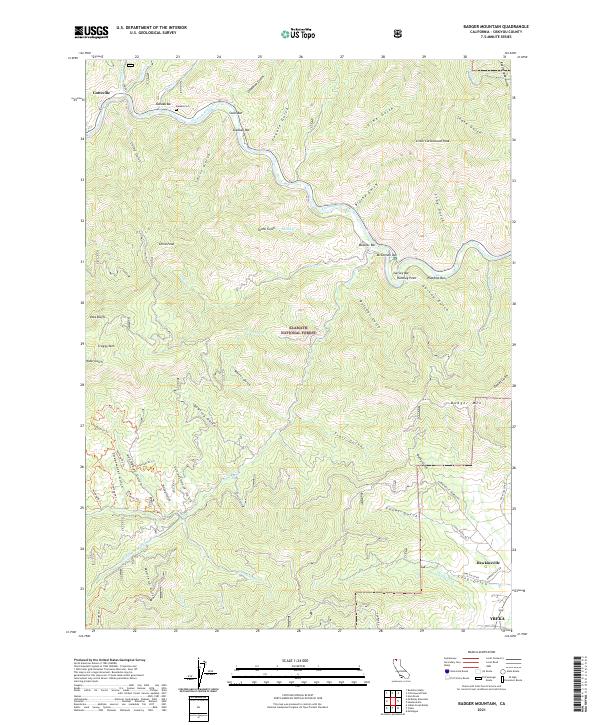
2021 Badger Mountain
Siskiyou County, CA
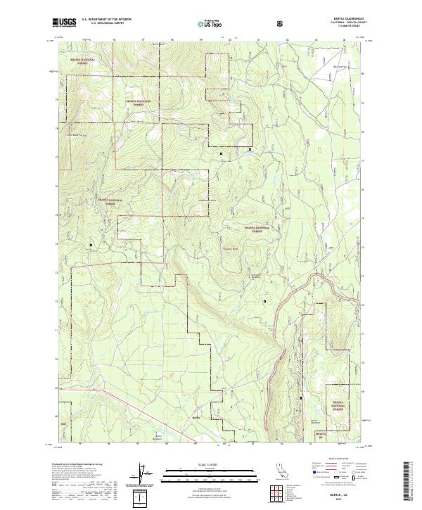
2021 Bartle
Siskiyou County, CA
2021 Bear Peak
Siskiyou County, CA
2021 Bogus Mountain
Siskiyou County, CA
2021 Bonita Butte
Siskiyou County, CA
2021 Boulder Peak
Siskiyou County, CA
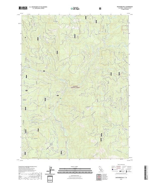
2021 Buckhorn Bally
Siskiyou County, CA
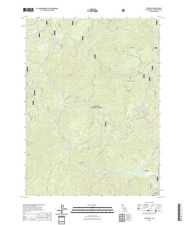
2021 Cecilville
Siskiyou County, CA

2021 Dead Horse Summit
Siskiyou County, CA
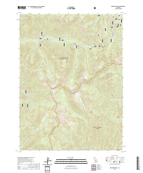
2021 Deadman Peak
Siskiyou County, CA
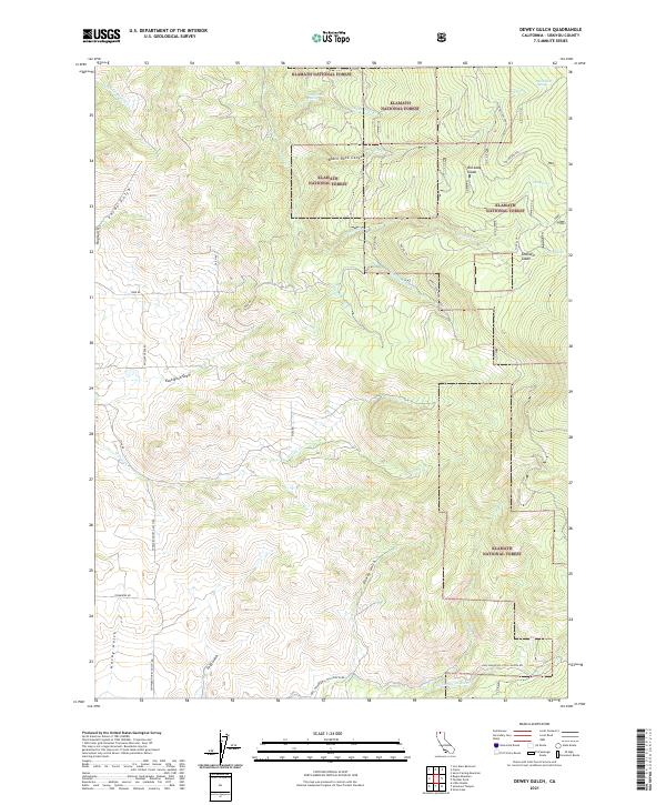
2021 Dewey Gulch
Siskiyou County, CA
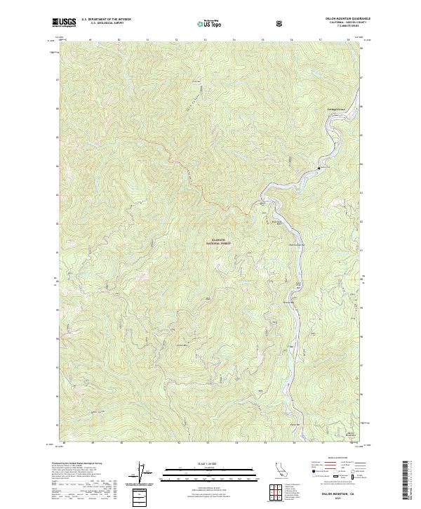
2021 Dillon Mountain
Siskiyou County, CA
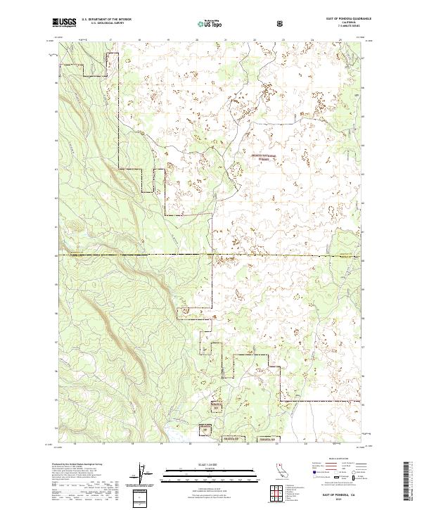
2021 East of Pondosa
Siskiyou County, CA
2021 Elk Spring
Siskiyou County, CA
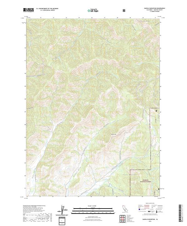
2021 Gazelle Mountain
Siskiyou County, CA
2021 Grass Lake
Siskiyou County, CA
2021 Grizzly Peak
Siskiyou County, CA
2021 Horse Creek
Siskiyou County, CA
2021 Indian Spring Mountain
Siskiyou County, CA
2021 Iron Gate Reservoir
Siskiyou County, CA
2021 Juniper Flat
Siskiyou County, CA
2021 Kinyon
Siskiyou County, CA
2021 Little Glass Mountain
Siskiyou County, CA
2021 Little Shasta
Siskiyou County, CA
2021 McConaughy Gulch
Siskiyou County, CA
2021 McKinley Mountain
Siskiyou County, CA
2021 Medicine Lake
Siskiyou County, CA
2021 Penoyar
Siskiyou County, CA
2021 Porcupine Butte
Siskiyou County, CA
2021 Red Rock Lakes
Siskiyou County, CA
2021 Scott Mountain
Siskiyou County, CA
2021 Sharp Mountain
Siskiyou County, CA
2021 Sheep Mountain
Siskiyou County, CA
2021 Solomons Temple
Siskiyou County, CA
2021 West Haight Mountain
Siskiyou County, CA
2021 Yellow Dog Peak
Siskiyou County, CA
2021 Youngs Peak
Siskiyou County, CA
2022 Bark Shanty Gulch
Siskiyou County, CA
2022 Bray
Siskiyou County, CA
2022 Callahan
Siskiyou County, CA

2022 Captain Jacks Stronghold
Siskiyou County, CA
2022 Caribou Lake
Siskiyou County, CA
2022 China Mountain
Siskiyou County, CA
2022 City of Mount Shasta
Siskiyou County, CA
2022 Clear Creek
Siskiyou County, CA
2022 Condrey Mountain
Siskiyou County, CA
2022 Copco
Siskiyou County, CA
2022 Cottonwood Peak
Siskiyou County, CA
2022 Deadman Point
Siskiyou County, CA
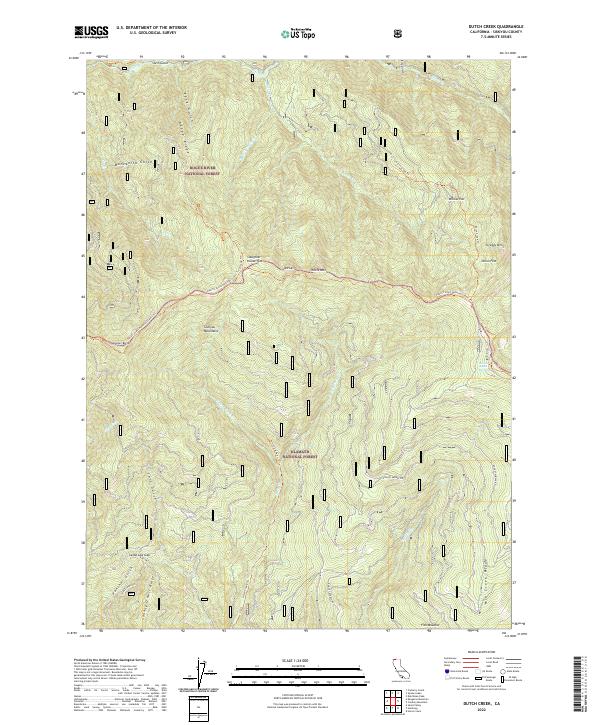
2022 Dutch Creek
Siskiyou County, CA
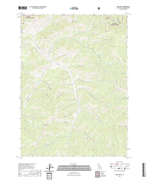
2022 Duzel Rock
Siskiyou County, CA
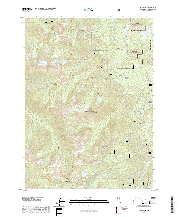
2022 Eaton Peak
Siskiyou County, CA
2022 English Peak
Siskiyou County, CA
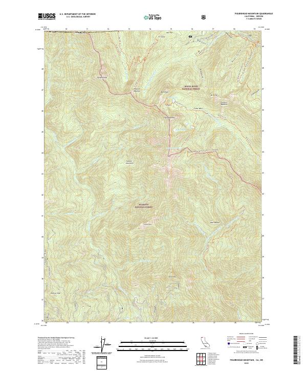
2022 Figurehead Mountain
Siskiyou County, CA
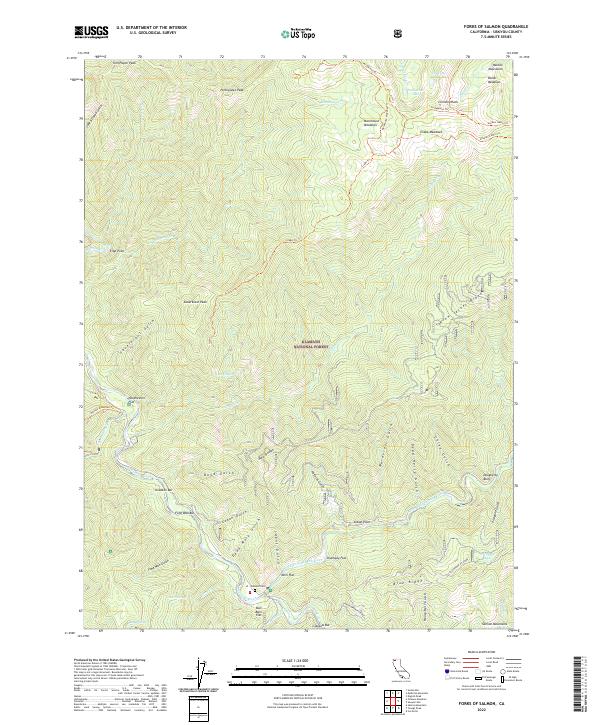
2022 Forks of Salmon
Siskiyou County, CA
2022 Garner Mountain
Siskiyou County, CA
2022 Girard Ridge
Siskiyou County, CA
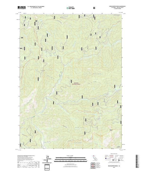
2022 Grasshopper Ridge
Siskiyou County, CA
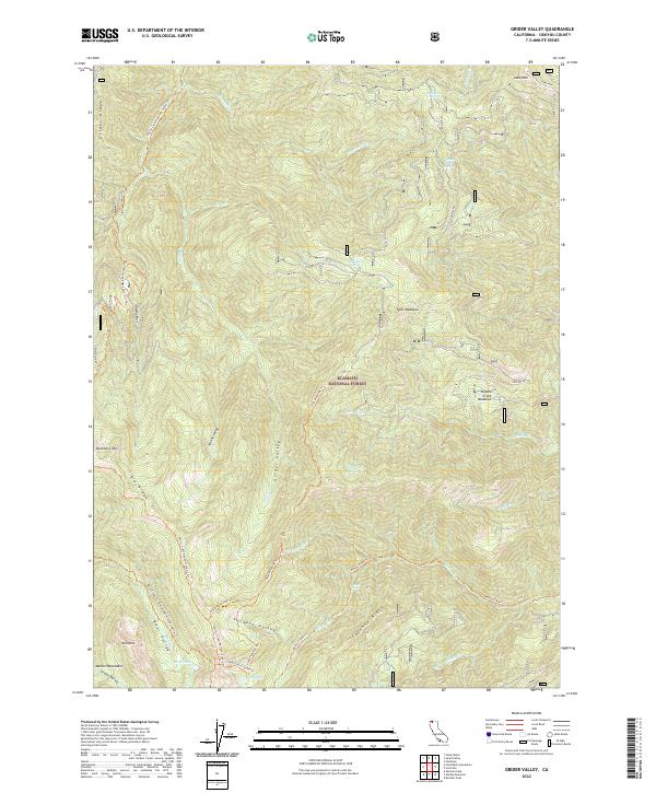
2022 Grider Valley
Siskiyou County, CA
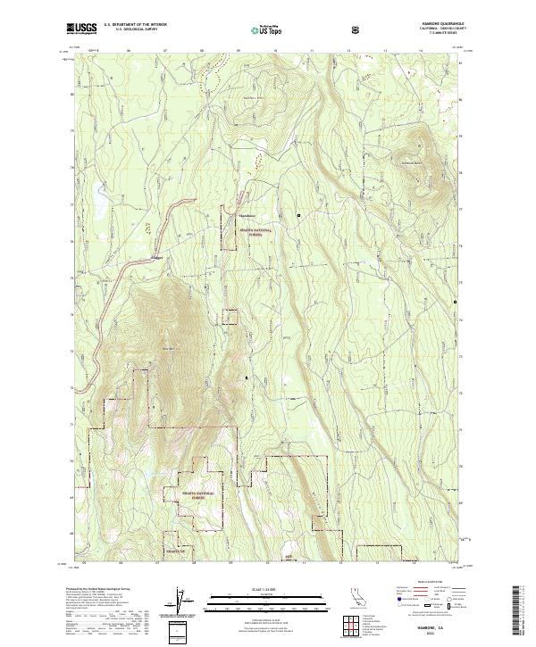
2022 Hambone
Siskiyou County, CA
2022 Hamburg
Siskiyou County, CA
2022 Hatfield
Siskiyou County, CA
2022 Hawkinsville
Siskiyou County, CA
2022 Horse Peak
Siskiyou County, CA
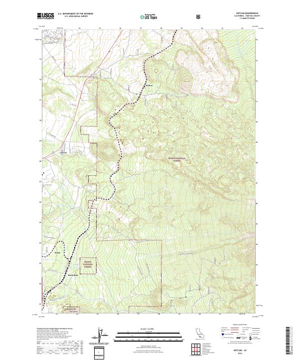
2022 Hotlum
Siskiyou County, CA
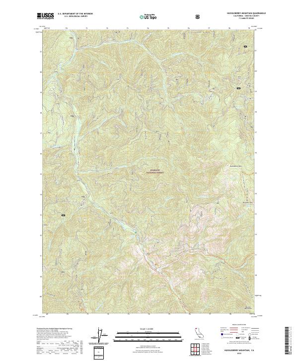
2022 Huckleberry Mountain
Siskiyou County, CA
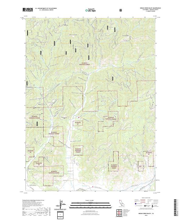
2022 Indian Creek Baldy
Siskiyou County, CA
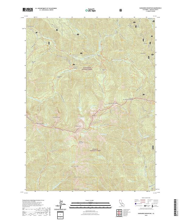
2022 Kangaroo Mountain
Siskiyou County, CA
2022 Lake McCloud
Siskiyou County, CA
2022 Lower Klamath Lake
Siskiyou County, CA
2022 MacDoel
Siskiyou County, CA
2022 Marble Mountain
Siskiyou County, CA
2022 Medicine Mountain
Siskiyou County, CA
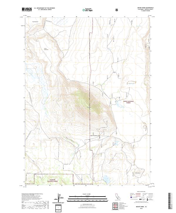
2022 Mount Dome
Siskiyou County, CA
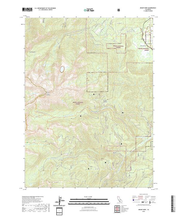
2022 Mount Eddy
Siskiyou County, CA
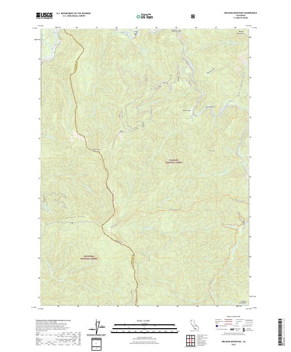
2022 Orleans Mountain
Siskiyou County, CA
2022 Panther Rock
Siskiyou County, CA
2022 Pondosa
Siskiyou County, CA
2022 Preston Peak
Siskiyou County, CA
2022 Rainbow Mountain
Siskiyou County, CA
2022 Russell Peak
Siskiyou County, CA
2022 Sams Neck
Siskiyou County, CA
2022 Sawyers Bar
Siskiyou County, CA
2022 Schonchin Butte
Siskiyou County, CA
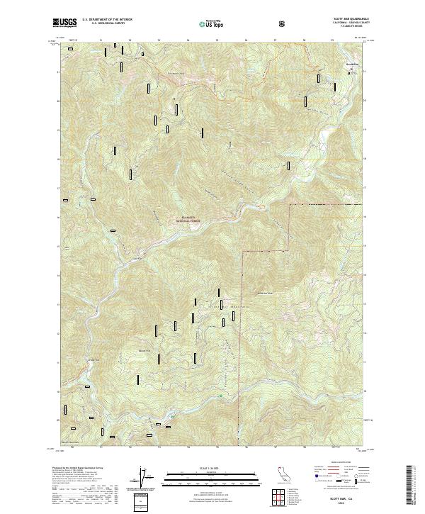
2022 Scott Bar
Siskiyou County, CA
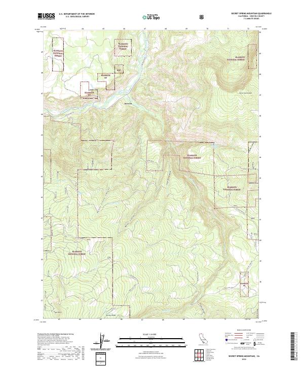
2022 Secret Spring Mountain
Siskiyou County, CA
2022 Seiad Valley
Siskiyou County, CA
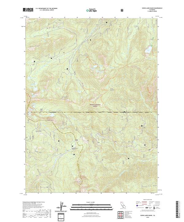
2022 Seven Lakes Basin
Siskiyou County, CA
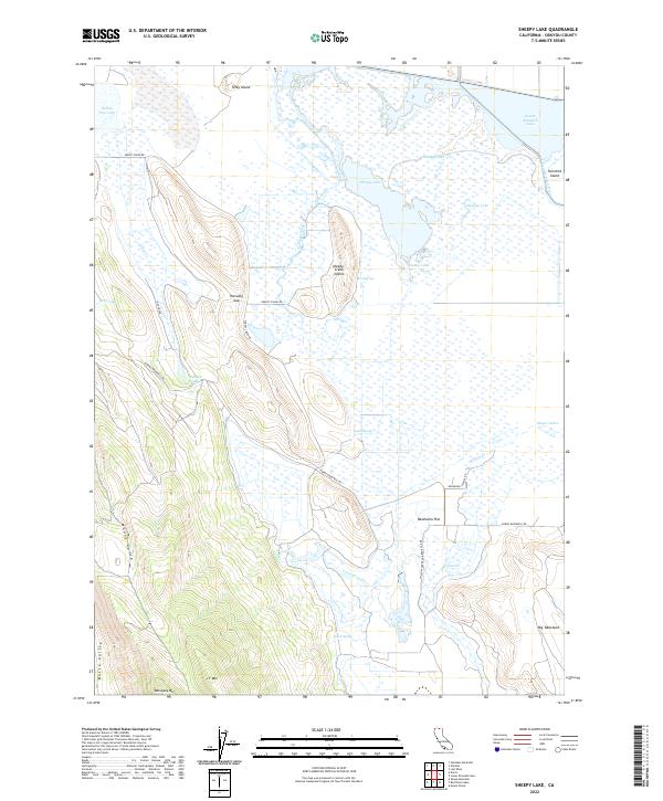
2022 Sheepy Lake
Siskiyou County, CA
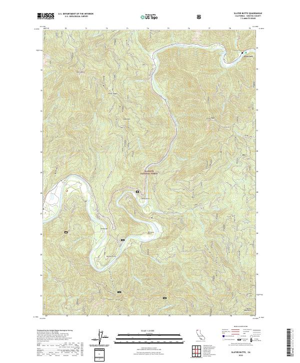
2022 Slater Butte
Siskiyou County, CA
2022 Snag Hill
Siskiyou County, CA
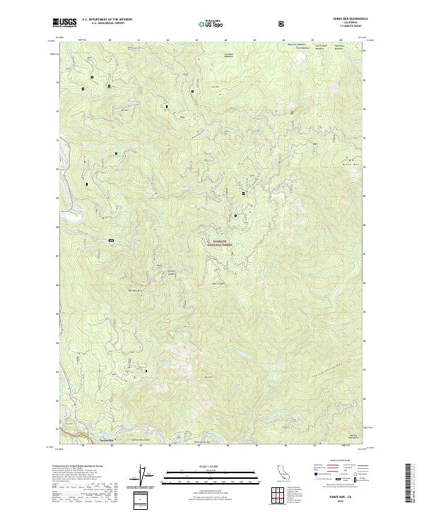
2022 Somes Bar
Siskiyou County, CA
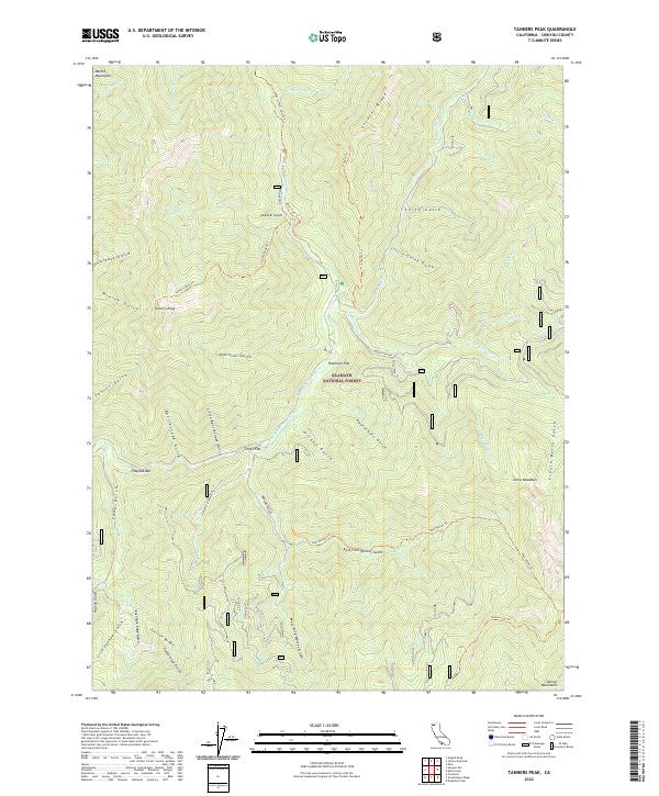
2022 Tanners Peak
Siskiyou County, CA
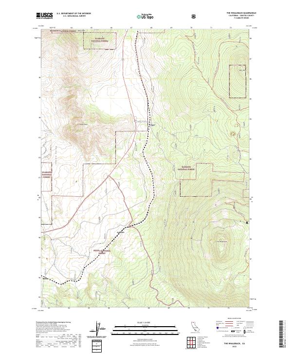
2022 The Whaleback
Siskiyou County, CA
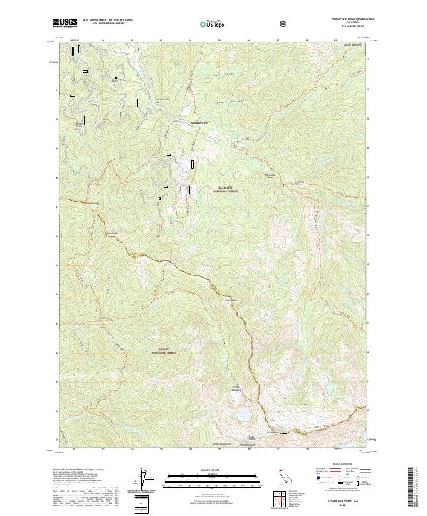
2022 Thompson Peak
Siskiyou County, CA
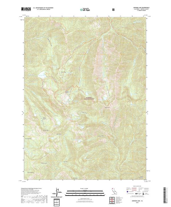
2022 Ukonom Lake
Siskiyou County, CA
2022 Ukonom Mountain
Siskiyou County, CA
2023 Callahan
Siskiyou County, CA
2023 Elk Spring
Siskiyou County, CA
2023 Garner Mountain
Siskiyou County, CA
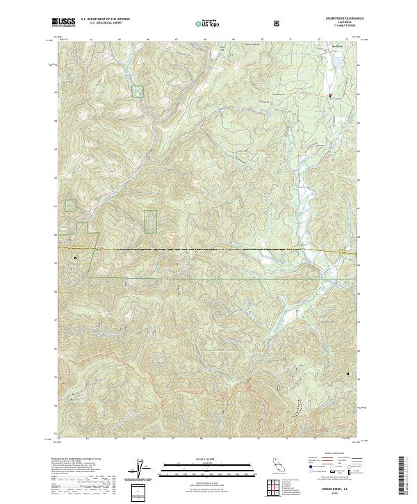
2023 Girard Ridge
Siskiyou County, CA