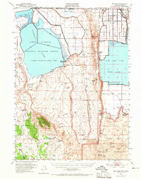
1950 Map of Mt Dome
USGS Topo · Published 1965About this map
The high desert landscape along the California-Oregon border near Mt Dome reveals a complex history of settlement and conflict amidst geological wonders. Much of the terrain is defined by extensive Lava beds, punctuated by landmarks such as the Captain Jacks Stronghold and the Site of Thomas & Wright Massacre, which anchor the map's historical narrative to the Modoc War era. Toward the north, the transformation of the basin is evident in the managed waters of the Lower Klamath Lake Sump and Tule Lake Sump, part of the larger Lower Klamath National Wildlife Refuge.
Find a feature on this map
59 named features on this map. Tap any name to fly to it.
Don’t see what you’re looking for? This feature index may not catch every label — zoom into the map to look around manually.
Map Details
Editions of this 1950 Mt Dome Map
4 editions found
Other maps of this area

1886 · Modoc Lava Bed
USGS Topo · 1:250,000

1889 · Klamath
USGS Topo · 1:250,000

1892 · Modoc Lava-Bed
USGS Topo · 1:250,000

1894 · Klamath
USGS Topo · 1:250,000

1950 · Mt. Dome
USGS Topo · 1:62,500

1950 · Bray
USGS Topo · 1:62,500

1950 · Dorris
USGS Topo · 1:62,500

1951 · Tulelake
USGS Topo · 1:62,500

1952 · Timber Mountain
USGS Topo · 1:62,500

1952 · Medicine Lake
USGS Topo · 1:62,500