
1954 Map of Alturas
USGS Topo · Published 1968About this map
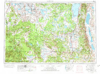
Alturas stands as the central hub of this northern California landscape, situated at the junction of U.S. 395 and U.S. 299. The map details a region defined by high volcanic plateaus and expansive basins, where the Pit River drainage system meets the high desert character of the Modoc Plateau. To the east, the steep rise of the Warner Mountains separates the central valley from the distinct, enclosed drainage of Surprise Valley, which contains the massive ephemeral beds of Upper Lake, Middle Alkali Lake, and Lower Lake.
Find a feature on this map
46 named features on this map. Tap any name to fly to it.
Don’t see what you’re looking for? This feature index may not catch every label — zoom into the map to look around manually.
Map Details
Editions of this 1954 Alturas Map
4 editions found
Other maps of this area

1886 · Alturas
USGS Topo · 1:250,000

1886 · Honey Lake
USGS Topo · 1:250,000

1886 · Lassen Peak
USGS Topo · 1:250,000

1886 · Modoc Lava Bed
USGS Topo · 1:250,000

1886 · Shasta
USGS Topo · 1:250,000

1886 · Granite Range
USGS Topo · 1:250,000

1889 · Klamath
USGS Topo · 1:250,000

1889 · Long Valley
USGS Topo · 1:250,000

1890 · Red Bluff
USGS Topo · 1:250,000

1891 · Honey Lake
USGS Topo · 1:250,000