
1957 Map of Malin
USGS Topo · Published 1961About this map
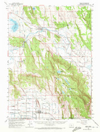
The agrarian and hydraulic landscape of southern Klamath County is captured here during the late 1950s, defined by a complex network of irrigation ditches and pump stations that support life in Poe Valley and Yonna Valley. Centered on the town of Malin, the map reveals the critical infrastructure of the era, from the Malin High Sch to numerous named pumps like the Irwins Pump and Nichols Pump along the Lost River.
Find a feature on this map
64 named features on this map. Tap any name to fly to it.
Don’t see what you’re looking for? This feature index may not catch every label — zoom into the map to look around manually.
Map Details
Editions of this 1957 Malin Map
2 editions found
Other maps of this area

1886 · Modoc Lava Bed
USGS Topo · 1:250,000

1889 · Klamath
USGS Topo · 1:250,000

1892 · Modoc Lava-Bed
USGS Topo · 1:250,000

1894 · Klamath
USGS Topo · 1:250,000

1950 · Mt. Dome
USGS Topo · 1:62,500

1951 · Clear Lake Reservoir
USGS Topo · 1:62,500

1951 · Tulelake
USGS Topo · 1:62,500

1954 · Alturas
USGS Topo · 1:250,000

1955 · Klamath Falls
USGS Topo · 1:250,000

1957 · Merrill
USGS Topo · 1:62,500