Old Maps of Rocky Point, Oregon for Academic Research
Study the evolution of Rocky Point with 13 high-resolution historic maps. Whether you're teaching, researching, or modeling changes in land use, these maps provide essential visual documentation of urban, environmental, and geographic change.
- Analyze long-term change: Track patterns in development, transportation, and natural features.
- Ideal for environmental or urban studies: Support academic projects with primary historical map data.
- Use in the classroom or lab: Educators and researchers rely on these maps to bring historical context to life.
These maps are a powerful tool for teaching, research, and visualizing how Rocky Point has changed over the decades.
Rocky Point, OR maps
(13)- 1891 Map of Ashland
 1891 Ashland1891 Print · USGSSouthern Oregon's Rogue River Valley was undergoing rapid transformation in the late nineteenth century as rail lines connected its emerging towns. Genealogists and historians can trace early property and settlement patterns near Jacksonville, Medford, and the pristine Crater Lake basin.
 - 1893 Map of Ashland
 1893 Ashland1893 Print · USGSSouthern Oregon in the late nineteenth century was a region of rapid change as the Oregon and California R. R. linked the valley floor. Researchers can trace the early footprints of Jacksonville, Medford, and Ashland, or locate landmarks like Crater Lake and Mt Pitt.6 unique versions available
 - 1897 Map of Ashland, 1937 Print
 1897 Ashland1937 Print · USGSSouthern Oregon's Rogue River Valley is captured here in the late nineteenth century as the railroad began to transform local commerce. Trace the early footprints of Jacksonville and Medford, or locate remote landmarks like Wizard Island and the high peaks of the Rogue River National Forest.
 - 1955 Map of Lake O' Woods, 1957 Print
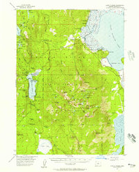 1955 Lake O' Woods1957 Print · USGSThe Oregon Cascades and the shores of Upper Klamath Lake are captured here in the mid-fifties, during the height of the region's recreational growth. Researchers can locate early camps and lodges like Harriman Lodge, Long Lake Camp, and the Lake O' Woods Resort.3 unique versions available
 - 1955 Map of Medford, 1964 Print
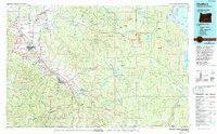
 1955 Medford1964 Print · USGSSouthern Oregon's valley towns and high peaks are captured here in the mid-1950s, showing the region before the completion of the modern interstate system. Genealogists and historians can trace the development of timber and mining outposts from Wolf Creek to Butte Falls and the early roads to Crater Lake.3 unique versions available
 - 1957 Map of Medford
 1957 Medford1957 Print · USGSSouthern Oregon during the mid-fifties is captured here as a region of growing valley cities and vast timberlands. Genealogists and historians can trace the rail-and-road corridors connecting Medford, Jacksonville, and Grants Pass to more remote locales like Wolf Creek or Butte Falls.
 - 1958 Map of Medford
 1958 Medford1958 Print · USGSSouthern Oregon's Rogue River valley thrived in the 1950s as a crossroads of rail and road. Researchers can trace the legacy of timber and tourism through Southern Pacific RR lines and landmarks like Crater Lake and Oregon Caves National Monument.
 - 1978 Map of Medford, 1994 Print
 1978 Medford1994 Print · USGSSouthern Oregon's Bear Creek Valley comes into sharp focus during the late seventies, showing the growth of Medford and Ashland along the rail lines. Local researchers can trace the development of White City, old routes through Sams Valley, and the irrigation infrastructure at Hyatt Reservoir.
 - 1985 Map of Pelican Bay
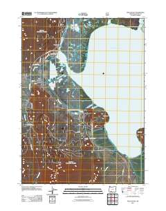
 1985 Pelican Bay1985 Print · USGSUpper Klamath Lake and the surrounding marshes are captured here in the mid-1980s during a period of managed forest and wildlife preservation. Researchers can trace recreational landmarks like Harriman Lodge or the industrial footprint of the Odessa Cinder Pit.
 - 1998 Map of Pelican Bay, 2000 Print
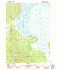
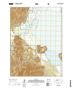
 1998 Pelican Bay2000 Print · USGSUpper Klamath Lake and the surrounding marshes are captured here in the late nineties, showing a complex network of wildlife refuges and forest wilderness. Researchers can trace lakeside developments like Harriman Lodge and Rocky Point, or locate the Denny Creek Historic Monument along the highway.
 - 2011 Map of Pelican Bay, 2011 Print
 2011 Pelican Bay2011 Print · USGSCovers Rocky Point, including Klamath County, United States, and other nearby areas
 - 2020 Map of Pelican Bay, 2020 Print
 2020 Pelican Bay2020 Print · USGSCovers Rocky Point, including Klamath County, United States, and other nearby areas
 - 2024 Map of Pelican Bay, 2024 Print
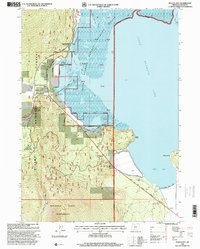
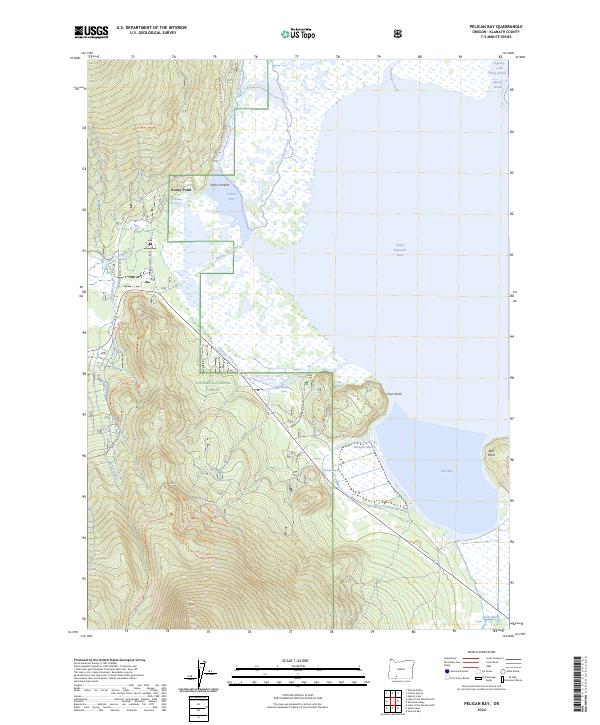 2024 Pelican Bay2024 Print · USGSKlamath County's western shoreline and forest interior are captured here in the 2020s, showing the intersection of lake life and protected wilderness. Researchers can trace the boundaries of the Upper Klamath National Wildlife Refuge and locate remote landmarks like Rocky Point, Harriman Spring, and the Pelican Cut Canal.
End of results
Showing maps 1-13 of 13
Top cities near Rocky Point
Frequently asked questions
- What are the different types of historical maps available for Rocky Point?
- What is the oldest map of Rocky Point?
- Where can I purchase historical maps of Rocky Point for my home or office?
- Where can I download high-res historical maps of Rocky Point?
- Are there historical topographic maps available for Rocky Point?
- Is there historical aerial imagery available for Rocky Point?
- Where are historical maps of Rocky Point sourced from?