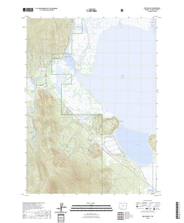
2024 Map of Pelican Bay
USGS Topo · Published 2024About this map
Upper Klamath National Wildlife Refuge dominates the eastern expanse of this landscape, where the waters of Upper Klamath Lake meet the dense timber of the Winema National Forest. The transition from aquatic marshes to forested peaks is marked by the presence of numerous springs, including Harriman Spring, Odessa Spring, and Wampler Spring, which feed into the intricate wetland systems of Pelican Bay and Ball Bay. Small settlements and seasonal destinations such as Rocky Point and Point Comfort provide access points to the waterfront.
Find a feature on this map
39 named features on this map. Tap any name to fly to it.
Don’t see what you’re looking for? This feature index may not catch every label — zoom into the map to look around manually.
Map Details
Editions of this 2024 Pelican Bay Map
This is the sole edition of this map. No revisions or reprints were ever made.
Other maps of this area

1889 · Klamath
USGS Topo · 1:250,000

1891 · Ashland
USGS Topo · 1:250,000

1893 · Ashland
USGS Topo · 1:250,000

1894 · Klamath
USGS Topo · 1:250,000

1897 · Ashland
USGS Topo · 1:250,000

1955 · Lake O' Woods
USGS Topo · 1:62,500

1955 · Pelican Butte
USGS Topo · 1:62,500

1955 · Klamath Falls
USGS Topo · 1:250,000

1955 · Medford
USGS Topo · 1:250,000

1957 · Medford
USGS Topo · 1:250,000