Old Maps of Plush, Oregon for Academic Research
Study the evolution of Plush with 11 high-resolution historic maps. Whether you're teaching, researching, or modeling changes in land use, these maps provide essential visual documentation of urban, environmental, and geographic change.
- Analyze long-term change: Track patterns in development, transportation, and natural features.
- Ideal for environmental or urban studies: Support academic projects with primary historical map data.
- Use in the classroom or lab: Educators and researchers rely on these maps to bring historical context to life.
These maps are a powerful tool for teaching, research, and visualizing how Plush has changed over the decades.
Plush, OR maps
(11)- 1955 Map of Adel, 1971 Print
 1955 Adel1971 Print · USGSSoutheast Oregon in the mid-fifties remains a landscape of vast alkaline basins and high mountain scarps, anchored by remote outposts. Researchers can trace historic ranching routes through Catlow Valley and locate landmarks like Beatys Butte or the small settlement of Blitzen.2 unique versions available
 - 1957 Map of Adel
 1957 Adel1957 Print · USGSSoutheast Oregon in the mid-fifties reveals a high-desert landscape of sprawling ranches and vast wildlife refuges before modern development. Genealogists and researchers can trace the remote outposts of the region, from the Red Point School to historic headquarters like the Guano Ranch and Frenchglen.
 - 1958 Map of Adel
 1958 Adel1958 Print · USGSSoutheastern Oregon in the mid-fifties is captured here, showing a vast territory of high desert basins and isolated ranching outposts. Genealogists and researchers can trace the locations of the Red Point School, Frenchglen, and remote sites like Guano Ranch.2 unique versions available
 - 1962 Map of Adel, 1963 Print
 1962 Adel1963 Print · USGSSoutheastern Oregon in the early sixties reveals a landscape of massive basins, remote ranches, and expansive wildlife refuges. Researchers can locate vanished rural infrastructure like the Trout Creek School or trace early routes through Adel and Frenchglen.
 - 1967 Map of Plush, 1969 Print
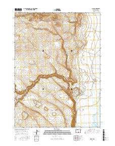
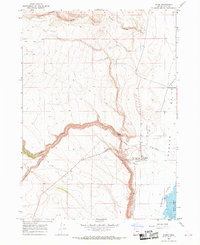 1967 Plush1969 Print · USGSThe high-desert community of Plush is documented here in the late sixties, situated where the creeks meet the basin floor. Genealogists and historians can trace the early infrastructure of the Warner Valley, including the Landing Strip and Hart Lake shoreline.3 unique versions available
 - 1994 Map of Adel
 1994 Adel1994 Print · USGSLake County and Harney County are captured here in the mid-1990s, revealing a landscape defined by high desert refuges and alkaline basins. Researchers can trace remote landmarks like Mustang Jail, the Langdell Monument, and the isolated outposts of Adel and Plush.
 - 2011 Map of Plush, 2011 Print
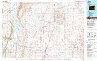
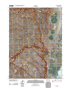 2011 Plush2011 Print · USGSCovers Plush, including Lake County, United States, and other nearby areas
 - 2014 Map of Plush, 2014 Print
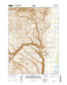 2014 Plush2014 Print · USGSCovers Plush, including Lake County, United States, and other nearby areas
 - 2017 Map of Plush, 2017 Print
 2017 Plush2017 Print · USGSCovers Plush, including Lake County, United States, and other nearby areas
 - 2020 Map of Plush, 2020 Print
 2020 Plush2020 Print · USGSCovers Plush, including Lake County, United States, and other nearby areas
 - 2024 Map of Plush, 2024 Print
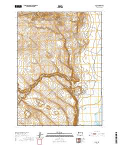
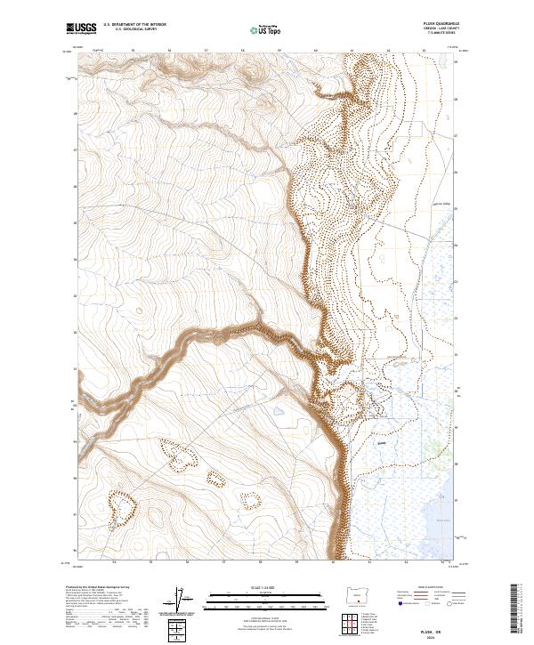 2024 Plush2024 Print · USGSIn the high desert of Lake County, the settlement of Plush anchors a landscape where the Warner Valley meets the rising rimrock. Trace the routes of Honey Creek and Twelvemile Creek as they flow toward the shoreline of Hart Lake.
End of results
Showing maps 1-11 of 11
Frequently asked questions
- What are the different types of historical maps available for Plush?
- What is the oldest map of Plush?
- Where can I purchase historical maps of Plush for my home or office?
- Where can I download high-res historical maps of Plush?
- Are there historical topographic maps available for Plush?
- Is there historical aerial imagery available for Plush?
- Where are historical maps of Plush sourced from?