Old Maps of Summer Lake, Oregon for Academic Research
Study the evolution of Summer Lake with 9 high-resolution historic maps. Whether you're teaching, researching, or modeling changes in land use, these maps provide essential visual documentation of urban, environmental, and geographic change.
- Analyze long-term change: Track patterns in development, transportation, and natural features.
- Ideal for environmental or urban studies: Support academic projects with primary historical map data.
- Use in the classroom or lab: Educators and researchers rely on these maps to bring historical context to life.
These maps are a powerful tool for teaching, research, and visualizing how Summer Lake has changed over the decades.
Summer Lake, OR maps
(9)- 1955 Map of Klamath Falls, 1963 Print
 1955 Klamath Falls1963 Print · USGSSouthern Oregon's high desert and timber country are captured here during the mid-fifties, showing the rail-dependent economies of the basin. Genealogists and researchers can locate old outposts like the Keno Guard Station, the Bly Ranger Station, and the campus of the Oregon Technical Institute.4 unique versions available
 - 1958 Map of Klamath Falls
 1958 Klamath Falls1958 Print · USGSSouthern Oregon and the California borderlands are captured here in the mid-1950s during a peak era for the region's timber and rail industries. Trace the historic Klamath Indian Reservation boundaries and the rail lines of the Great Northern RR and the Oregon California and Eastern RR that connected remote towns like Bly and Beatty.3 unique versions available
 - 1966 Map of Summer Lake, 1968 Print
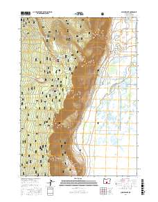
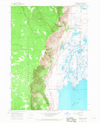 1966 Summer Lake1968 Print · USGSThe high rim of Winter Ridge and the marshlands of the Summer Lake State Game Management Area define this central Oregon landscape in the mid-sixties. Genealogists and researchers can locate the Ana River Sch, the local Grange Hall, and trace the path of the Old Indian Treaty Boundary.3 unique versions available
 - 1974 Map of Lake Abert, 1994 Print
 1974 Lake Abert1994 Print · USGSThe high desert of Lake County is captured here in the mid-1970s, showing a landscape defined by massive fault blocks and terminal lakes. Genealogists and historians can locate legacy ranching sites like O'Keefe Ranch and follow the Chewaucan River past Paisley.
 - 2004 Map of Summer Lake, 2007 Print
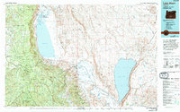
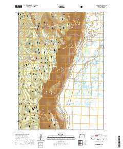
 2004 Summer Lake2007 Print · USGSLake County at the start of the millennium shows a land of dramatic elevation shifts and vital water sources. You can trace the boundaries of the Fremont National Forest and locate local landmarks like the Grange Hall and Ana River Sch.
 - 2011 Map of Summer Lake, 2011 Print
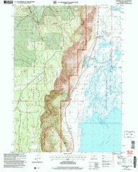
 2011 Summer Lake2011 Print · USGSCovers Summer Lake, including Lake County, United States, and other nearby areas
 - 2017 Map of Summer Lake, 2017 Print
 2017 Summer Lake2017 Print · USGSCovers Summer Lake, including Lake County, United States, and other nearby areas
 - 2020 Map of Summer Lake, 2020 Print
 2020 Summer Lake2020 Print · USGSCovers Summer Lake, including Lake County, United States, and other nearby areas
 - 2023 Map of Summer Lake, 2023 Print
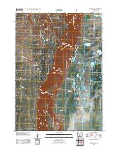
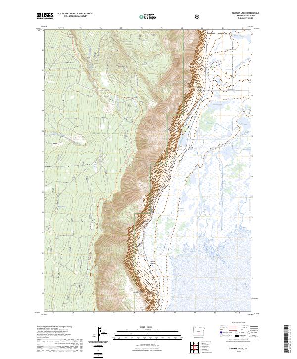 2023 Summer Lake2023 Print · USGSThe Lake County high desert comes into focus in this contemporary survey of the Winter Rim area. Researchers can trace land use through the Summer Lake Cem, established forest boundaries of the Fremont National Forest, and water systems like the Summer Lake I D Canal.
End of results
Showing maps 1-9 of 9
Frequently asked questions
- What are the different types of historical maps available for Summer Lake?
- What is the oldest map of Summer Lake?
- Where can I purchase historical maps of Summer Lake for my home or office?
- Where can I download high-res historical maps of Summer Lake?
- Are there historical topographic maps available for Summer Lake?
- Is there historical aerial imagery available for Summer Lake?
- Where are historical maps of Summer Lake sourced from?