Old Maps of West Side, Oregon for Academic Research
Study the evolution of West Side with 8 high-resolution historic maps. Whether you're teaching, researching, or modeling changes in land use, these maps provide essential visual documentation of urban, environmental, and geographic change.
- Analyze long-term change: Track patterns in development, transportation, and natural features.
- Ideal for environmental or urban studies: Support academic projects with primary historical map data.
- Use in the classroom or lab: Educators and researchers rely on these maps to bring historical context to life.
These maps are a powerful tool for teaching, research, and visualizing how West Side has changed over the decades.
West Side, OR maps
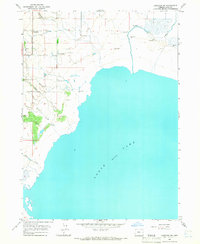
(8)- 1955 Map of Klamath Falls, 1963 Print
 1955 Klamath Falls1963 Print · USGSSouthern Oregon's high desert and timber country are captured here during the mid-fifties, showing the rail-dependent economies of the basin. Genealogists and researchers can locate old outposts like the Keno Guard Station, the Bly Ranger Station, and the campus of the Oregon Technical Institute.4 unique versions available
 - 1958 Map of Klamath Falls
 1958 Klamath Falls1958 Print · USGSSouthern Oregon and the California borderlands are captured here in the mid-1950s during a peak era for the region's timber and rail industries. Trace the historic Klamath Indian Reservation boundaries and the rail lines of the Great Northern RR and the Oregon California and Eastern RR that connected remote towns like Bly and Beatty.3 unique versions available
 - 1964 Map of Lakeview SW, 1965 Print
 1964 Lakeview SW1965 Print · USGSGoose Lake and its marshy western shoreline are the focus of this Oregon survey from the early sixties. Researchers can trace the rural infrastructure of West Side and locate various family-scale landmarks like the Corral or the course of Thomas Creek.2 unique versions available
 - 1975 Map of Lakeview, 1994 Print
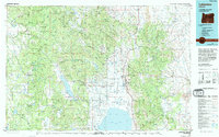 1975 Lakeview1994 Print · USGSLakeview and the surrounding high desert terrain are captured in the mid-seventies just as the region’s timber and mining industries remained active. Researchers can trace the layout of Booth-Kelly State Park or locate the White King Mine and the Thomas Creek Work Center.
 - 2014 Map of West Side, 2014 Print
 2014 West Side2014 Print · USGSCovers West Side, including Lake County, United States, and other nearby areas
 - 2017 Map of West Side, 2017 Print
 2017 West Side2017 Print · USGSCovers West Side, including Lake County, United States, and other nearby areas
 - 2020 Map of West Side, 2020 Print
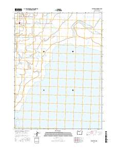
 2020 West Side2020 Print · USGSCovers West Side, including Lake County, United States, and other nearby areas
 - 2023 Map of West Side, 2023 Print
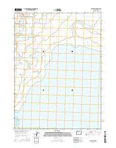
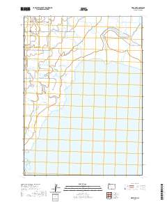
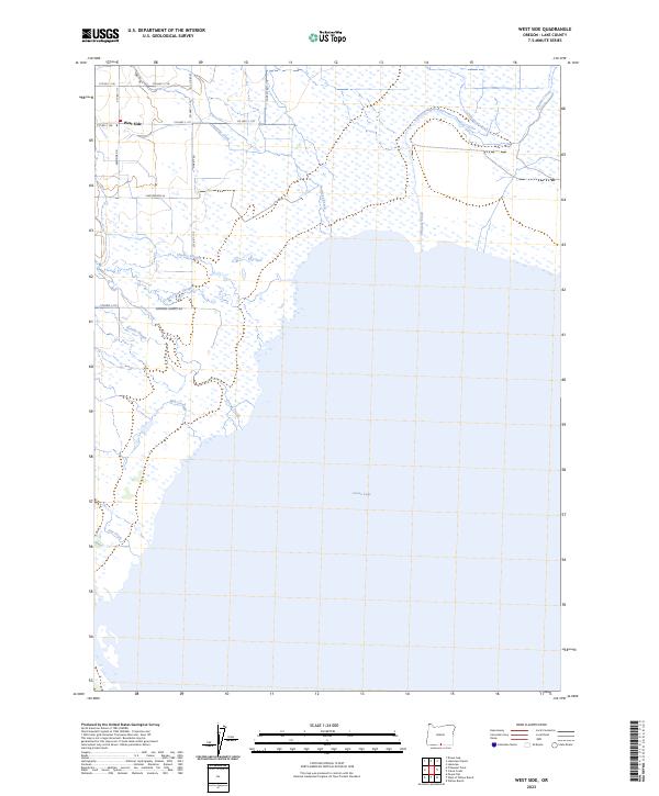 2023 West Side2023 Print · USGSThe West Side of Lake County appears here as a land of expansive lakefront and intricate wetlands in the early twenty-first century. Researchers can trace the rural road networks and water features like Goose Lake, the settlement of West Side, and Drews Creek Slough.
End of results
Showing maps 1-8 of 8
Top cities near West Side
Frequently asked questions
- What are the different types of historical maps available for West Side?
- What is the oldest map of West Side?
- Where can I purchase historical maps of West Side for my home or office?
- Where can I download high-res historical maps of West Side?
- Are there historical topographic maps available for West Side?
- Is there historical aerial imagery available for West Side?
- Where are historical maps of West Side sourced from?