Old Maps of Pleasant Hill, Oregon for Hiking & Exploration
Hike through history with 11 historic maps of Pleasant Hill. Explore old trails, ghost towns, and forgotten backroads — perfect for outdoor adventurers and local explorers.
- Rediscover forgotten places: Map out old mining camps, roads, and footpaths that no longer exist on modern maps.
- Layer with modern tools: Combine with LiDAR or satellite views to plan hikes through historical terrain.
- Made for exploration: Popular among hikers, overlanders, and local history lovers.
Use these maps to find adventure and explore the hidden past of Pleasant Hill.
Pleasant Hill, OR maps
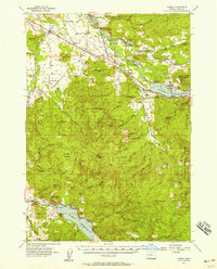
(11)- 1935 Map of Lowell
 1935 Lowell1935 Print · USGSIn the mid-1930s, this region of the Willamette foothills was a busy landscape of timber and rail. Researchers can trace rural school districts like Unity Sch, small post offices at Fall Creek PO, and the path of the Southern Pacific railroad.
 - 1942 Map of Lowell
 1942 Lowell1942 Print · USGSThe Willamette River valley and the foothills of the Cascades are captured here before the construction of major dams and reservoirs. Genealogists can trace family locations at the Smithson Homestead, early schools like Unity Sch, and the remote Bohemia Post Office.3 unique versions available
 - 1955 Map of Lowell, 1958 Print
 1955 Lowell1958 Print · USGSUpper Willamette Valley life in the mid-fifties is captured here during a period of massive hydraulic change and timber growth. Researchers can trace the original rail lines of the Southern Pacific Railroad and locate vanished family landmarks near Cloverdale Cem and Butte Disappointment.3 unique versions available
 - 1958 Map of Roseburg, 1960 Print
 1958 Roseburg1960 Print · USGSThe timber valleys and high volcanic peaks of Southern Oregon are captured here in the late fifties. Researchers can trace the Southern Pacific rail line through historic settlements like Cottage Grove, Yoncalla, and Oakridge near the Cascade Range crest.4 unique versions available
 - 1959 Map of Roseburg
 1959 Roseburg1959 Print · USGSThe Umpqua and Willamette valleys meet the high Cascades in this late-fifties study of Southern Oregon's timber and rail corridors. Genealogists and researchers can trace the Southern Pacific RR through historic towns like Roseburg, Yoncalla, and Cottage Grove.
 - 1983 Map of Oakridge
 1983 Oakridge1983 Print · USGSThe Cascades of Lane County are shown in the early eighties, centered on the timber and rail corridors of the Willamette. Genealogists and historians can trace the Southern Pacific line through Oakridge or find old mining sites like Mayflower Mine.
 - 1986 Map of Jasper
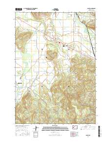
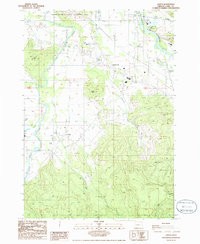 1986 Jasper1986 Print · USGSLane County in the mid-1980s shows the convergence of the Willamette River forks near the community of Jasper. Researchers can trace local landmarks like Pleasant Hill Sch, family-named summits such as Sellers Butte, and several active Quarry sites.
 - 2011 Map of Jasper, 2011 Print
 2011 Jasper2011 Print · USGSCovers Pleasant Hill, including Creswell, Jasper, and other nearby areas
 - 2017 Map of Jasper, 2017 Print
 2017 Jasper2017 Print · USGSCovers Pleasant Hill, including Creswell, Jasper, and other nearby areas
 - 2020 Map of Jasper, 2020 Print
 2020 Jasper2020 Print · USGSCovers Pleasant Hill, including Creswell, Jasper, and other nearby areas
 - 2023 Map of Jasper, 2023 Print
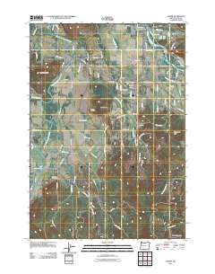
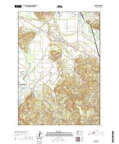
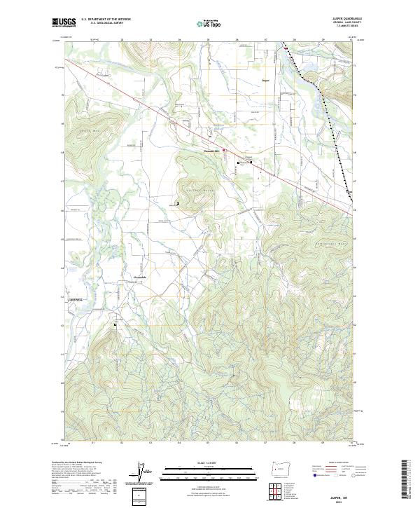 2023 Jasper2023 Print · USGSThe river valleys of Lane County come into focus in this contemporary survey of the Willamette's forks. Genealogists and local historians can locate family plots at Pleasant Hill Cem or Sellers Cem and trace the roads connecting Jasper and Cloverdale.
End of results
Showing maps 1-11 of 11
Top cities near Pleasant Hill
- Eugene historical maps
- Springfield historical maps
- Cottage Grove historical maps
- Creswell historical maps
- Coburg historical maps
- Lowell historical maps
Frequently asked questions
- What are the different types of historical maps available for Pleasant Hill?
- What is the oldest map of Pleasant Hill?
- Where can I purchase historical maps of Pleasant Hill for my home or office?
- Where can I download high-res historical maps of Pleasant Hill?
- Are there historical topographic maps available for Pleasant Hill?
- Is there historical aerial imagery available for Pleasant Hill?
- Where are historical maps of Pleasant Hill sourced from?