Old Maps of Wecoma Beach, Lincoln City
Explore 41 old maps of Wecoma Beach, spanning from 1941 to today. These high-resolution historic maps reveal how streets, neighborhoods, landmarks, and natural features evolved over time — perfect for genealogy, metal detecting, research, and local history exploration.
What you can do with these maps:
- See how Wecoma Beach changed over time: Compare historical maps to modern-day views to trace roads, homesites, rail lines & more.
- View detailed metadata: Each map includes creators, publishers, year, scale, and archive source.
- Overlay maps with satellite & LiDAR: Visualize the past alongside modern tools to explore terrain & human change.
- Trusted historical sources: Maps sourced from the USGS, Library of Congress, and other archives.
- Access maps your way: View online, download high-res files, or order prints for personal or research use.
Start exploring old maps of Wecoma Beach to uncover forgotten places, hidden landmarks, and the deep history beneath your feet.
Wecoma Beach, Lincoln City maps
(41)- 1941 Map of Nestucca Bay
 1941 Nestucca Bay1941 Print · USGSThe Oregon coast at the start of the 1940s reveals a mix of timber industry and early seaside tourism. Trace the history of coastal work and recreation through labels like the Miles Lake CCC Camp, Hebo Alder Mill, and the many fire lookouts.
 - 1941 Map of Cape Foulweather
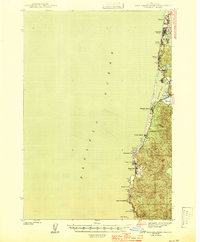
 1941 Cape Foulweather1941 Print · USGSThe Oregon coast at the start of the 1940s reveals a chain of separate seaside villages along the Pacific. Genealogists and historians can trace early boundaries of Oceanlake, Delake, and Taft or locate the old ferry crossing at Kernville.
 - 1942 Map of Euchre Mtn
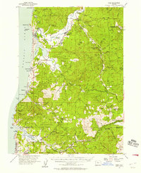
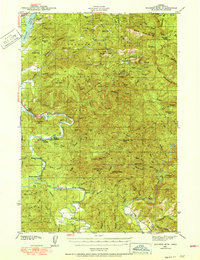 1942 Euchre Mtn1942 Print · USGSCoastal Lincoln County during the early 1940s reveals a landscape of isolated timber outposts and river-oriented landings. Researchers can trace historic river access at Melco Landing and Mowrey Landing or locate family landmarks like Horner Ranch and the Ojalla Bridge.
 - 1942 Map of Nestucca Bay
 1942 Nestucca Bay1942 Print · USGSCoastal Oregon is captured here during the early war years as timber and forest management shaped the local economy. Researchers can locate vanished infrastructure like the Hebohalder Mill and Powder House, or trace the development of Pacific City and Neskowin.
 - 1943 Map of Euchre Mtn
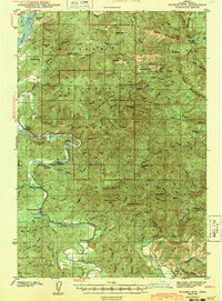 1943 Euchre Mtn1943 Print · USGSThe Oregon Coast Range at the start of the 1940s reveals a river-driven landscape shaped by the Siletz River and deep forest. Genealogists and historians can trace riverside settlements and river access points like Mack Landing, the Horner Ranch, and the Ojalla Bridge near The Maples.
 - 1944 Map of Cape Foulweather
 1944 Cape Foulweather1944 Print · USGSThe Oregon coastline north of Newport appears here in the late 1930s as a series of emerging seaside communities connected by the Coast Highway. Researchers can trace the early footprints of Depoe Bay and Taft, or locate landmarks like Devils Lake and Otter Rock.
 - 1948 Map of Vancouver, 1957 Print
 1948 Vancouver1957 Print · USGSPost-war growth transforms the river valleys of the Pacific Northwest as the timber and rail economy thrives. Trace family roots in Tillamook or Oregon City, and locate vanished landmarks like the spit at Bayocean or the Skamania Mine.
 - 1950 Map of Vancouver
 1950 Vancouver1950 Print · USGSCoastal Oregon and the lower Columbia River valley are captured in detail just after the war. Researchers can trace historic rail routes like the Southern Pacific or locate early settlements such as Vernonia, Gaston, and the Grand Ronde Indian Reservation.
 - 1950 Map of Vancouver, 1951 Print
 1950 Vancouver1951 Print · USGSThe Pacific Northwest urban corridor meets the rugged coast in the years following the war, showing the expansion of Portland and Vancouver. Genealogists and historians can trace the reach of the Southern Pacific RR and locate coastal communities like Tillamook, Seaside, and Tolovana Park.
 - 1953 Map of Salem
 1953 Salem1953 Print · USGSMid-century Oregon comes to life through this detailed survey of the Willamette Valley and the adjacent Pacific coastline. Researchers can trace the rail lines of the Southern Pacific RR, visit rural hubs like Fairview School, or locate coastal landmarks like the Yaquina Head Lighthouse.
 - 1954 Map of Salem
 1954 Salem1954 Print · USGSMid-century Western Oregon is centered on the productive Willamette River valley as its cities and infrastructure expand toward the mountains. Genealogists and historians can trace the rail lines of the Southern Pacific RR and Oregon Electric Ry through towns like Dallas, Independence, and Brownsville.
 - 1955 Map of Hebo, 1957 Print
 1955 Hebo1957 Print · USGSCoastal Tillamook County is captured here in the mid-fifties, showing the development of beach communities and forest management. Genealogists can trace family sites like Herbst Place or locate the Town Lake Cemetery and Cloverdale School.3 unique versions available
 - 1957 Map of Cape Foulweather, 1958 Print
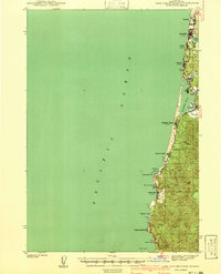
 1957 Cape Foulweather1958 Print · USGSThe Lincoln County coastline in the mid-fifties is a landscape of emerging seaside towns and protected headlands connected by the Oregon Coast Highway. Trace the early development of communities like Wecoma Beach, Taft, and Depoe Bay before they consolidated into modern municipalities.2 unique versions available
 - 1957 Map of Euchre Mtn, 1958 Print
 1957 Euchre Mtn1958 Print · USGSCoastal Lincoln County is shown here in the late fifties, featuring the timber-rich mountains and river landings of the northern Oregon coast. Researchers can find specific riverfront history at Morgan Landing, trace old timber routes along the Logging R R, and locate the Covered Bridge on Schooner Creek.3 unique versions available
 - 1958 Map of Vancouver, 1968 Print
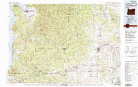
 1958 Vancouver1968 Print · USGSThe Lower Columbia and Willamette valleys thrive in the late sixties as major rail and river hubs. Genealogists and historians can trace the development of Portland, identify the grounds of Camp Withycombe, and locate coastal landmarks from Tillamook Head to Garibaldi.3 unique versions available
 - 1960 Map of Salem, 1968 Print
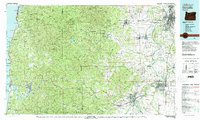
 1960 Salem1968 Print · USGSThe Willamette Valley and the surrounding mountain ranges are shown here in the 1960s during a period of significant reservoir construction. Genealogists and historians can trace rail lines like the Oregon Electric and find communities from Lincoln City on the coast to Sweet Home and Mill City in the foothills.2 unique versions available
 - 1962 Map of Salem
 1962 Salem1962 Print · USGSThe Willamette Valley and the surrounding Oregon ranges are captured here in the early sixties, showing the vital growth of the state's primary agricultural and academic corridor. Researchers can trace the mid-century footprints of Oregon State University and the University of Oregon, alongside rural landmarks like Camp Adair and Black Butte Mine.
 - 1963 Map of Salem
 1963 Salem1963 Print · USGSMid-century Oregon comes into focus as the Willamette Valley’s timber and agricultural industries meet the growing campuses of Oregon State University and the University of Oregon. Researchers can trace old rail lines like the Oregon Electric Railway and locate family plots at Siletz Cem or Dallas Cem.
 - 1964 Map of Vancouver
 1964 Vancouver1964 Print · USGSThe Pacific Northwest interior and coast are shown here in the 1960s, from the Portland metropolitan hub to the rugged Pacific shoreline. Researchers can trace the legacy of the Grand Ronde Indian Reservation, the early layout of McMinnville, and the maritime approaches near Tillamook Head.
 - 1980 Map of Yamhill River
 1980 Yamhill River1980 Print · USGSThe Oregon Coast Range and the western Willamette Valley meet in this 1980 survey, showing the landscape from the Pacific shore to the valley floor. Genealogists and historians can trace old routes like the Salmon River Highway to find the Grand Ronde Agency, Cloverdale, and Perrydale.3 unique versions available
 - 1980 Map of Corvallis, 1981 Print
 1980 Corvallis1981 Print · USGSThe Oregon Coast Range meets the fertile Willamette Valley in the early eighties, documenting a landscape of timber, agriculture, and growing college towns. Genealogists and historians can trace old rail lines like the Southern Pacific or locate landmarks like Marys Peak and the College of Education.
 - 1981 Map of Newport
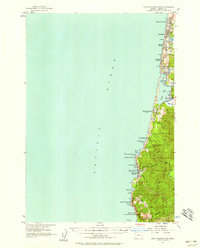
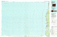 1981 Newport1981 Print · USGSThe Oregon coast in the early eighties shows a landscape of busy estuaries and established seaside communities from Lincoln City down to Southbench. Genealogists and local historians can trace the development of towns like Depoe Bay, locate family-named landmarks like McLean Point, or explore the many inlets of Yaquina Bay.
 - 1984 Map of Devils Lake
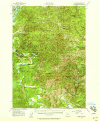
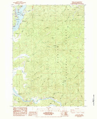 1984 Devils Lake1984 Print · USGSCoastal development meets the deep timber of the Oregon Coast Range in the mid-eighties as Lincoln City expands around the shores of Devils Lake. Researchers can trace the layout of Oceanlake, find Sunset Landing on the Siletz River, or locate the Schooner Creek Campground within the Siuslaw National Forest.
 - 1984 Map of Lincoln City
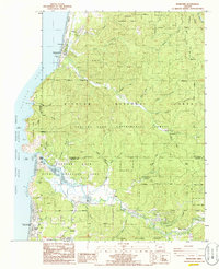
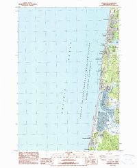 1984 Lincoln City1984 Print · USGSThe Oregon Coast in the mid-1980s reveals a series of growing seaside communities from Wecoma Beach down to Gleneden Beach. Trace the historical layout of Lincoln City neighborhoods and waterfront landmarks like Salishan Spit, Devils Lake, and Kernville.
 - 1985 Map of Neskowin
 1985 Neskowin1985 Print · USGSThe Oregon coast at the mid-eighties reveals a landscape of protected forests and quiet seaside communities along the Salmon River. Genealogists and local historians can trace the early layout of Neskowin, Otis, and Rose Lodge amid the Siuslaw National Forest.2 unique versions available
Showing maps 1-25 of 41
Frequently asked questions
- What are the different types of historical maps available for Wecoma Beach?
- What is the oldest map of Wecoma Beach?
- Where can I purchase historical maps of Wecoma Beach for my home or office?
- Where can I download high-res historical maps of Wecoma Beach?
- Are there historical topographic maps available for Wecoma Beach?
- Is there historical aerial imagery available for Wecoma Beach?
- Where are historical maps of Wecoma Beach sourced from?