Old Maps of Dennis, Oregon for Academic Research
Study the evolution of Dennis with 10 high-resolution historic maps. Whether you're teaching, researching, or modeling changes in land use, these maps provide essential visual documentation of urban, environmental, and geographic change.
- Analyze long-term change: Track patterns in development, transportation, and natural features.
- Ideal for environmental or urban studies: Support academic projects with primary historical map data.
- Use in the classroom or lab: Educators and researchers rely on these maps to bring historical context to life.
These maps are a powerful tool for teaching, research, and visualizing how Dennis has changed over the decades.
Dennis, OR maps
(10)- 1950 Map of Jamieson, 1952 Print
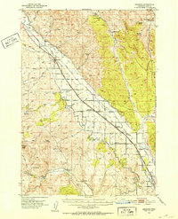 1950 Jamieson1952 Print · USGSEastern Oregon ranching and railroad life come into focus in the early fifties, following the path of the Union Pacific through Malheur County. Genealogists and historians can trace the irrigation networks of the Vale Main Canal and locate the Bully Creek School and Lancaster.3 unique versions available
 - 1955 Map of Baker, 1964 Print
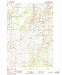
 1955 Baker1964 Print · USGSThe Oregon-Idaho borderlands are captured here in the mid-fifties as the Snake River underwent massive changes from dam construction. Trace the Oregon Trail Memorial Monument near Baker, find early mines like Virtue Mine, and follow the Union Pacific Railroad through Huntington.4 unique versions available
 - 1959 Map of Baker
 1959 Baker1959 Print · USGSThe Oregon and Idaho borderlands come alive in the late fifties, showing the rugged corridor along the Snake River and the high peaks of the Wallowa Mountains. Researchers can trace the legacy of the Union Pacific railroad or locate historic mining sites like the Flagstaff Mine and Virtue Mine.2 unique versions available
 - 1980 Map of Brogan, 1997 Print
 1980 Brogan1997 Print · USGSThe Oregon-Idaho borderlands come alive in this late-century survey of the high desert and river valleys. Researchers can trace the legacy of ranching and transport through sites like Malheur City, the Union Pacific rail lines, and the Snake River crossings.
 - 1987 Map of Willowcreek, 1988 Print
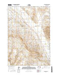
 1987 Willowcreek1988 Print · USGSThe high desert near Willowdale is captured here in the late eighties, showing a landscape defined by deep canyons and public lands. Trace the remote terrain through family-named landmarks like Friends Peak or natural features such as Trout Creek and Pony Butte.
 - 1988 Map of Willowcreek
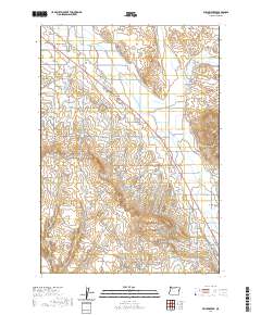
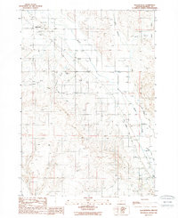 1988 Willowcreek1988 Print · USGSEastern Oregon's pioneer history meets modern irrigation in the late 1980s as the desert landscape is transformed by water management. Genealogists and historians can trace the paths of the Oregon Trail past local settlements like Willowcreek and Dennis.
 - 2011 Map of Willowcreek, 2011 Print
 2011 Willowcreek2011 Print · USGSCovers Dennis, including Willowcreek, Malheur County, and other nearby areas
 - 2017 Map of Willowcreek, 2017 Print
 2017 Willowcreek2017 Print · USGSCovers Dennis, including Willowcreek, Malheur County, and other nearby areas
 - 2020 Map of Willowcreek, 2020 Print
 2020 Willowcreek2020 Print · USGSCovers Dennis, including Willowcreek, Malheur County, and other nearby areas
 - 2023 Map of Willowcreek, 2023 Print
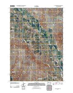
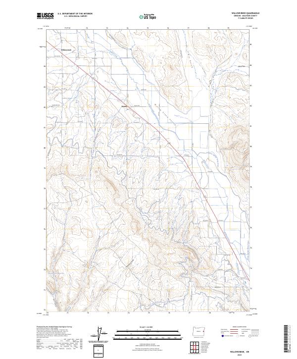 2023 Willowcreek2023 Print · USGSEastern Oregon agriculture and irrigation define this portion of Malheur County in the twenty-first century. Researchers can trace the path of the Old Oregon Trl and examine the intricate canal networks like the Vale Oregon Main Canal and Gellerman Canal.
End of results
Showing maps 1-10 of 10
Top cities near Dennis
Frequently asked questions
- What are the different types of historical maps available for Dennis?
- What is the oldest map of Dennis?
- Where can I purchase historical maps of Dennis for my home or office?
- Where can I download high-res historical maps of Dennis?
- Are there historical topographic maps available for Dennis?
- Is there historical aerial imagery available for Dennis?
- Where are historical maps of Dennis sourced from?