Old Maps of Hardman, Oregon for Metal Detecting
Plan your next treasure hunt with 7 historic maps of Hardman. Find old homesites, ghost towns, trails, and gathering spots that may be lost to time — perfect for identifying promising metal detecting locations.
- Locate forgotten sites: Uncover places like long-lost settlements, abandoned rail lines, or gathering spots.
- Plan better hunts: Use map overlays combined with LiDAR or satellite views to narrow in on historically rich areas.
- Made for detectorists: Thousands of hobbyists use these maps to discover relics, coins, and hidden history.
Use these historic maps to boost your research and find new opportunities beneath the surface of Hardman.
Hardman, OR maps
(7)- 1953 Map of Pendleton, 1957 Print
 1953 Pendleton1957 Print · USGSNortheastern Oregon and the Columbia River frontier are captured here in the early fifties, a time of massive federal infrastructure projects. Researchers can trace the historic route of The Old Oregon Trail as it passes near the Umatilla Ordnance Depot and the new McNary Dam.4 unique versions available
 - 1956 Map of Pendleton
 1956 Pendleton1956 Print · USGSNortheastern Oregon’s high plateau and timbered peaks appear here in the mid-fifties, during a time of major military and hydroelectric development. Trace the path of The Old Oregon Trail alongside modern landmarks like McNary Dam and the Umatilla Ordnance Depot.
 - 1969 Map of Hardman, 1973 Print
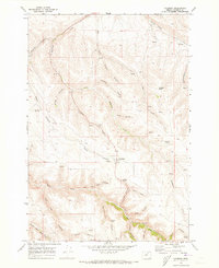 1969 Hardman1973 Print · USGSMorrow County's high country is captured here in the late sixties, centered on the small community of Hardman. Genealogists and local historians can trace family locations near the Hardman IOOF Cem or follow water sources from Glutton Falls to Spring Hollow Creek.
 - 1981 Map of Heppner
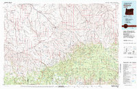 1981 Heppner1981 Print · USGSNorth-Central Oregon's canyon country comes into focus in the early 1980s, centered on the high-desert plateaus and timbered slopes of Morrow County. Researchers can trace the Union Pacific rail corridor and find remote landmarks like Lonerock, Hardman, and the high peaks of the Umatilla National Forest.
 - 2014 Map of Hardman, 2014 Print
 2014 Hardman2014 Print · USGSCovers Hardman, including Morrow County, United States, and other nearby areas
 - 2017 Map of Hardman, 2017 Print
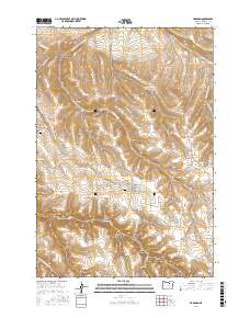 2017 Hardman2017 Print · USGSCovers Hardman, including Morrow County, United States, and other nearby areas
 - 2024 Map of Hardman, 2024 Print
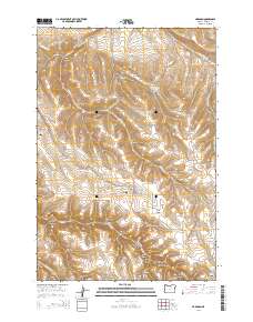
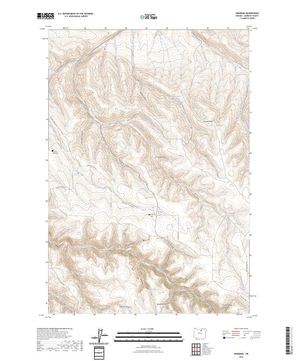 2024 Hardman2024 Print · USGSMorrow County rangeland and deep canyon systems define the landscape in the 2020s. Researchers can trace historical burials at Hardman Cem and Hardman IOOF Cem or locate geographical landmarks like Glutton Falls and Stuckey Butte.
End of results
Showing maps 1-7 of 7
Top cities near Hardman
Frequently asked questions
- What are the different types of historical maps available for Hardman?
- What is the oldest map of Hardman?
- Where can I purchase historical maps of Hardman for my home or office?
- Where can I download high-res historical maps of Hardman?
- Are there historical topographic maps available for Hardman?
- Is there historical aerial imagery available for Hardman?
- Where are historical maps of Hardman sourced from?