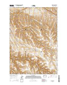
2014 Map of Hardman
USGS Topo · Published 2014About this map
Hardman (Historical) and the high plateau of Hardman Ridge define this landscape in the Columbia Basin's southern reaches. The area is marked by a complex network of deep drainages, including Porcupine Canyon, Wild Calf Canyon, and Glutton Falls Canyon. Settled agriculture and ranching history are evident in the concentration of local landmarks such as the Hardman IOOF Cemetery and Hardman Cemetery, while the Heppner-Spray Hwy serves as the primary corridor through the terrain. Water is a vital, localized resource across this dry upland, noted by numerous named points like Stuckey Butte Reservoir, Reininger Spring, and Hoskins Spring. The map documents a topography where high points like Stuckey Butte and Deadman Hill overlook the branching tributaries of McKinney Creek and Rock Creek, reflecting a landscape deeply etched by seasonal water and long-standing rural routes.
Find a feature on this map
42 named features on this map. Tap any name to fly to it.
Don’t see what you’re looking for? This feature index may not catch every label — zoom into the map to look around manually.
Map Details
Editions of this 2014 Hardman Map
This is the sole edition of this map. No revisions or reprints were ever made.
Other maps of this area

1953 · Pendleton
USGS Topo · 1:250,000

1956 · Pendleton
USGS Topo · 1:250,000

1968 · Eightmile
USGS Topo · 1:24,000

1968 · Ruggs
USGS Topo · 1:24,000

1968 · Heppner
USGS Topo · 1:24,000

1969 · Lefevre Prairie
USGS Topo · 1:24,000

1969 · Buttermilk Canyon
USGS Topo · 1:24,000

1969 · Chapin Creek
USGS Topo · 1:24,000

1969 · Hardman
USGS Topo · 1:24,000

1969 · Big Rock Flat
USGS Topo · 1:24,000