
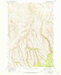
1968 Map of Ruggs
USGS Topo · Published 1970About this map
Ruggs sits at the junction of Rhea Creek and McKinney Creek, serving as a small agricultural node in the high country of Morrow County. This 1968 field-checked survey shows the landscape dominated by the prominent Social Ridge, which dictates the drainage patterns of several deep incisions such as Clarks Canyon and Cason Canyon. The presence of a Grain Elevator and a Storage Bin near the settlement reflects the region's reliance on dryland wheat farming and ranching during the late 1960s. The map illustrates a network of unimproved dirt roads and light-duty routes connecting isolated resources, including a Water Tank and several Spring sites located within the folds of the ridges. Smaller features like Spring Hollow and Fuller Canyon further define this dissected plateau before the terrain drops toward the creek beds.
Find a feature on this map
16 named features on this map. Tap any name to fly to it.
Don’t see what you’re looking for? This feature index may not catch every label — zoom into the map to look around manually.
Map Details
Editions of this 1968 Ruggs Map
This is the sole edition of this map. No revisions or reprints were ever made.
Other maps of this area

1953 · Pendleton
USGS Topo · 1:250,000

1956 · Pendleton
USGS Topo · 1:250,000

1968 · Swaggart Buttes
USGS Topo · 1:24,000

1968 · Lexington
USGS Topo · 1:24,000

1968 · Eightmile
USGS Topo · 1:24,000

1968 · Ione South
USGS Topo · 1:24,000

1968 · Heppner
USGS Topo · 1:24,000

1969 · Buttermilk Canyon
USGS Topo · 1:24,000

1969 · Hardman
USGS Topo · 1:24,000
1969 · Balm Canyon
USGS Topo · 1:24,000