
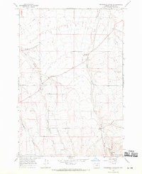
1968 Map of Lexington
USGS Topo · Published 1970About this map
Lexington serves as the central hub of this Morrow County landscape, where the Union Pacific railroad and local geography converge along the banks of Willow Creek. The town's infrastructure in the late 1960s is clearly defined, featuring a Grange Hall, a prominent Grain Elevator, and the County Airport situated just to the west. Outside the main settlement, the map reveals a rural economy dependent on the land, marked by a Gravel Pit and the outlying community at Cutsforth Corner. Steep drainage patterns like Clarks Canyon and Blackhorse Canyon cut through the high ground of Social Ridge, illustrating the challenging terrain that shaped early transportation and property lines. For those tracing family history, the Lexington Cem and scattered landmarks like a Cistern provide specific points of interest for genealogical research in this wheat-growing region.
Find a feature on this map
22 named features on this map. Tap any name to fly to it.
Don’t see what you’re looking for? This feature index may not catch every label — zoom into the map to look around manually.
Map Details
Editions of this 1968 Lexington Map
This is the sole edition of this map. No revisions or reprints were ever made.
Other maps of this area

1906 · Blalock Island
USGS Topo · 1:125,000

1908 · Blalock Island
USGS Topo · 1:125,000

1953 · Pendleton
USGS Topo · 1:250,000

1956 · Pendleton
USGS Topo · 1:250,000

1968 · Swaggart Buttes
USGS Topo · 1:24,000

1968 · Ione North
USGS Topo · 1:24,000

1968 · Eightmile
USGS Topo · 1:24,000

1968 · Ruggs
USGS Topo · 1:24,000

1968 · Ione South
USGS Topo · 1:24,000
1968 · Strawberry Canyon SE
USGS Topo · 1:24,000